|
We hiked it - we liked it! Here are some of our favorites hikes, scrambles and climbs in Washington State. We've got everything in Washington: mountains, rock climbing, glaciers, even deserts in eastern part of the state and rain forests on Olympic Penninsula. Big shoutout to Washington Trails Association and their excellent website. |
|
North Cascades are often called the American Alps, and for good reasons. But - unlike the European mountains - the North Cascades still remain wild. Much of it is protected as wilderness, so the landscape is largely undisturbed by civilization. National Geographic article about NCNP...
Hidden Lake Lookout https://www.wta.org/go-hiking/hikes/hidden-lake-lookout Craig Romano in his guidebook calls it “one of the finest hikes on the face of the planet” and he is not wrong. You won’t find solitude on it, but it’s a must-do in North Cascades National Park. Stunning panorama of the most photogenic mountain landscape in this part of the country. Trappers’s Peak https://www.mountaineers.org/activities/routes-places/thornton-lakes-trappers-peak The panorama from Trappers Peak is as spectacular as one from Hidden Lake Lookout, and without the crowds. The views start during the last mile of the hike and keep getting better with every step. After a short rock scramble to the summit, you immediately get a jaw dropping 360 panorama of the finest mountain scenery. Sahale Arm https://www.wta.org/go-hiking/hikes/sahale-arm This starts with boring switchbacks to Cascade Pass, but the view from the pass and occasional glimpses of the north face of Johannesburg Mountain (8,200 ft) will compensate for it. Don’t stop there. Continue to the Arm, and if you’re ready for glacier travel and a little bit of rock climbing, go all the way to the summit: Sahale Mountain https://www.summitpost.org/sahale-mountain/150220 The full climb is best done as an overnight trip. Sahale Glacier Camp is the highest established campsite in North Cascades (7600’). You will need a permit from the North Cascades Ranger Station in Marblemount. I can’t help mentioning the throne with view like no other…
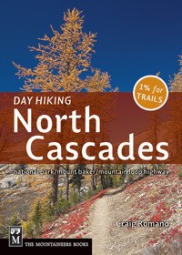
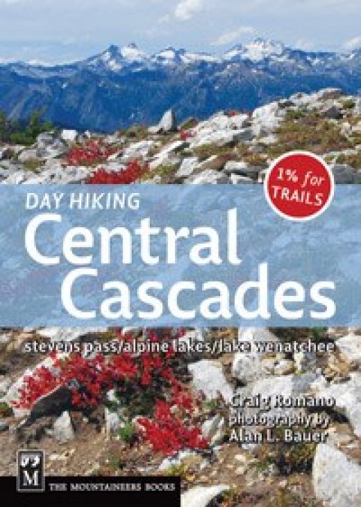
Recommended book: |
|
|
Trails around Mount Baker offer some of the most spectacular mountain views in this part of the country. On a clear day it really doesn't get better than that. Snow lingers here long into late summer, and never melts in some areas, so if you're not comfortable with snow/ice travel, the hiking window is limited to late August / early September. Warning: huge nasty biting flies will follow you here through most of summer - they could not care less about bug spray and will take a chunk of meat from any uncovered body part. Late summer and fall are the best to hike here since cooler temperatures will keep the flying monsters at bay. Fire season - that's a relatively new thing, but for the last couple years smoke was obstructing the views in that area until fall. Below you will find our picks. Except Goat Mountain, expect crowds, but the views are worth it. Goat Mountain is a more strenuous hike, the final approach to the summit is quite steep, but it gets much less traffic and the views are very similar to those from Hannegan Peak. Church Mountain https://www.wta.org/go-hiking/hikes/church-mountain Hannegan Peak https://www.wta.org/go-hiking/hikes/hannegan-pass-and-peak Ptarmigan Ridge https://www.wta.org/go-hiking/hikes/ptarmigan-ridge Yellow Aster Butte https://www.wta.org/go-hiking/hikes/yellow-aster-butte Park Butte https://www.wta.org/go-hiking/hikes/park-butte Goat Mountain https://www.wta.org/go-hiking/hikes/goat-mountain Winchester Mountain https://www.wta.org/go-hiking/hikes/winchester-mountain
|
|
|
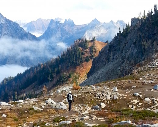
HWY 20 is a road to the North Cascades heaven. It provides easy access to hikes, scrambles and climbs literary starting straight of the road. But first, let's not forget about a mandatory ice-cream stop on HWY 20: Cascadian Farm Roadside Stand, 3 miles east of Rockport. Now that you know where to get your ice-cream fix, let's talk about hiking. Here are our picks. First, some very popular must-do day hikes. The views are splendid, but don't count on solitude: Sauk Mountain https://www.wta.org/go-hiking/hikes/sauk-mountain Easy Pass https://www.wta.org/go-hiking/hikes/easy-pass Maple Loop https://www.wta.org/go-hiking/hikes/maple-pass
But if you're looking for an escape from the crowds, then Pasayten Wilderness is your destination. This whole area is mainly backpackers realm, but there are few day hikes that will quickly take you away from civilization: Silver Lake from Harts Pass https://www.wta.org/go-hiking/hikes/silver-lake-1 Tiffany Mountain https://www.summitpost.org/tiffany-mountain/151171 We recommend taking the south route from Tiffany Lake Trail, and to Honeymoon Pass instead of the Freezout Ridge most popular version. Another route: Tiffany East Ridge https://www.summitpost.org/east-ridge/516205
Rock climbing A small mountain community of Mazama is the true North Cascades Base Camp. Rock climbing, mountaineering, hiking, biking, camping, winter sports, you name it, it's all there. Sport climbing in Mazama... | Most up-to-date info at Goat's Beard Washington Pass (trad): http://www.supertopo.com/packs/washington-pass.html |
|
|
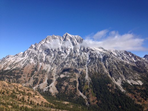
The Enchantments are the most known - and most crowded - jewels of Central Cascades. Thru-hikers visit the Enchantments as a 3-day backpacking trip, starting from Lake Stuart Trailhead. The number of overnight permits, required May 15th-October 31, is limitted. Permits can be aquired from Forest Service via lottery, usually in February. If you're out of luck or don't want to backpack, but still would like more than a glimpse of Mount Stuart Range, you have two options. Either attempt it as a day hike (the infamous 18-mile "Death March") or - choose one of many shorter hikes in the area. Our picks below. For the record, we did hike up to the Enchantments in a single day in June 2014, starting from Snow Lakes Trailhead. We did not make the full traverse, but came down same way we came up. Afterwards, we couldn't move for about a week.
Navaho Pass https://www.wta.org/go-hiking/hikes/navaho-pass Navaho Peak https://www.wta.org/go-hiking/hikes/navaho-peak Colchuck Lake https://www.wta.org/go-hiking/hikes/colchuck-lake Iron Peak https://www.summitpost.org/iron-peak/450472 Thorp Mountain https://www.wta.org/go-hiking/hikes/knox-creek Lake Ingalls https://www.wta.org/go-hiking/hikes/lake-ingalls - from Ingalls Pass - traverse to Longs Pass (easy scramble) for more views Wedge Mountain https://www.wta.org/go-hiking/hikes/wedge-mtn Davis Peak https://www.wta.org/go-hiking/hikes/davis-peak
|
|
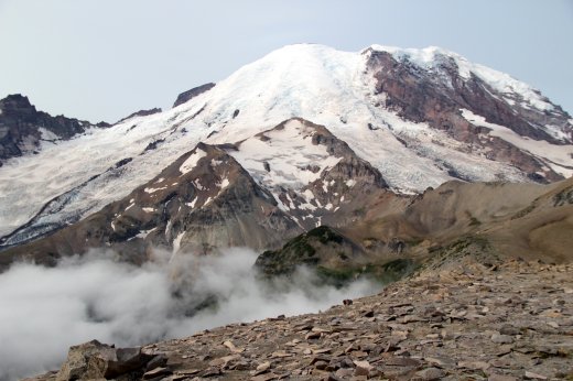
SOUTH CASCADES AND MOUNT RAINIER NATIONAL PARK Mount Rainier (Tahoma or Tacoma) is an active stratovolcano raising to the height of 14,411 ft (4,392 m) above sea level. It is the highest mountain of the Pacific Northwest region and most prominent peak in the continental United States. While hiking in the South Cascades, Mt. Rainier is likely to dominate the view, in addition to another volcano, Mt. Adams. On a clear day, two more volcanos, Mt. St. Helens and even Mt. Hood may be visible at a distance. Burroughs Mountain https://www.nps.gov/mora/planyourvisit/burroughs-mountain.htm You will be as close to Mount Rainier as you can get without actually stepping on it. The best view is from the third summit. We hiked it very early in the morning, before all the crowds arrived. The smoky skies from the forest fires made everything look a little bit like we were approaching Mordor and Mount Doom instead of Mount Rainier. Panhandle Gap and Banshee Peak https://www.summitpost.org/banshee-peak/532630 Stunning views in all directions, and despite the long distance, quite doable as a day hike thanks to the managable elevation gain (below 4000 ft). Panhandle Gap is the highest point of the famous Wonderland Trail encircling the base of Mount Rainier. The route to Banshee Peak from Panhandle Gap is an easy scramble up grassy slopes with dramatic views from the ridge. Palisades and Marcus Peak https://www.mountaineers.org/activities/routes-places/the-palisades-marcus-peak A crowd-free alternative to popular trails in Mt.Rainier National Park, with great views of The Mountain, a charming little lake filled with salamanders, and just a tiny bit of bushwacking and easy routefinding. Outside the Park (no MRNP fees required, but Northwest Forest Pass is): Tatoosh Peak https://www.wta.org/go-hiking/hikes/tatoosh-lookout A very steep approach up to the ridge, then the trail levels a bit, and the views just keep getting better and better. From the top, you get the front sit view of Mt. Rainier, a nice glimpse of the tarn down below, and 360 panorama of the South Cascades. Worth the sweat! Mount Aix https://www.wta.org/go-hiking/hikes/mount-aix Apparently it is pronounced "aches" and hard to disagree. Endless switchbacks lead to Nelson Ridge, and then after a turn, to the first view of the mountain. And that's where the fun starts. We took the scramble route to the top, and the regular trail on the way down - the right way to do that! Lots of loose rock on the scramble route, so careful not to throw any on folks below, and honestly, wearing a helmet would not be a bad idea.
|
|
|
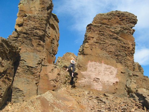
Vantage - Frenchman Coulee rock climbing https://www.summitpost.org/vantage/151624 Sport climbing, 5.5 - 5.12+ (grade 5.5 - 5.12+) on basalt columns. Frenchman Coulee is the main climbing destination for autumn, winter and early spring. Late spring and summers can be scorching hot, so usually climbers abandon this area by mid June and head to the mountains.
Lakes in the middle of a desert? Or even a waterfall in spring? Why not? Everything is possible in Washington. Hike or camp, it will feel a bit like being on another planet. It is a strangely remote and quiet place. I even did a recording session on one of the lakes to capture some weird echos. https://www.wta.org/go-hiking/hikes/ancient-lakes
While the Palouse region may not be a major hiking destination, it is a magnet for nature photographers. The Palouse landscape with its gentle rolling hills and endless wheat fields, has become an international attraction. Photographers flock here to capture almost a surreal landscape, with its color palette changing each season, amplified by the game of shadows and lights.
A must-do stop for photographers is Steptoe Butte, with its expansive panorama from the top. It's not a hike, you can drive to the top with all you tripods and heavy lenses. If you'd like to hike a tiny bit, check out Kamiak Butte... Also let's not forget about the waterfall...
|
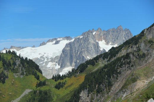
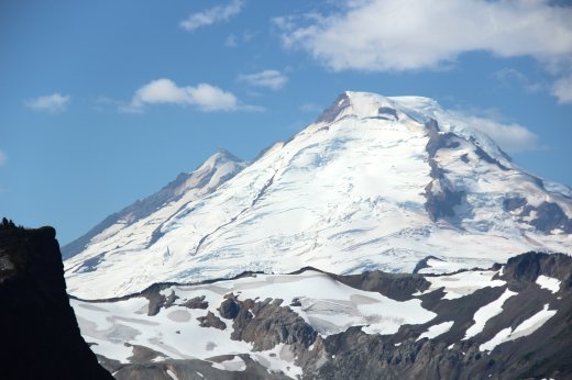 NORTH CASCADES: MOUNT BAKER
 NORTH CASCADES: HIGHWAY 20 CORRIDOR
 CENTRAL CASCADES
 EASTERN WASHINGTON
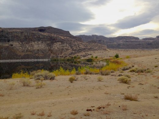 Ancient Lakes
 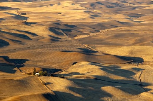 The Palouse
 girlbot@ewatrebacz.com
 BabelScores
 Youtube
 SoundCloud