Squamish - Whistler - Pemberton - Lillooet
While Whistler can be a crowded touristy place, you don't have to go very far from most popular hikes to get away and find yourself alone in the vast wilderness away from phone access and surrounded by bears.
If you're new to Whistler hikes, this site is a great start: https://whistlerhiatus.com/.
Here are our picks - great views, and no crowds (with the exception of Wedgemount Lake). All of them are accessible by a regular vehicle. High clearance helps but you don't need a jeep to get there.
|
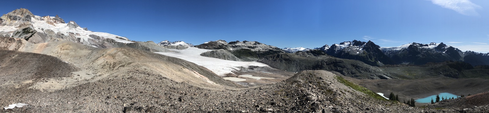
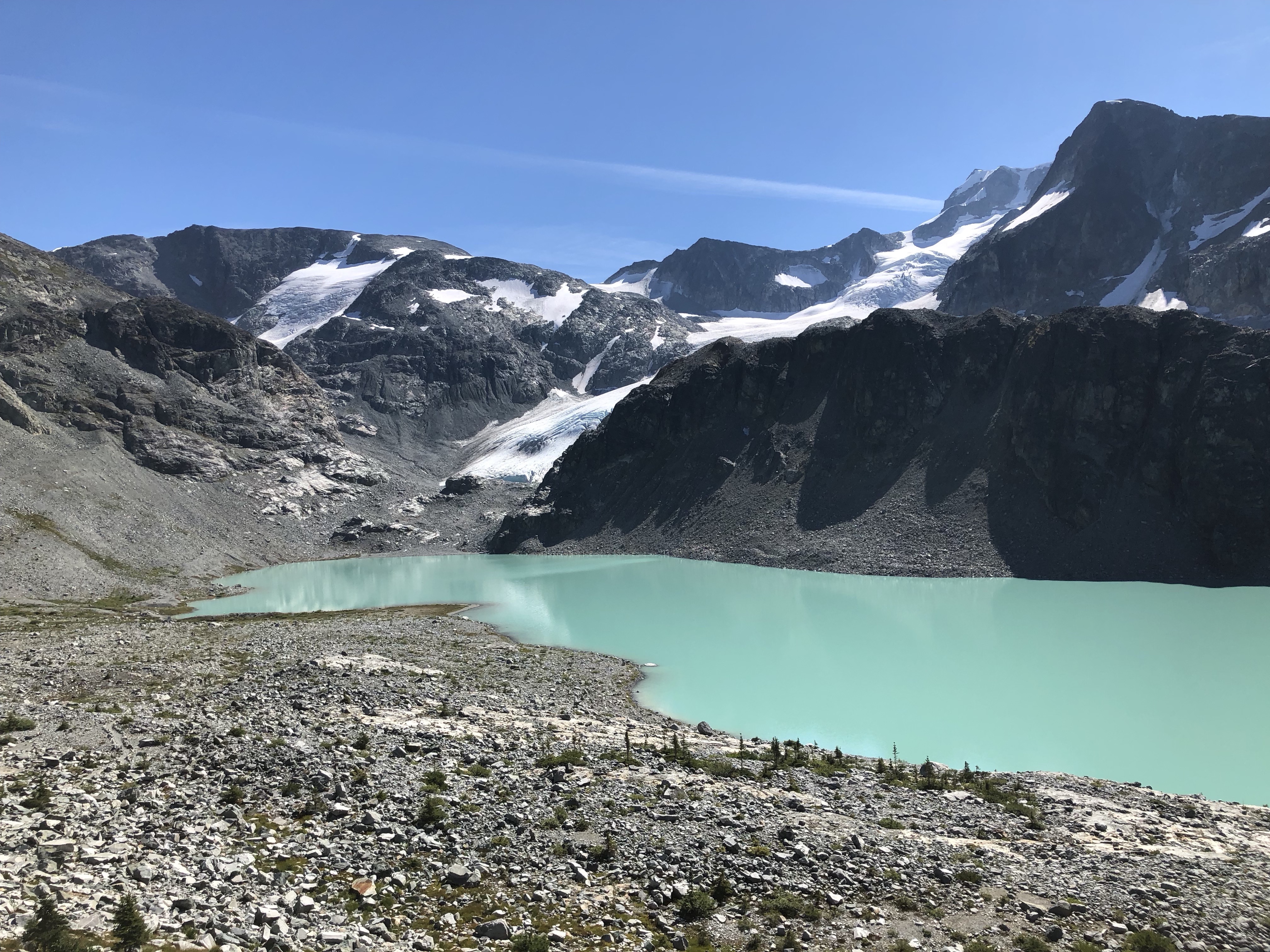
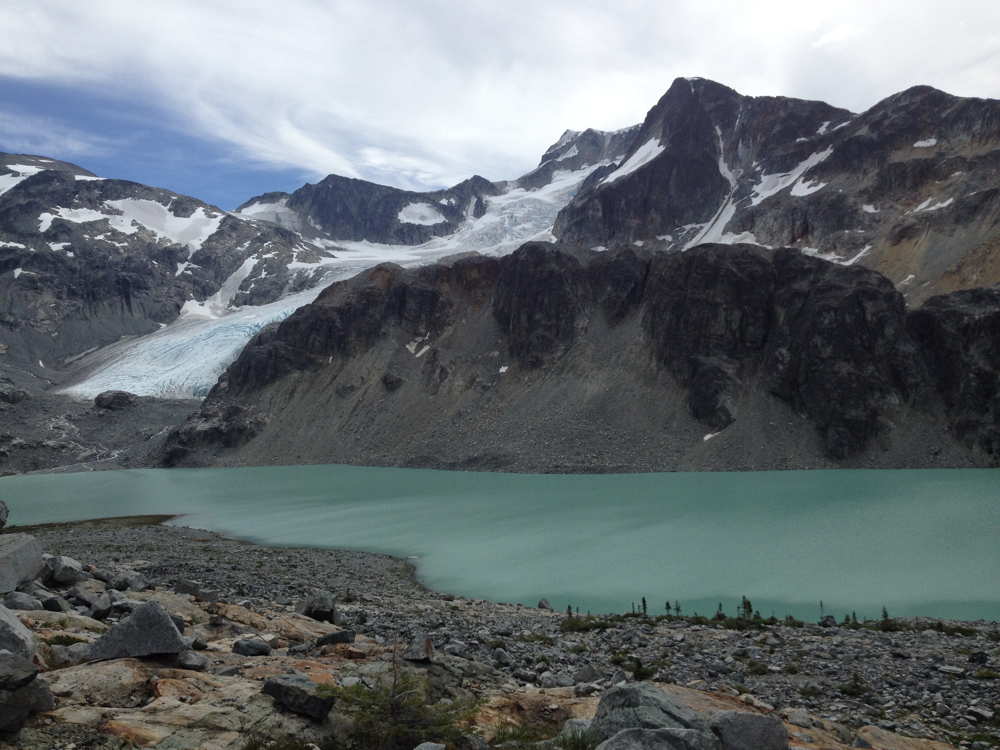
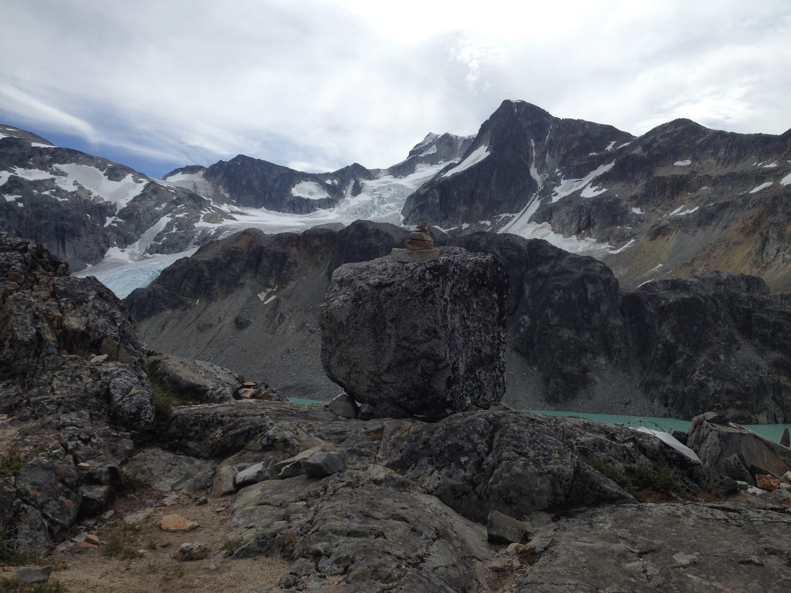
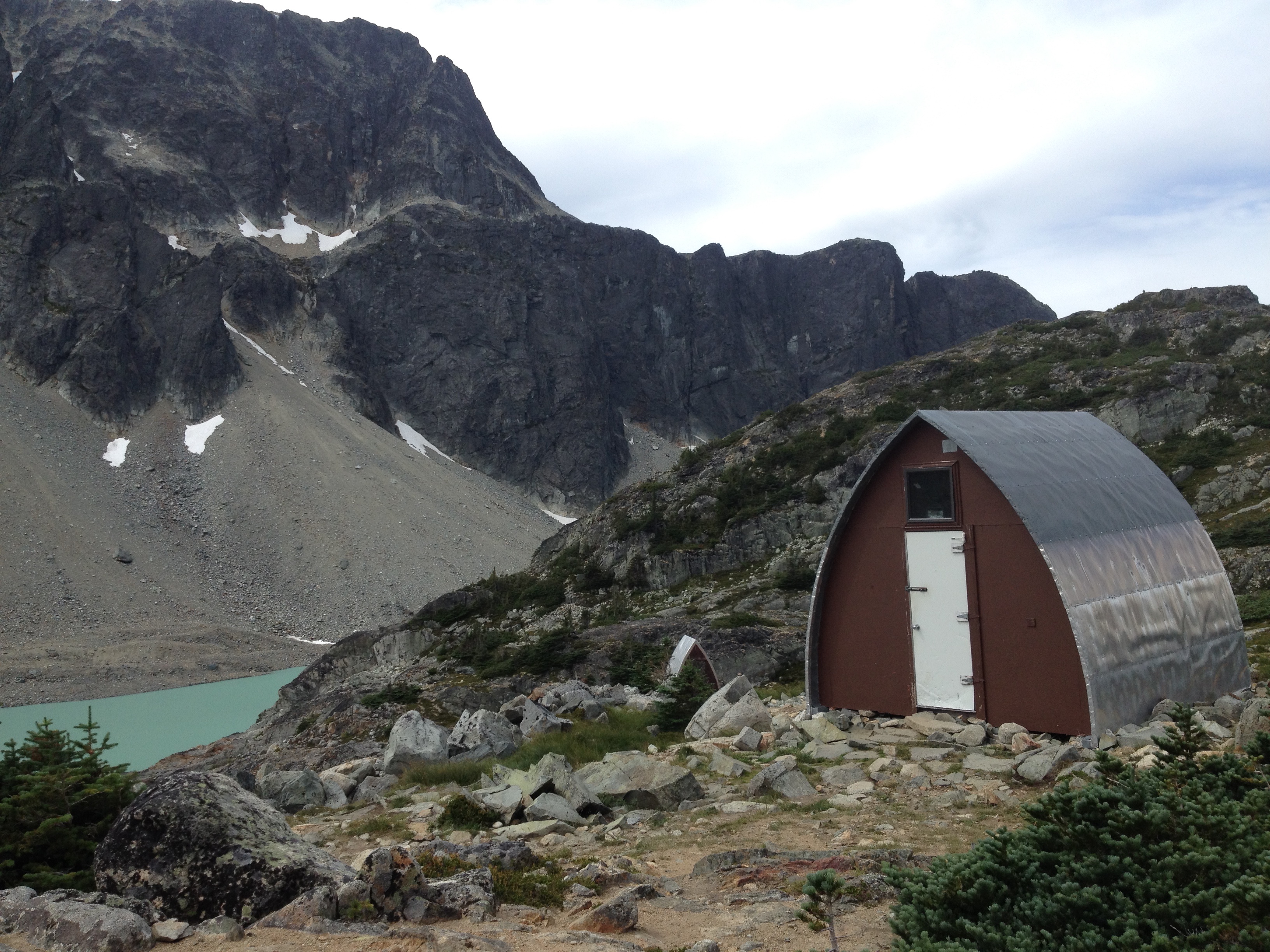
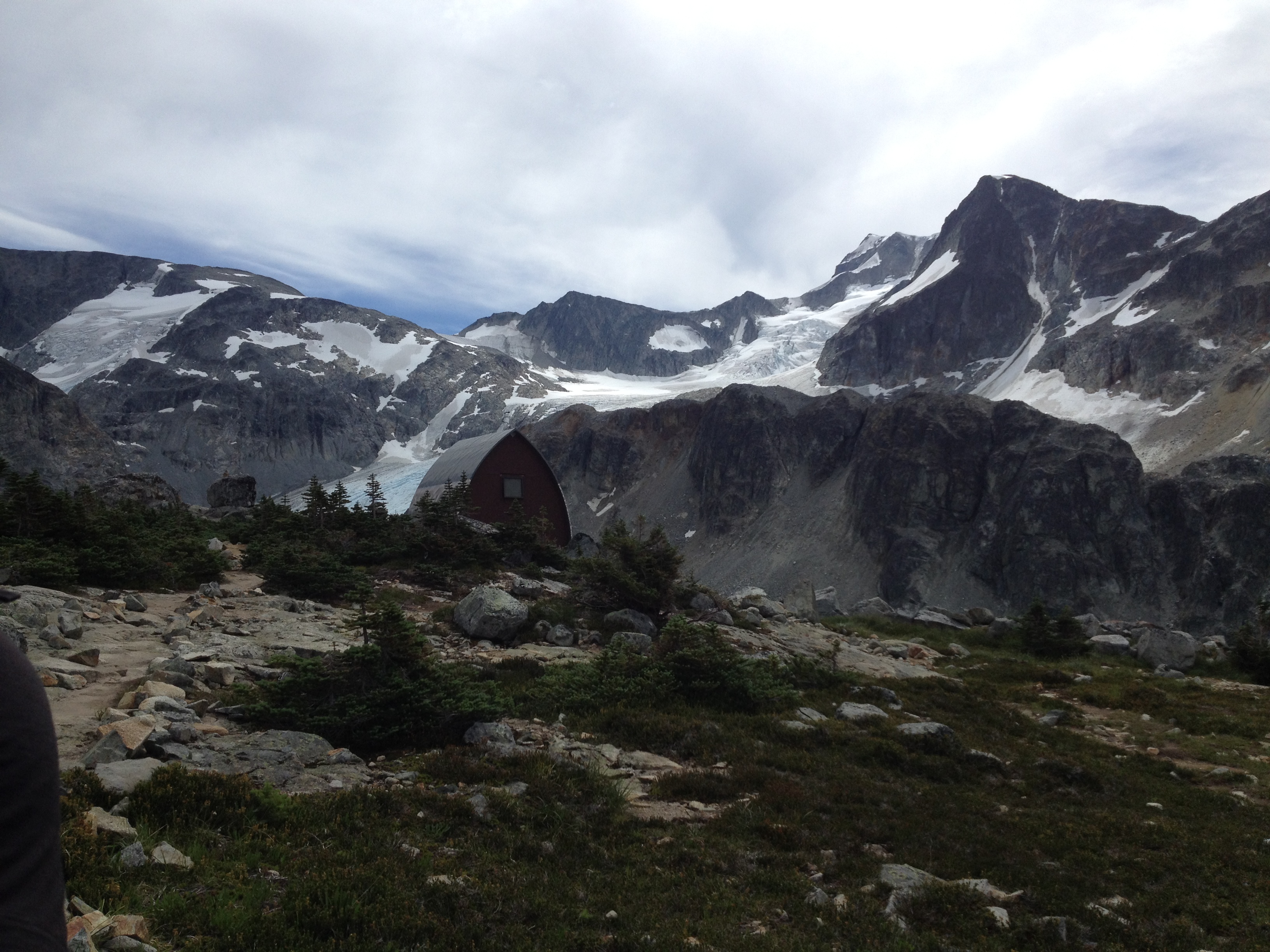
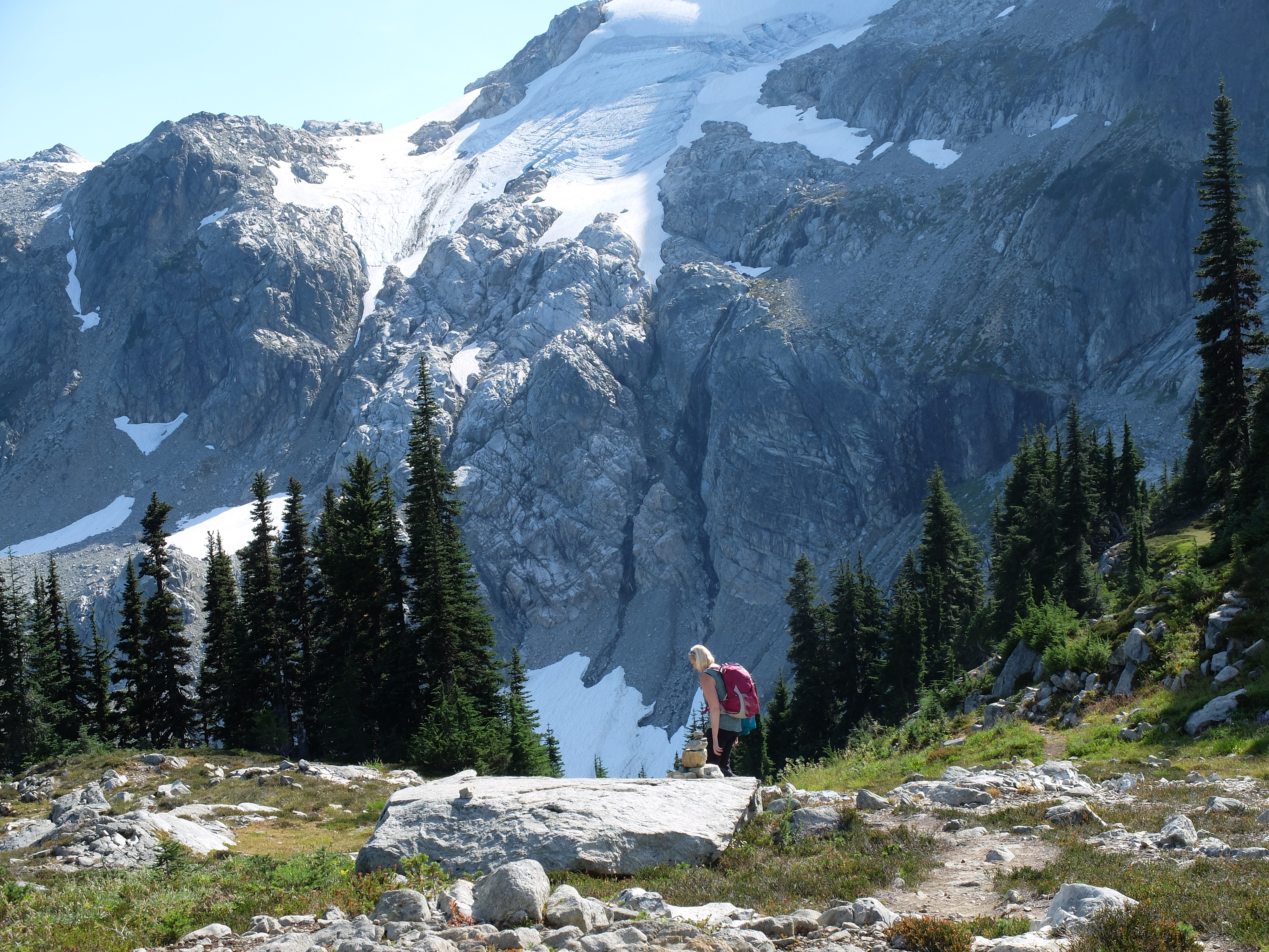
Infamous for its steepness, this short but rugged trail leads to a turquoise lake surrounded by glaciated peaks. It’s a popular trail despite its reputation so expect crowds. The trail is relentlessly steep and can be tough on a hot muggy day. It is also very rocky and rooty in places. The last mile is the steepest and turns into a semi-scramble. The struggle is worth all the effort onces you reach the saddle and see the lake and surrounding mountains. From the lake there is a possible scramble to the top of Mt. Cook, famous for fantastic panoramic views of surrounding mountains. Based on descriptions we’ve read, Mt. Cook is still doable as a day trip, but the elevation gain from the trailhead all the way to the top is intimidating: 1925m / 6316ft. We saved it for another day. Twice. More info: https://www.whistlerhiatus.com/whistlerhikes/wedgemount-lake.html |
|
|
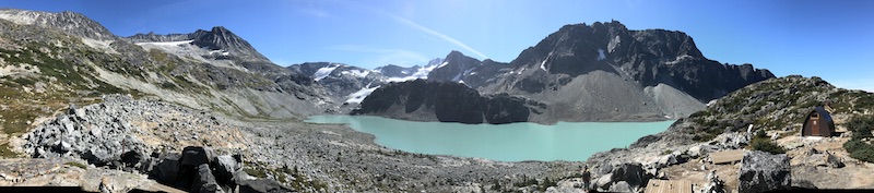
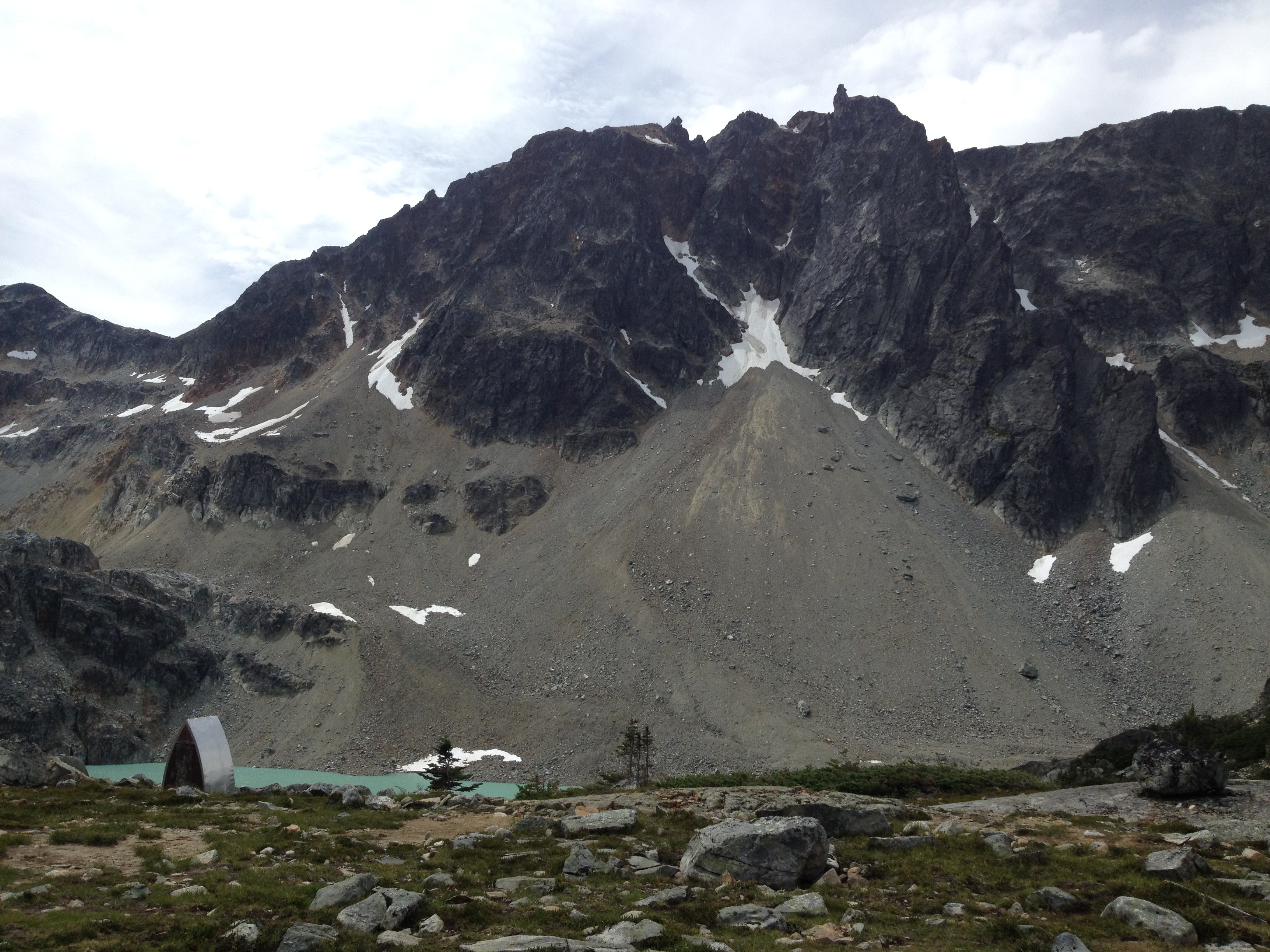
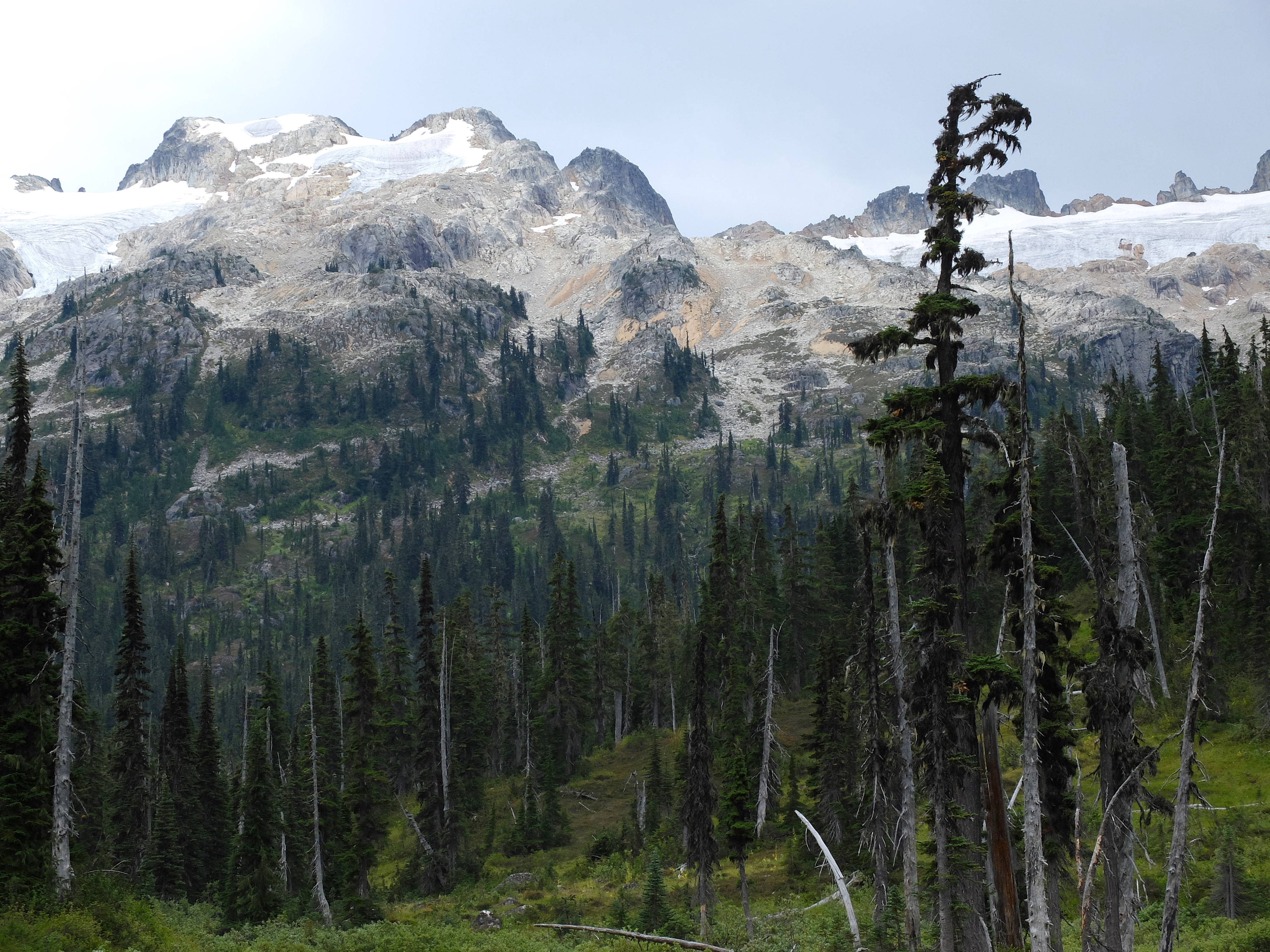
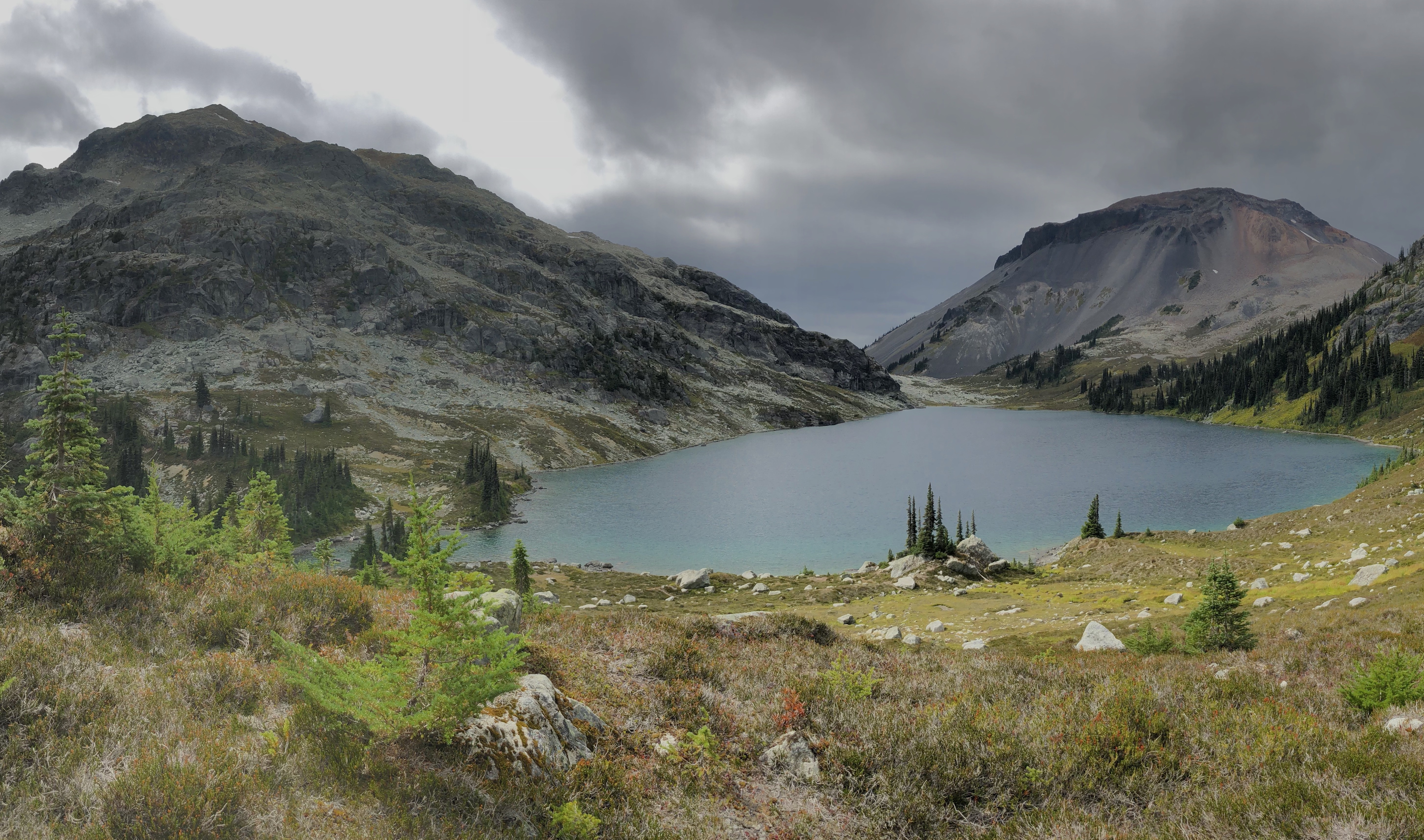
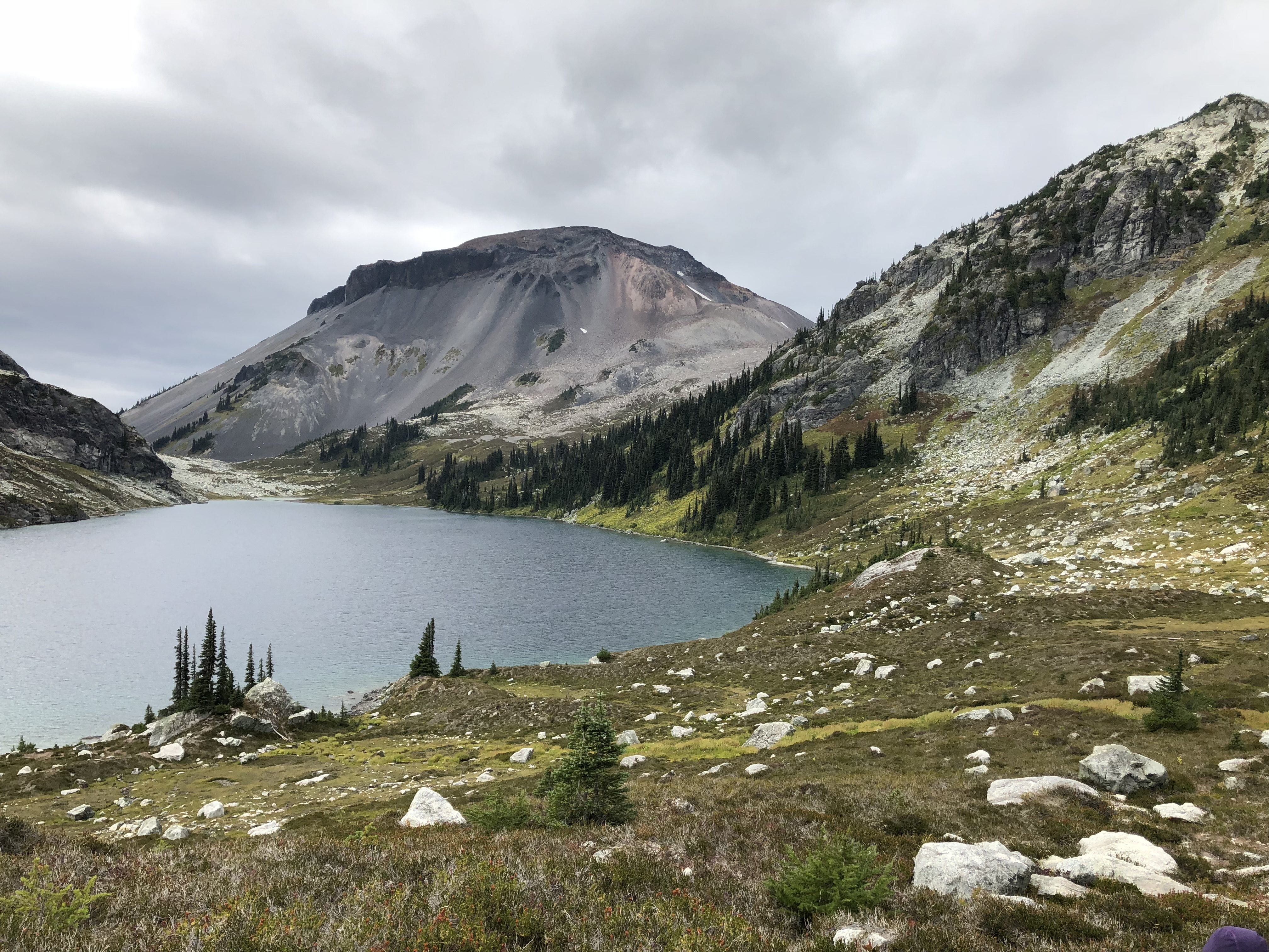
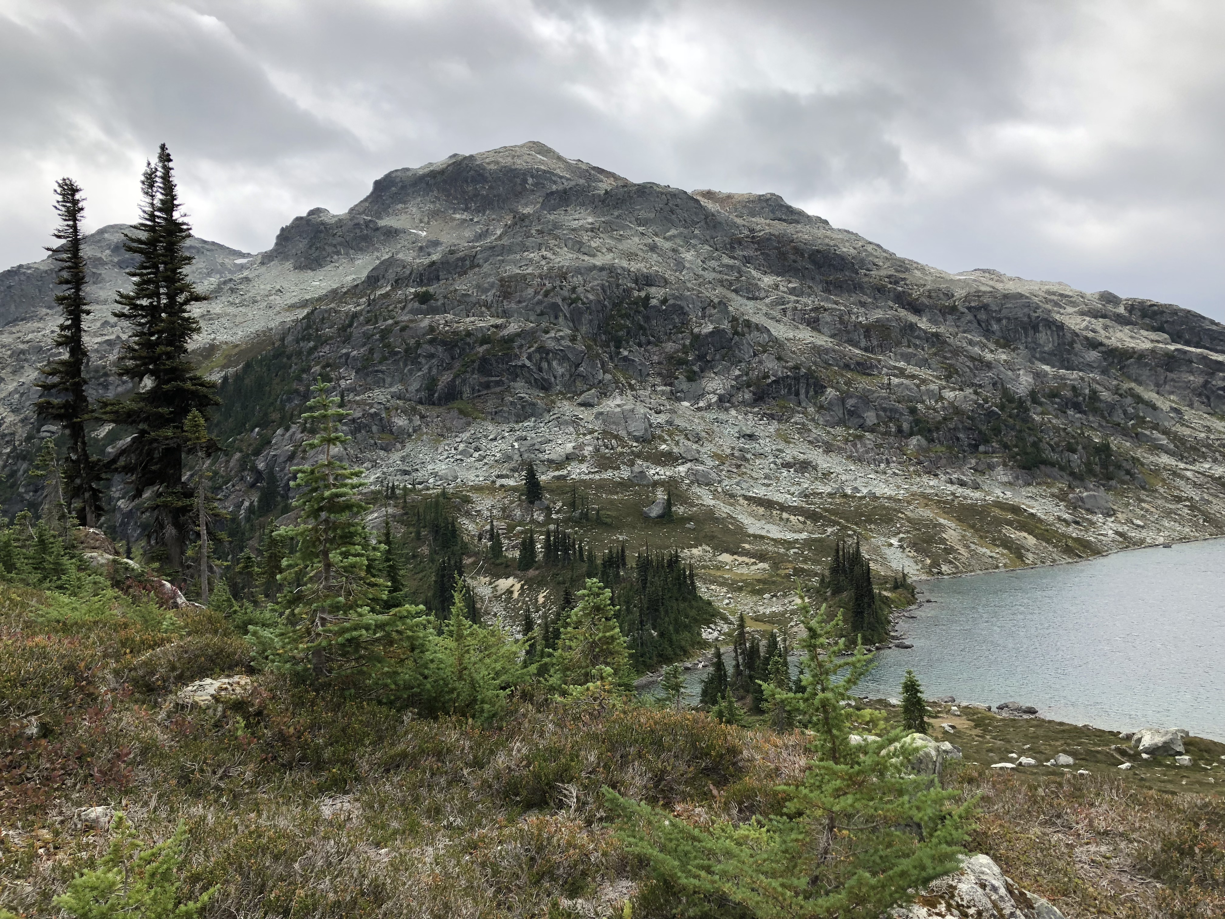
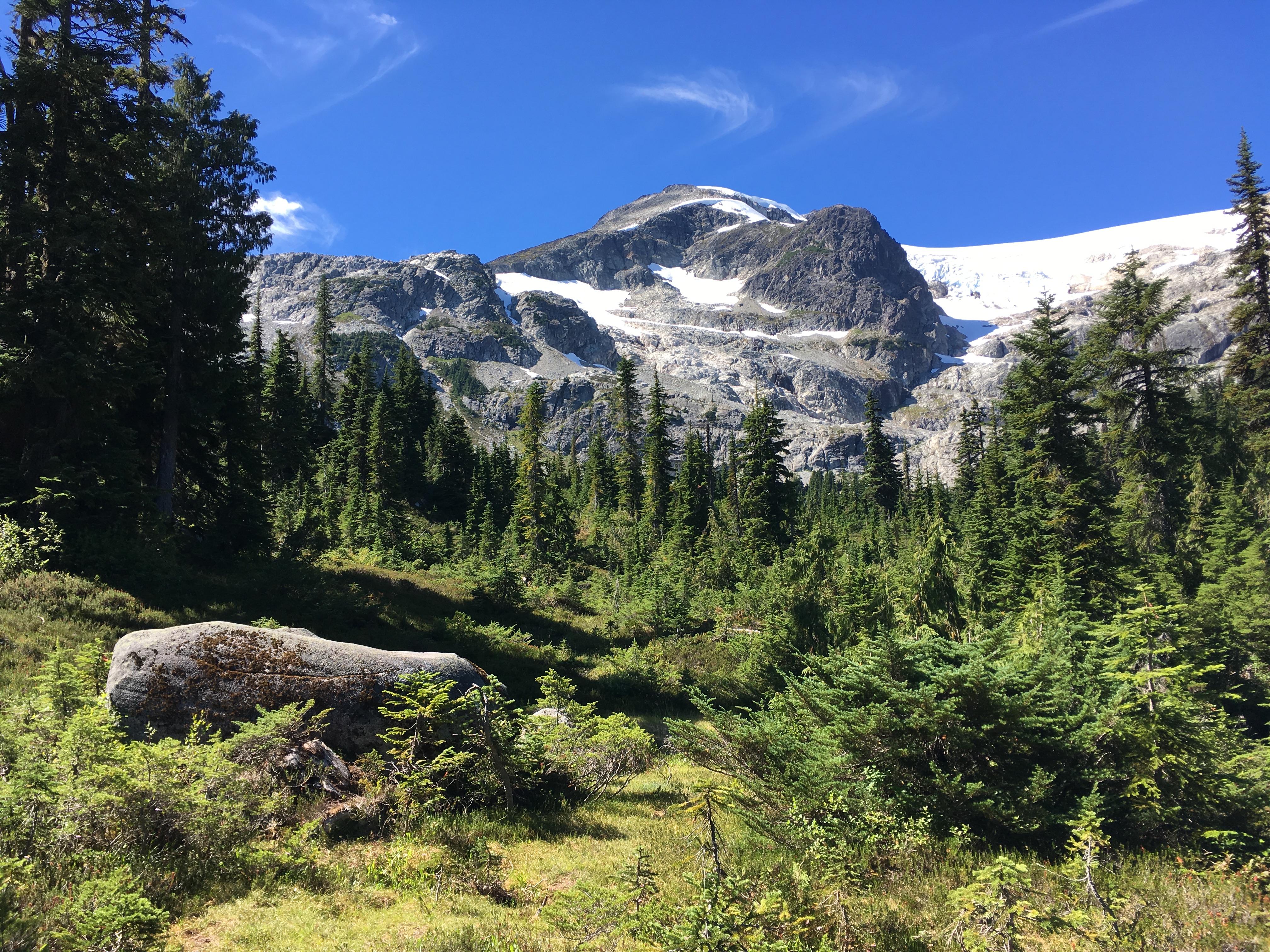
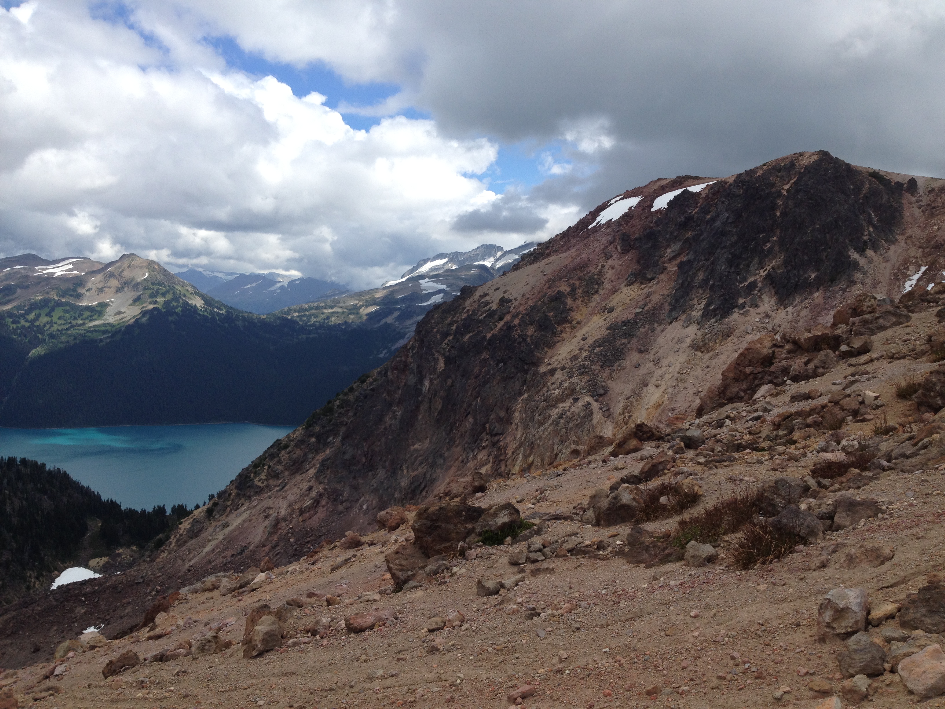
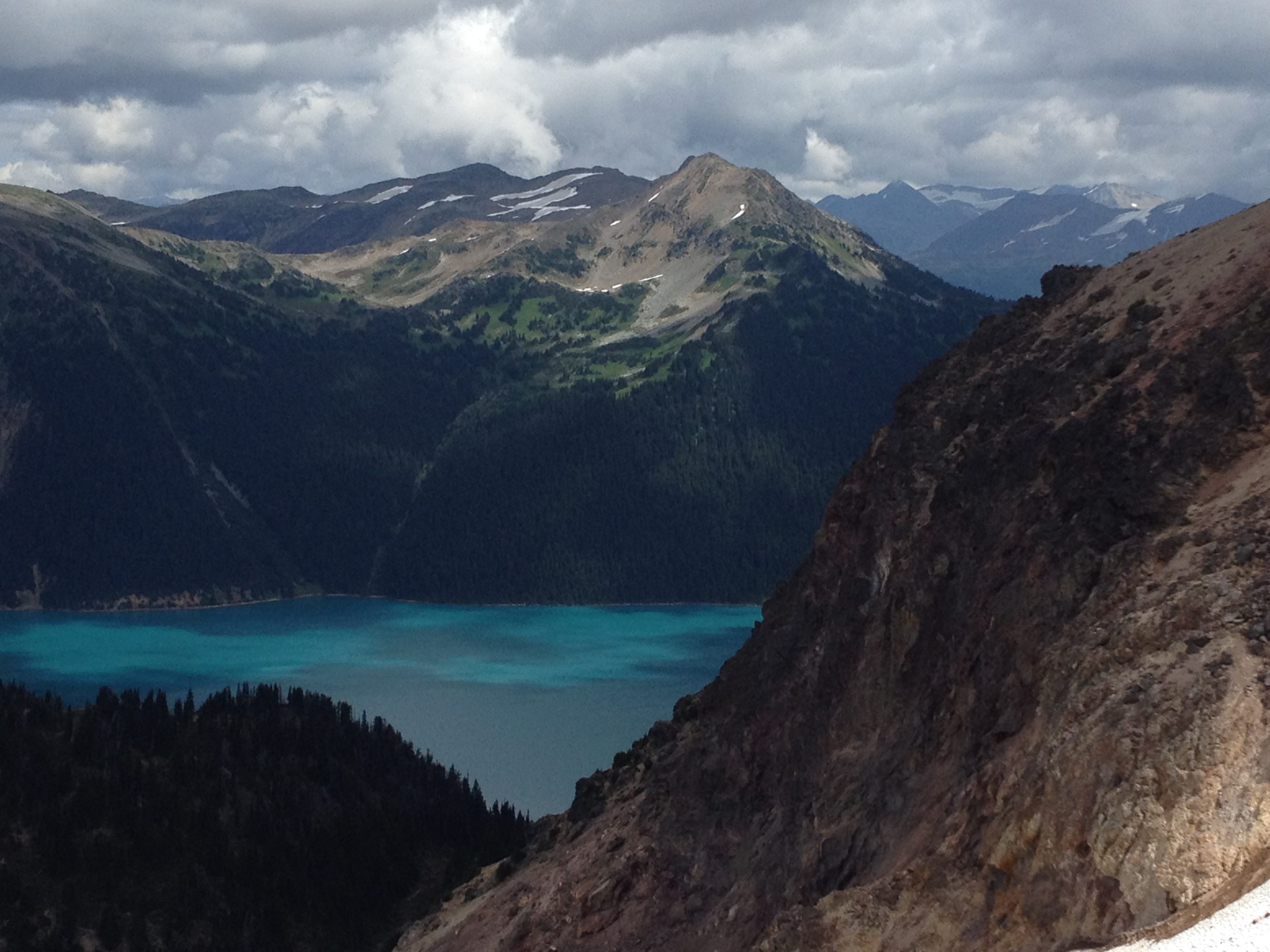
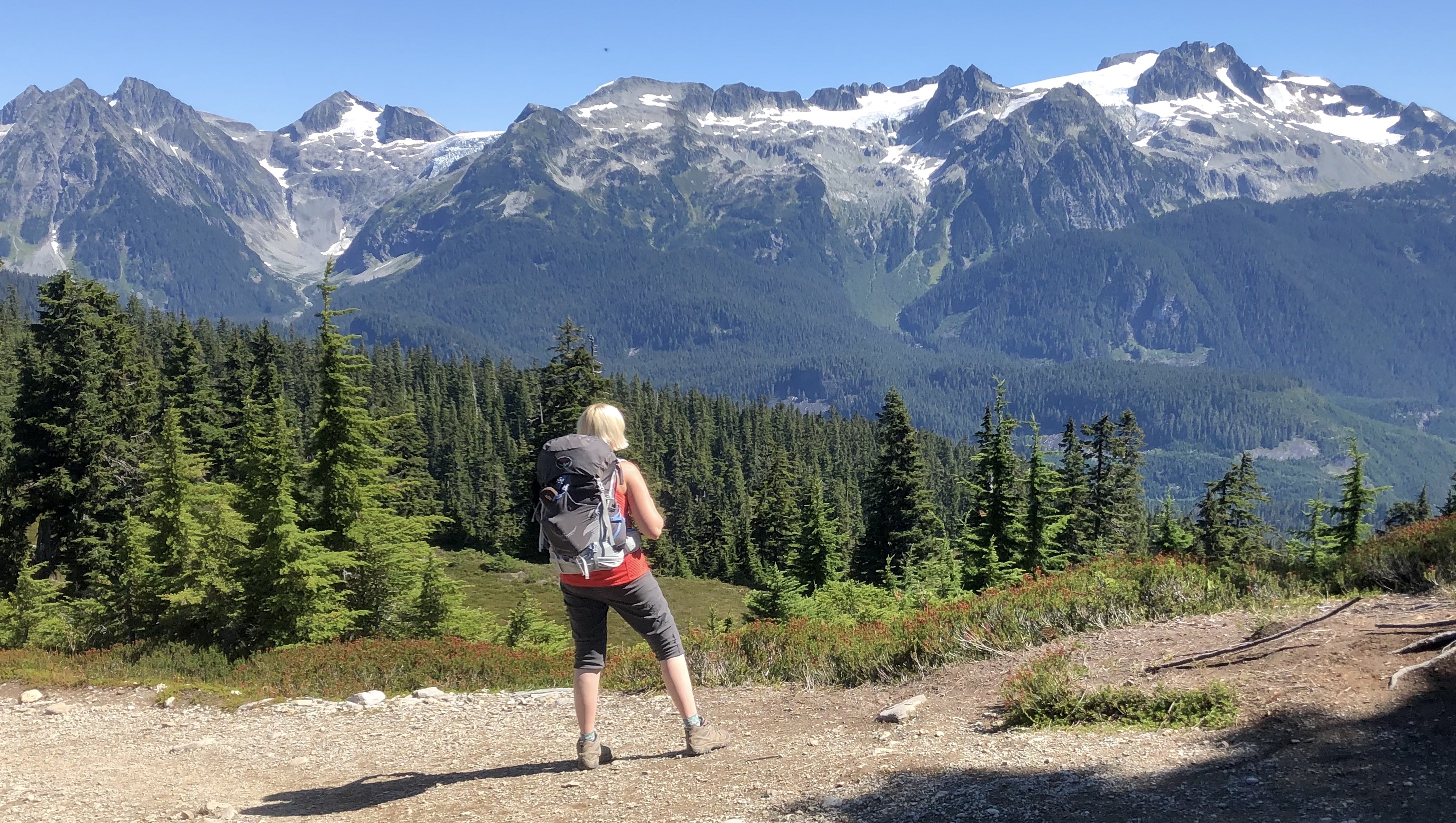
Beautifully remote area and sort of an otherworldly landscape, with bizarre shaped Ring Mountain towering over the lake. Difficulties: the road to the trailhead is a little rough and low clearance vehicles may struggle, on the hike there is a creek crossing that can be hard to impossible if water runs high, finally this is a grizzly bear habitat (several sitings reported in the recent years, although the bears didn’t seem to care too much about humans). More info: https://whistlerhiatus.com/whistlerhikes/ring-lake-a-conflict-lake.html |
|
|
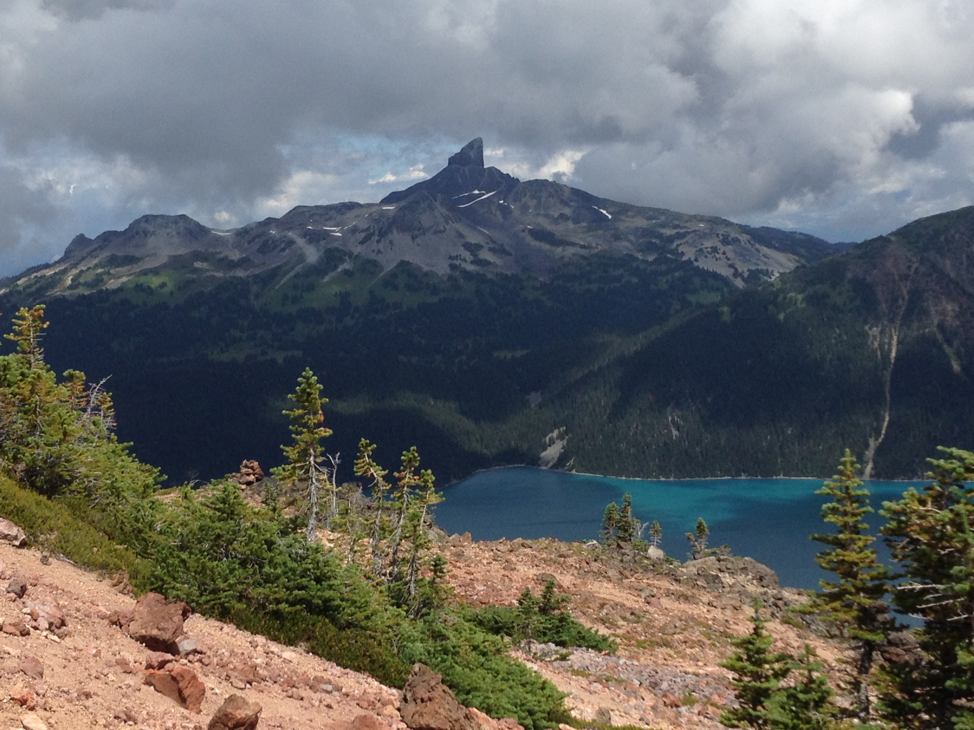
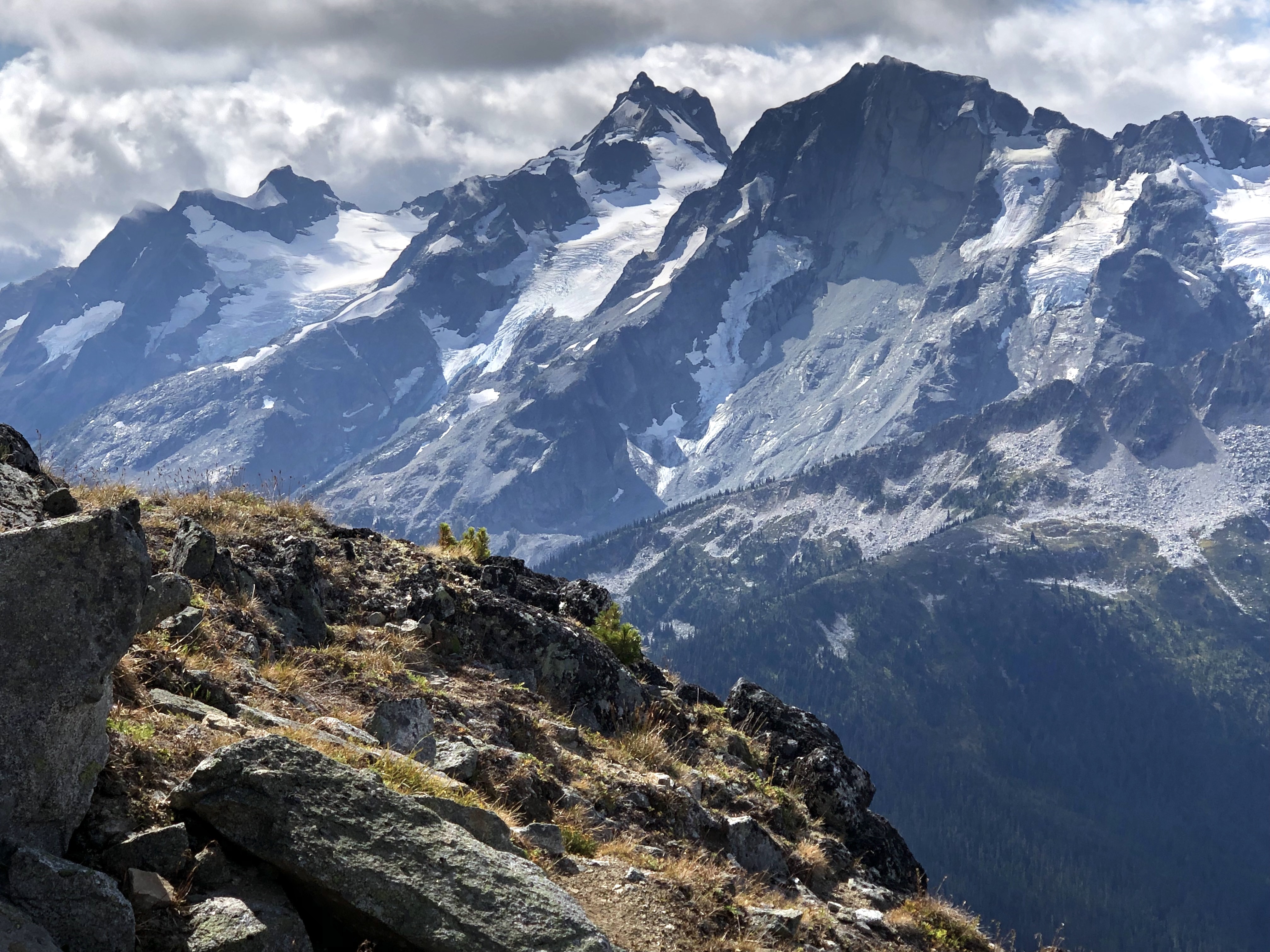
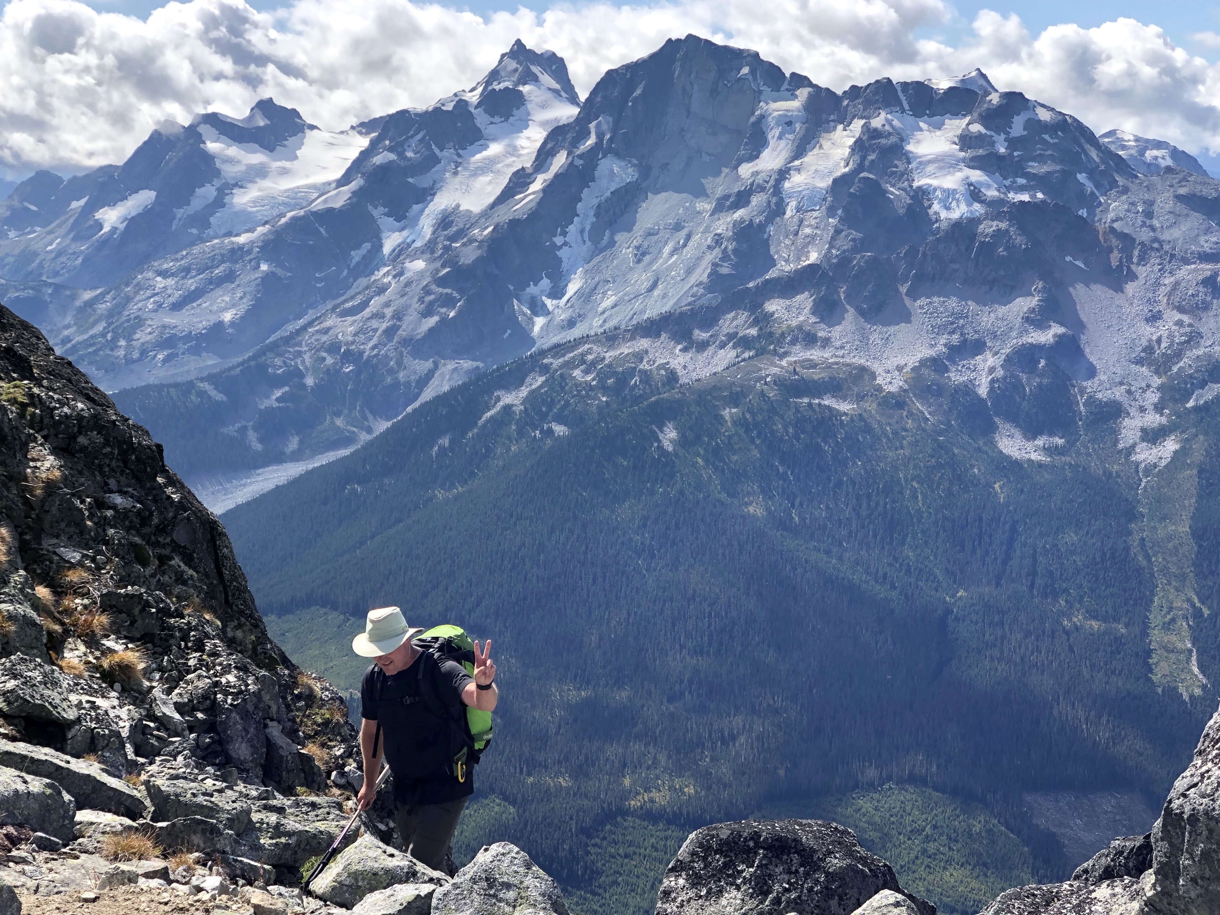
This hike can be done as a very long day (28km round trip) or a wonderful overnight trip (which was our choice). We backpacked and had the lake to ourselves. While you can hike up to it from Whistler itself (a much longer and steeper approach), we are lazy so we took the Whistler Gondola and took the Musical Bumps Trail. Bugs will eat you alive on the lake, so bring bug spray if you're planning to camp. There is a mice-infested hut on the lake, but in summer, a tent is a much nicer option. We camped at the lake. It was is remote, beautiful, and quiet. This can be a fun day hike itself if you only go to Flute Summit, the best viewing point of the ridge, with an amazing 360 degree mountain panorama. More info: https://www.whistlerhiatus.com/whistlerhikes/russet-lake-a-singing-pass.html |
|
|
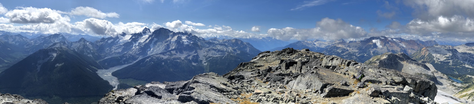
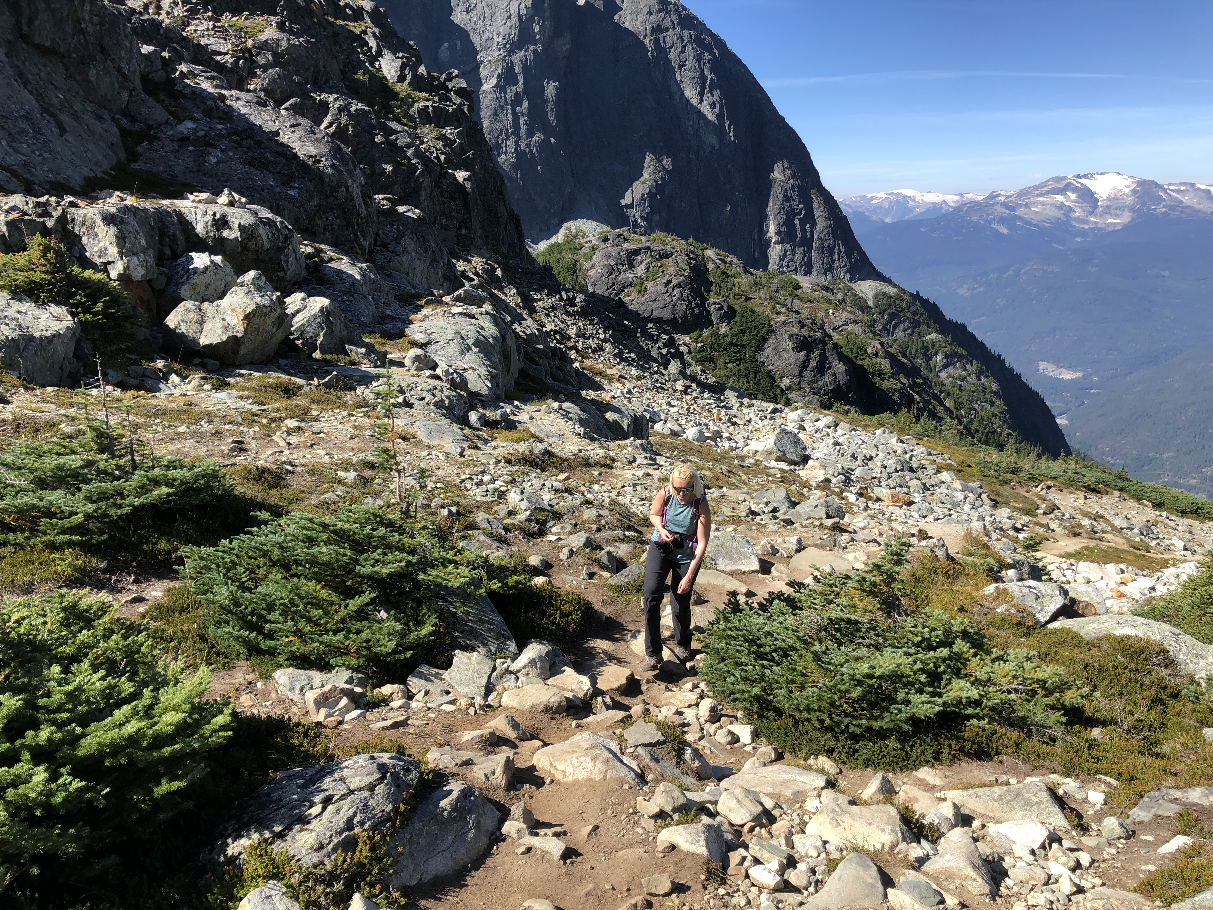
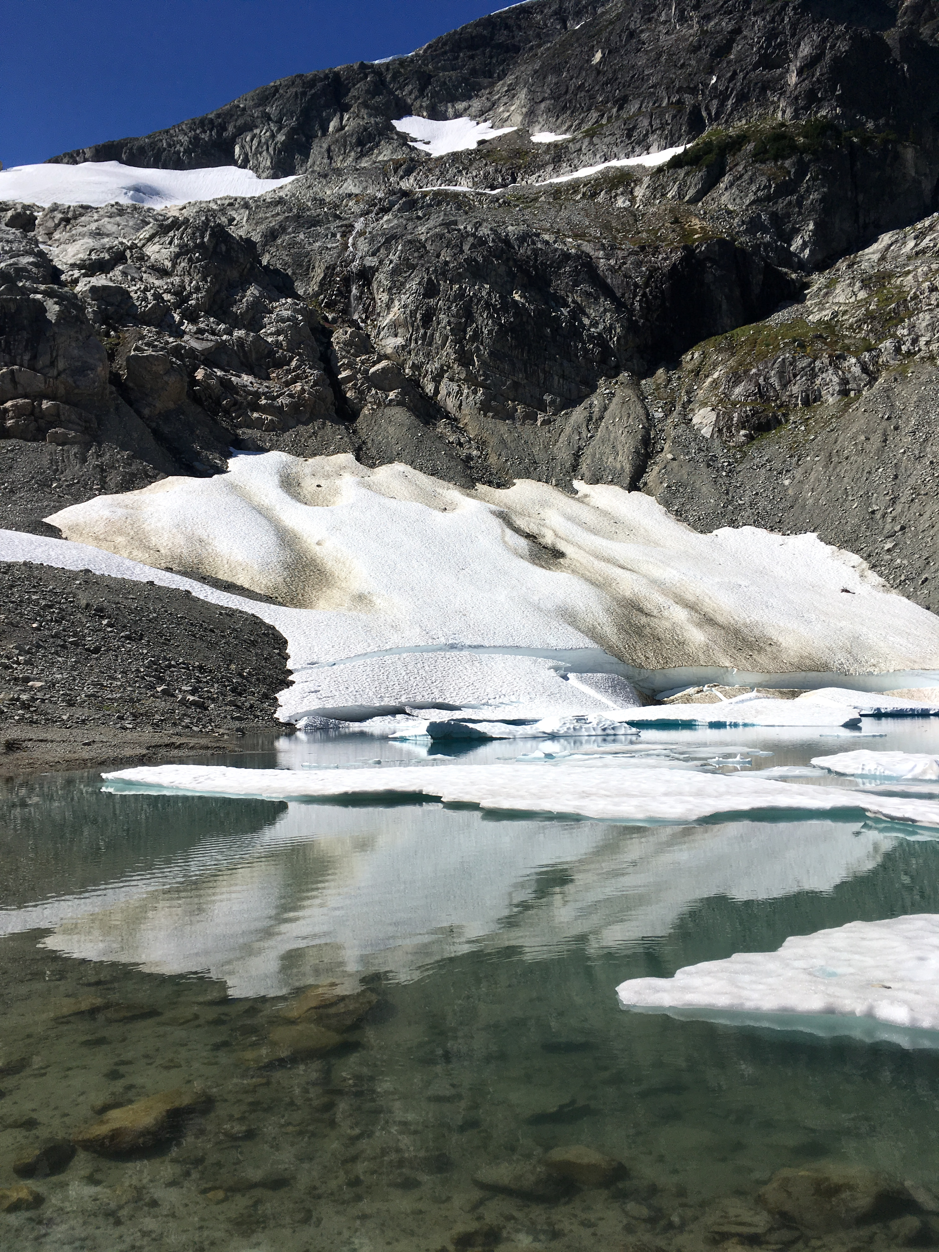
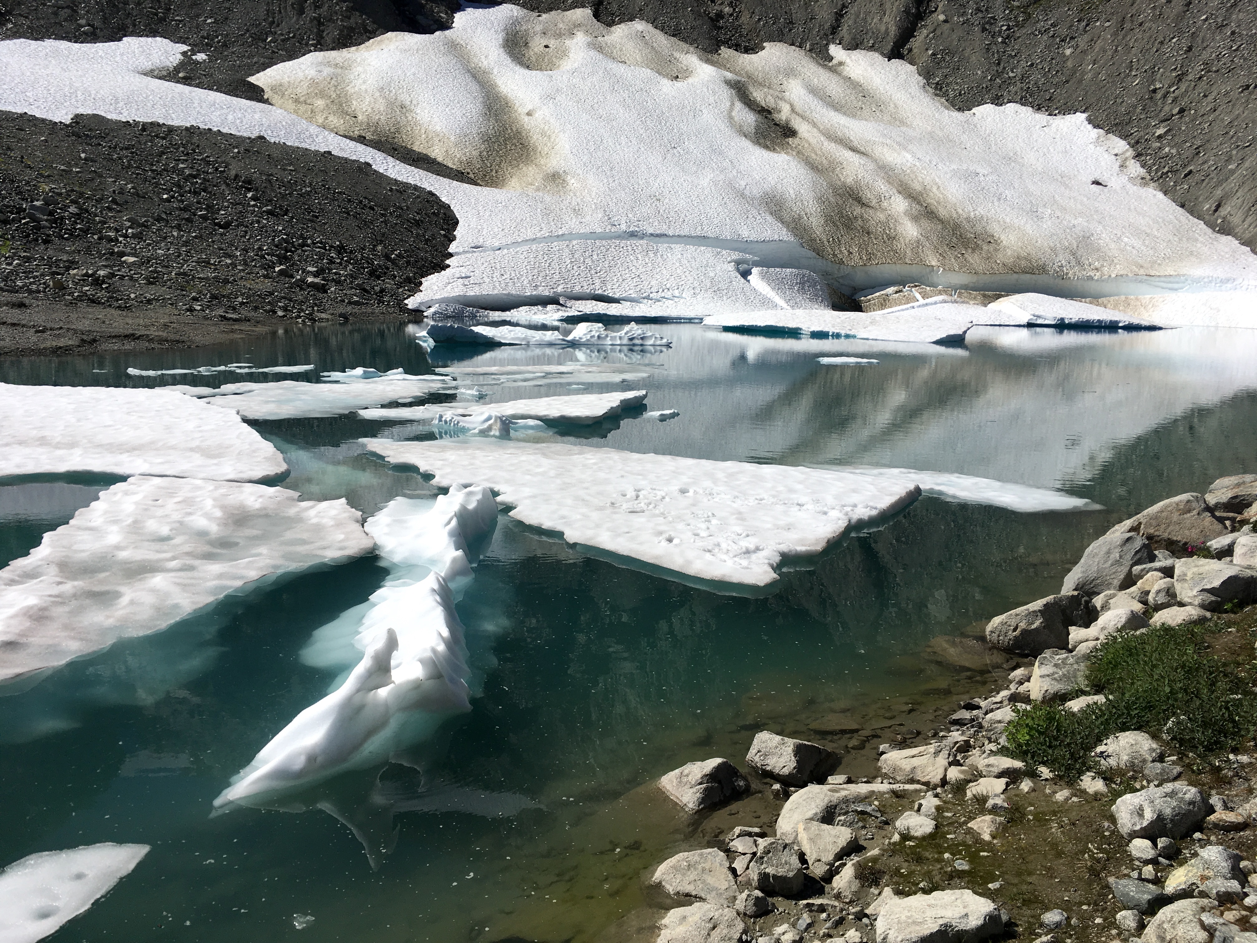
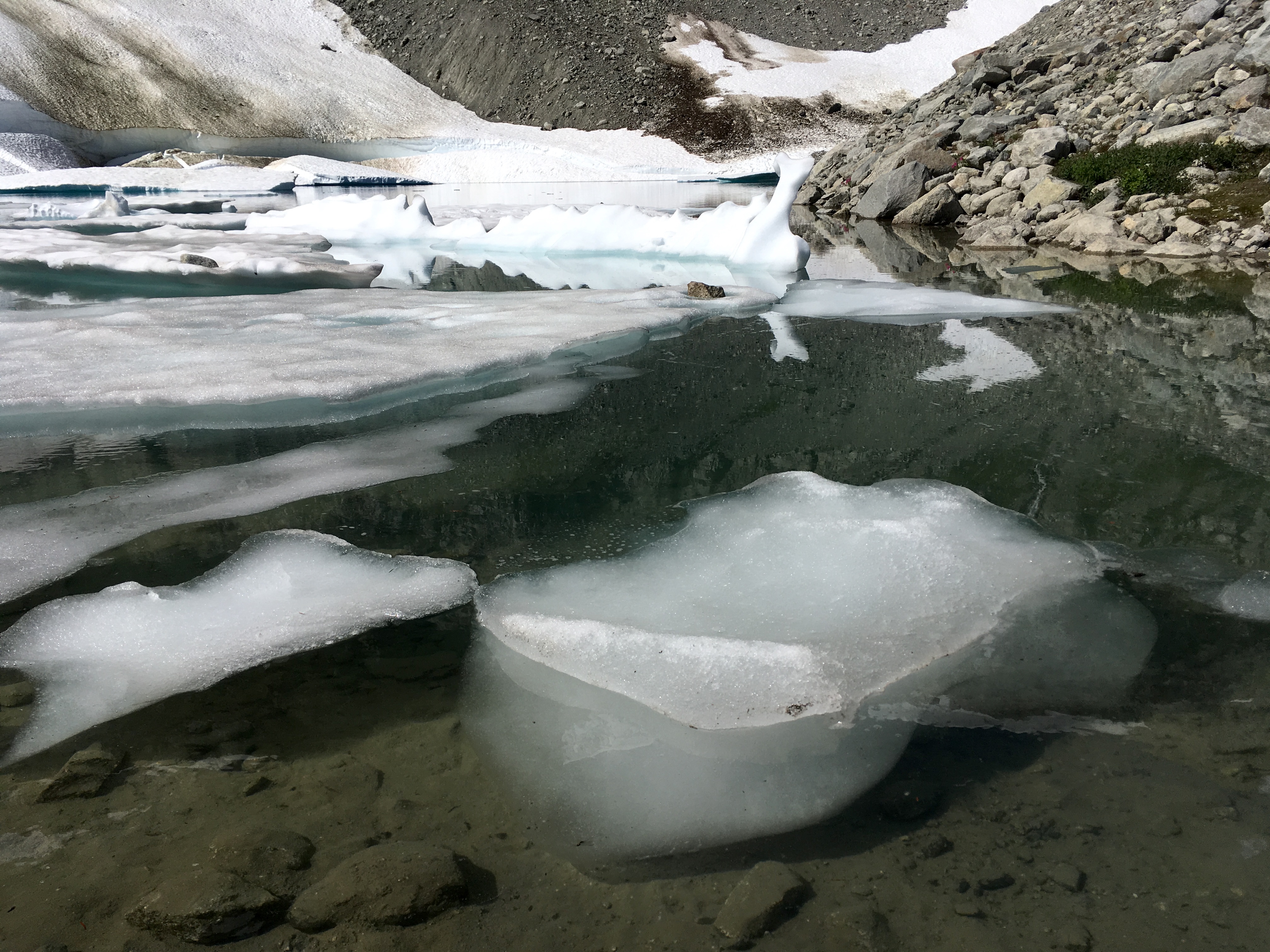
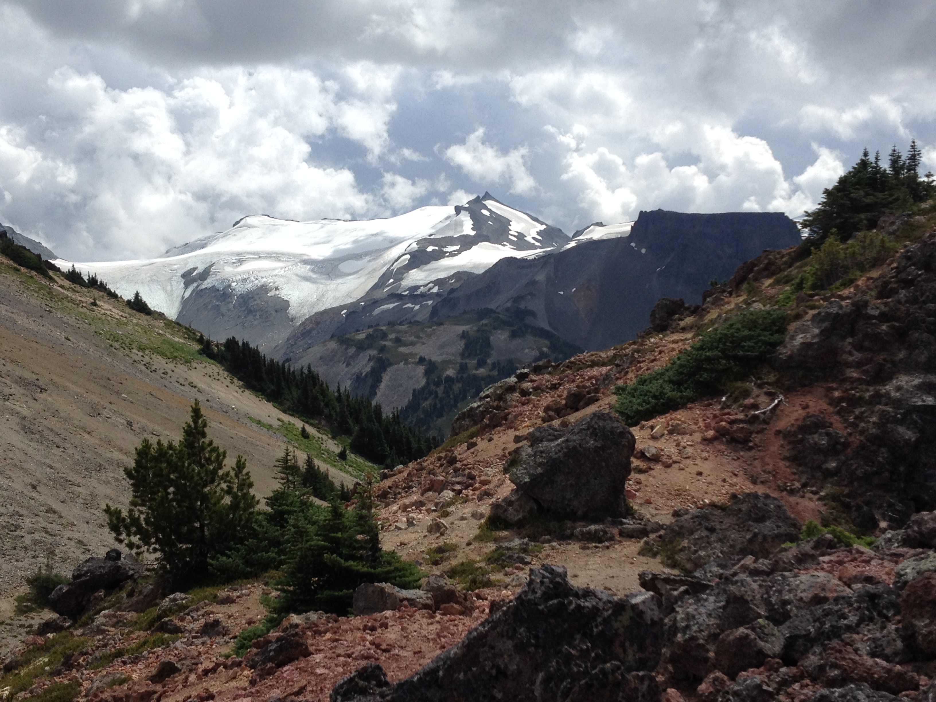
Skywalk North is a a part of a fairly new (2014) alpine trail system in Whistler, with several options and connector trails. The full loop is a long day hike with a substantial elevation gain, traversing several mountain ridges with jaw-dropping 360 degree mountain views. We did a long loop - about 14 miles round trip with a little over 4100 ft elevation gain. We followed the route recommended by Whistler-based photographer, Abby Cooper from the link below. From our start at Mountain View Drive in Whistler, we took the Screaming Cat Lake Trail. After reaching the lake, we picked Skywalk North and traversed several ridges, after finally descending steeply towards Iceberg Lake (in the photo). From the lake, we went down to Mid Flank Trail, then 19 Mile Creek straight down to Mountain View Drive where we started. Bugs alert!!! There is a swampy area after descending from Iceberg Lake - so bring bug spray or the blood suckers will eat you alive. More info: https://www.whistler.com/blog/post/2017/10/10/rainbow-mountain-trail-systems/ |
|
|
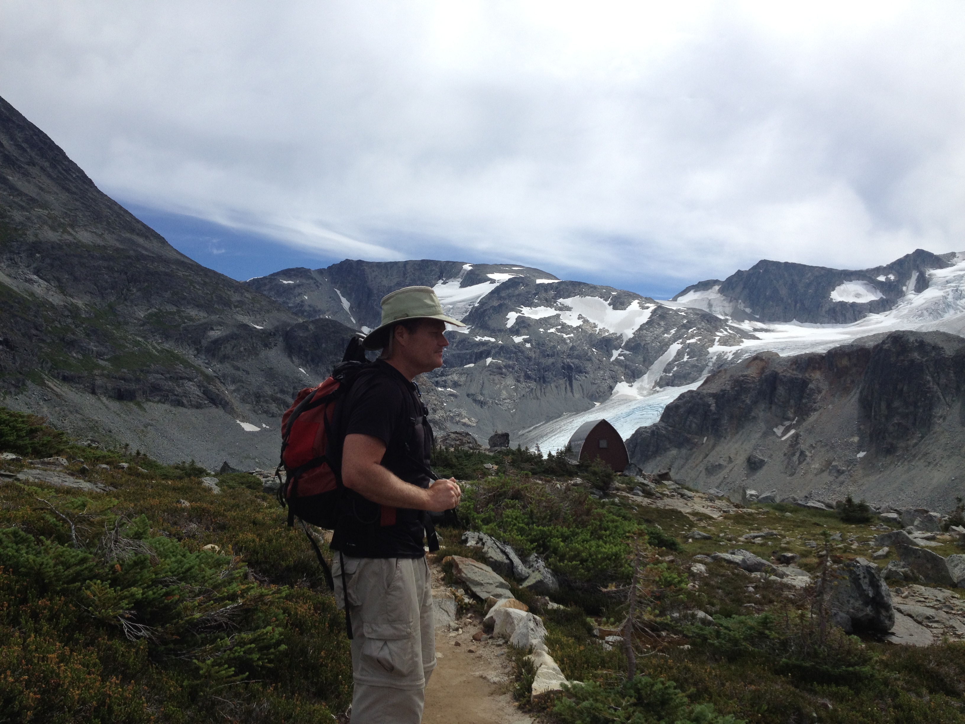
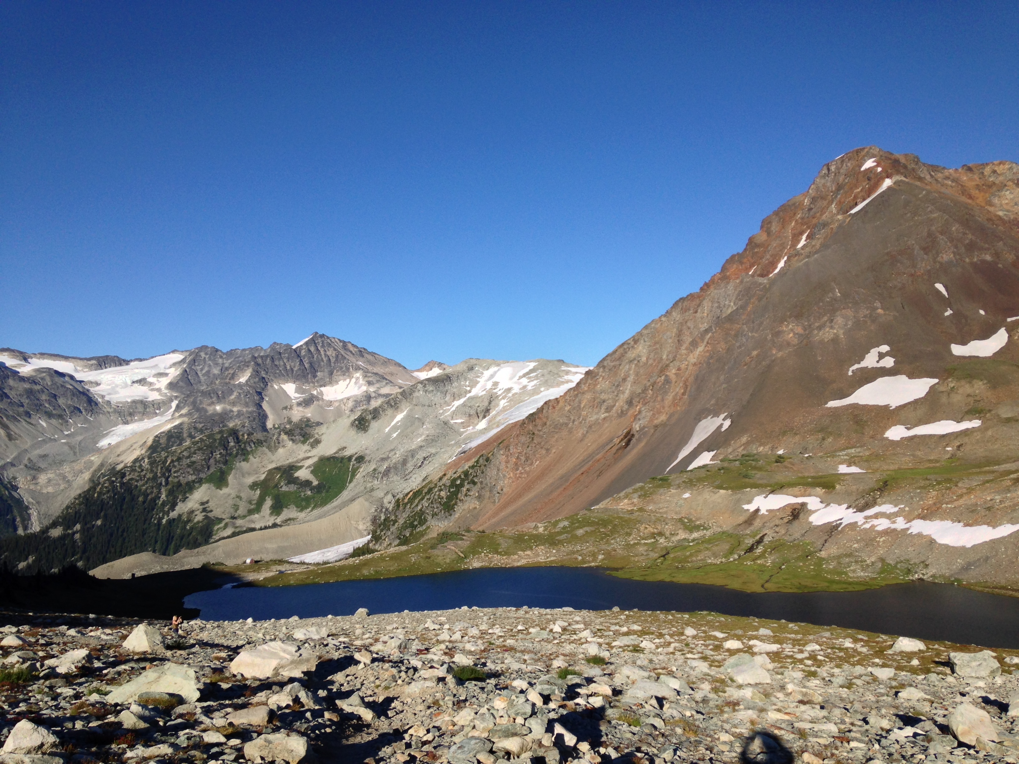
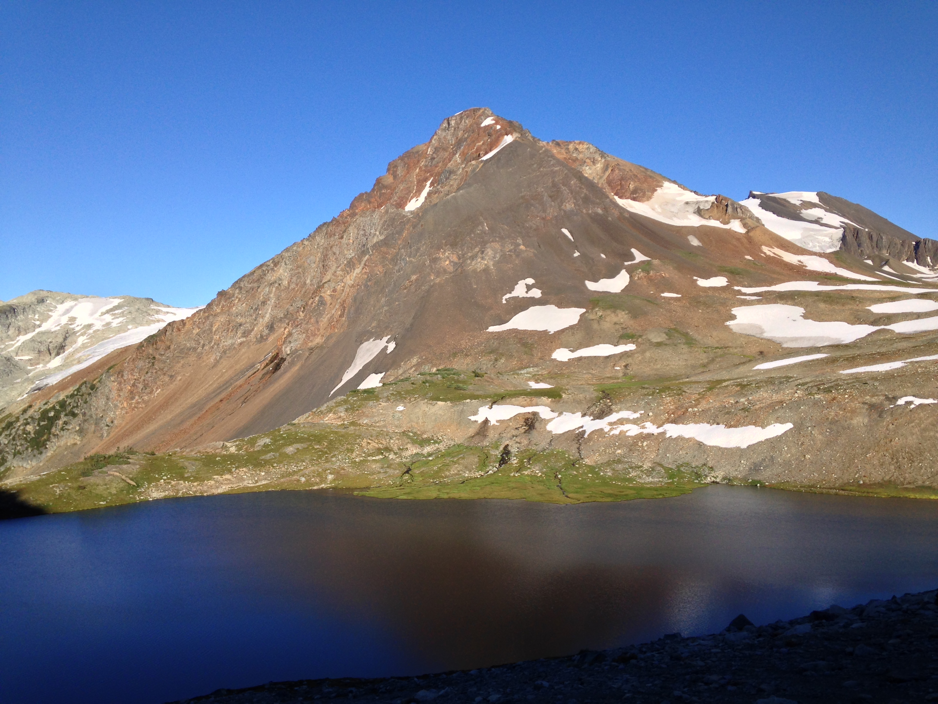
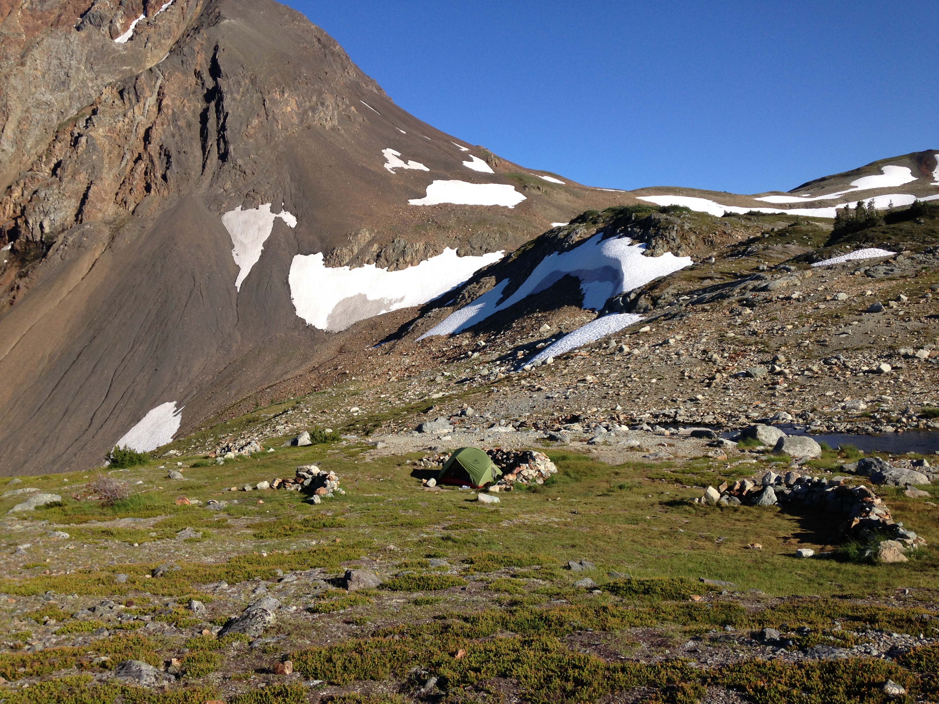
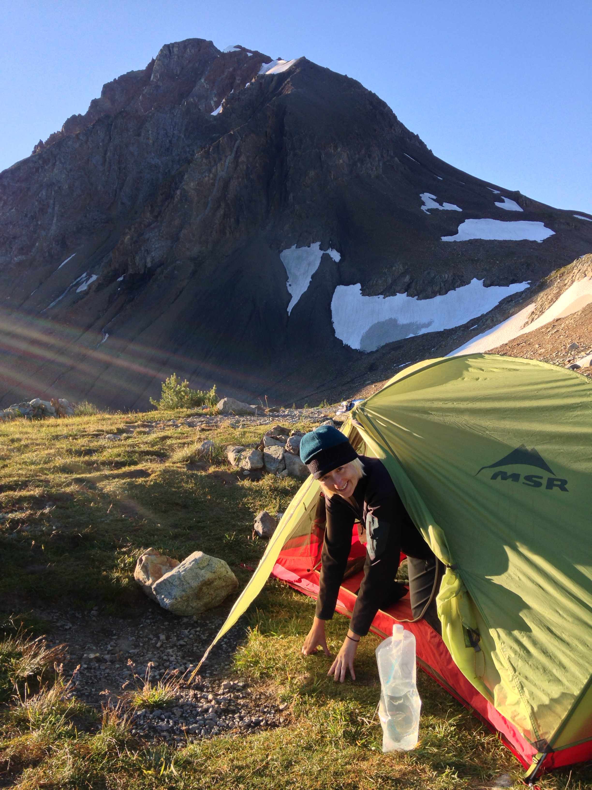
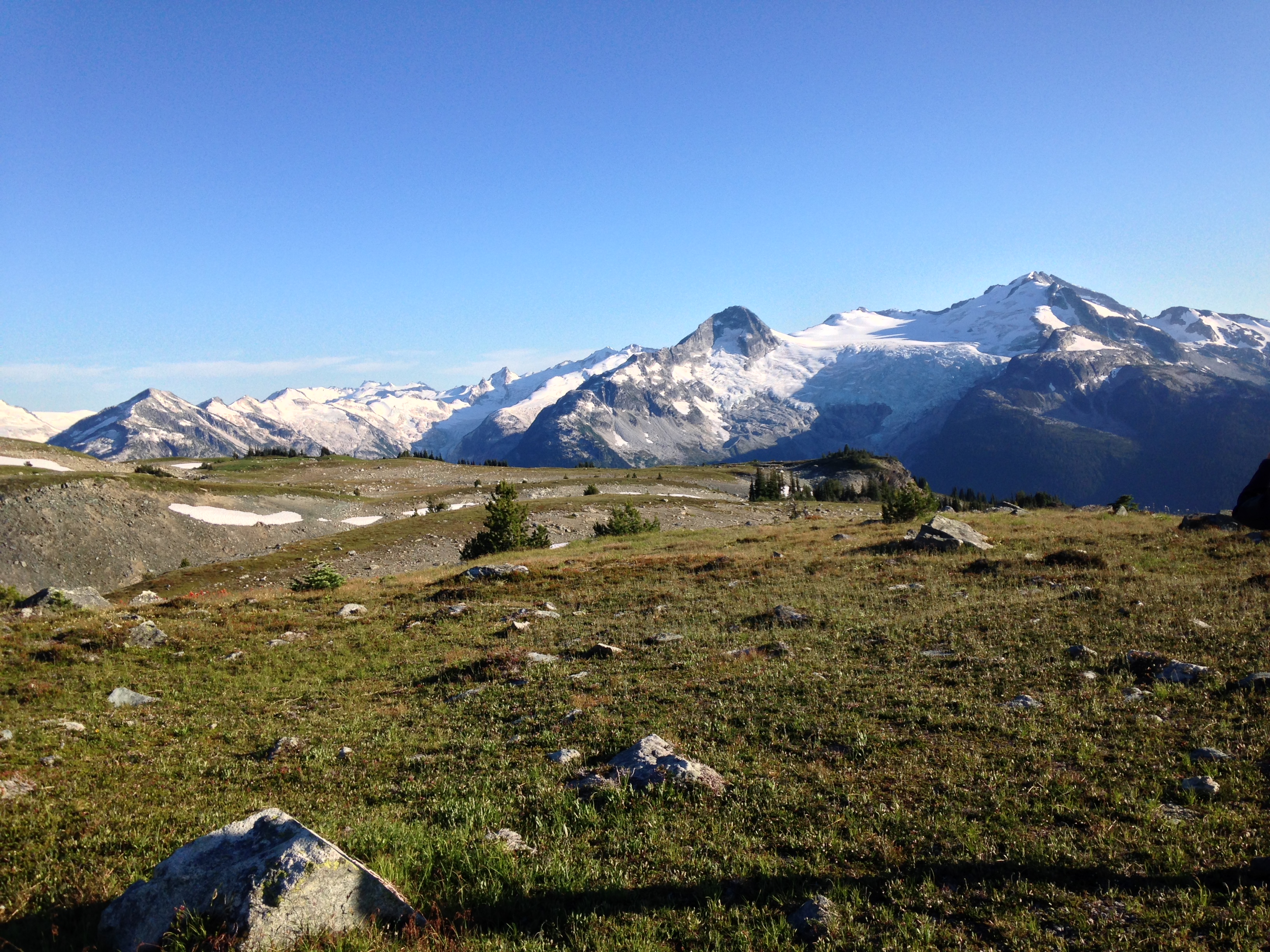
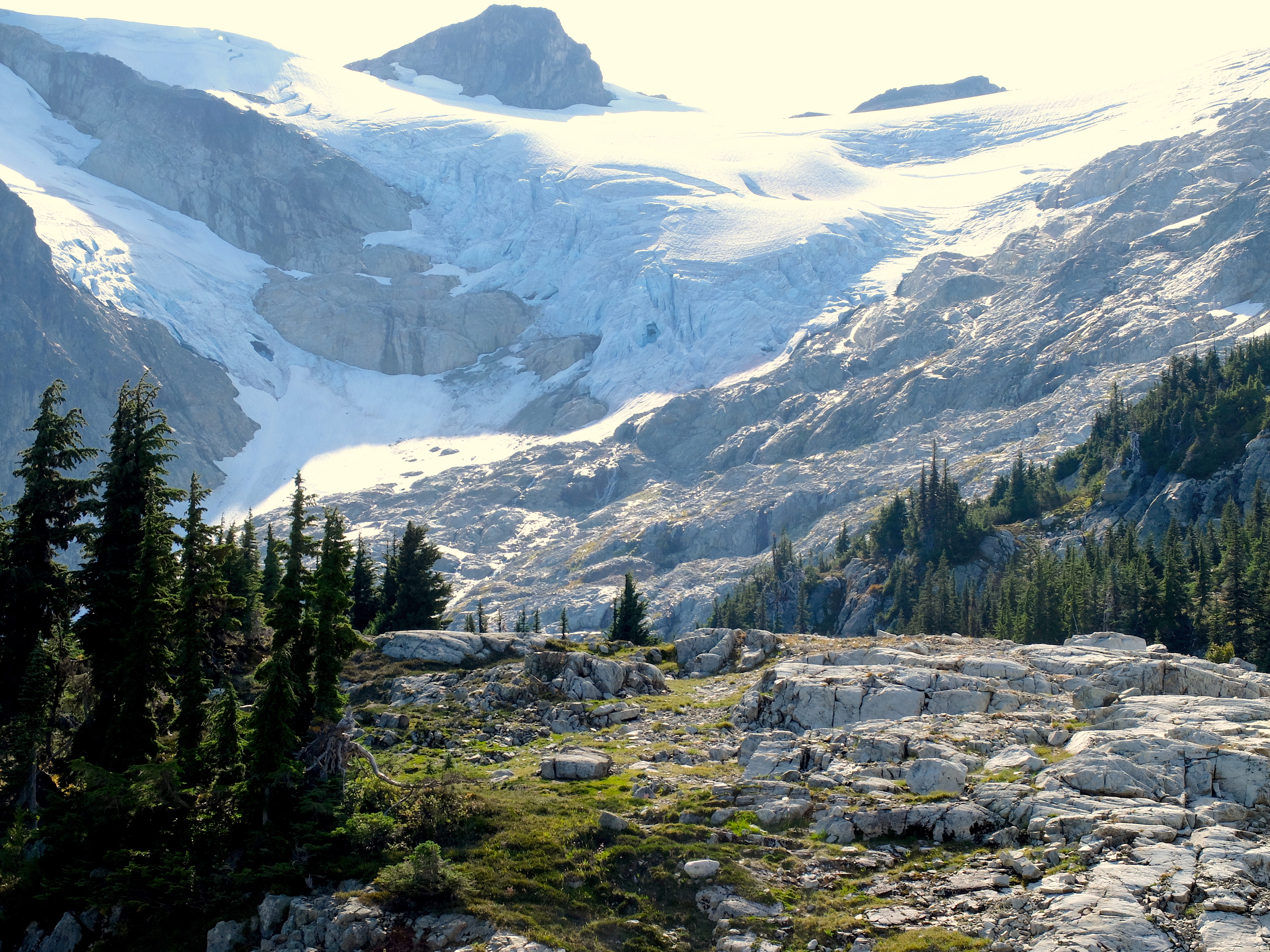
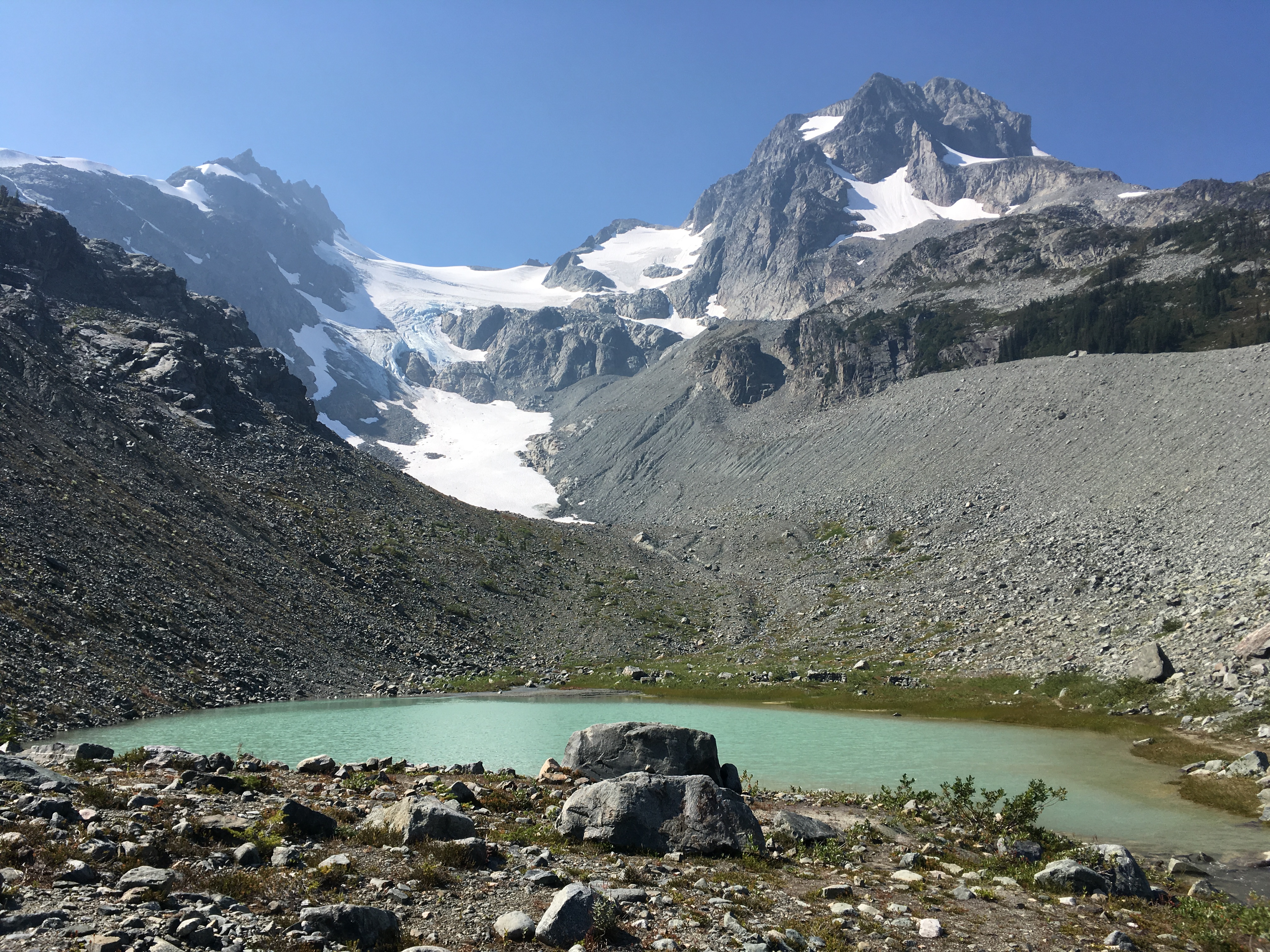
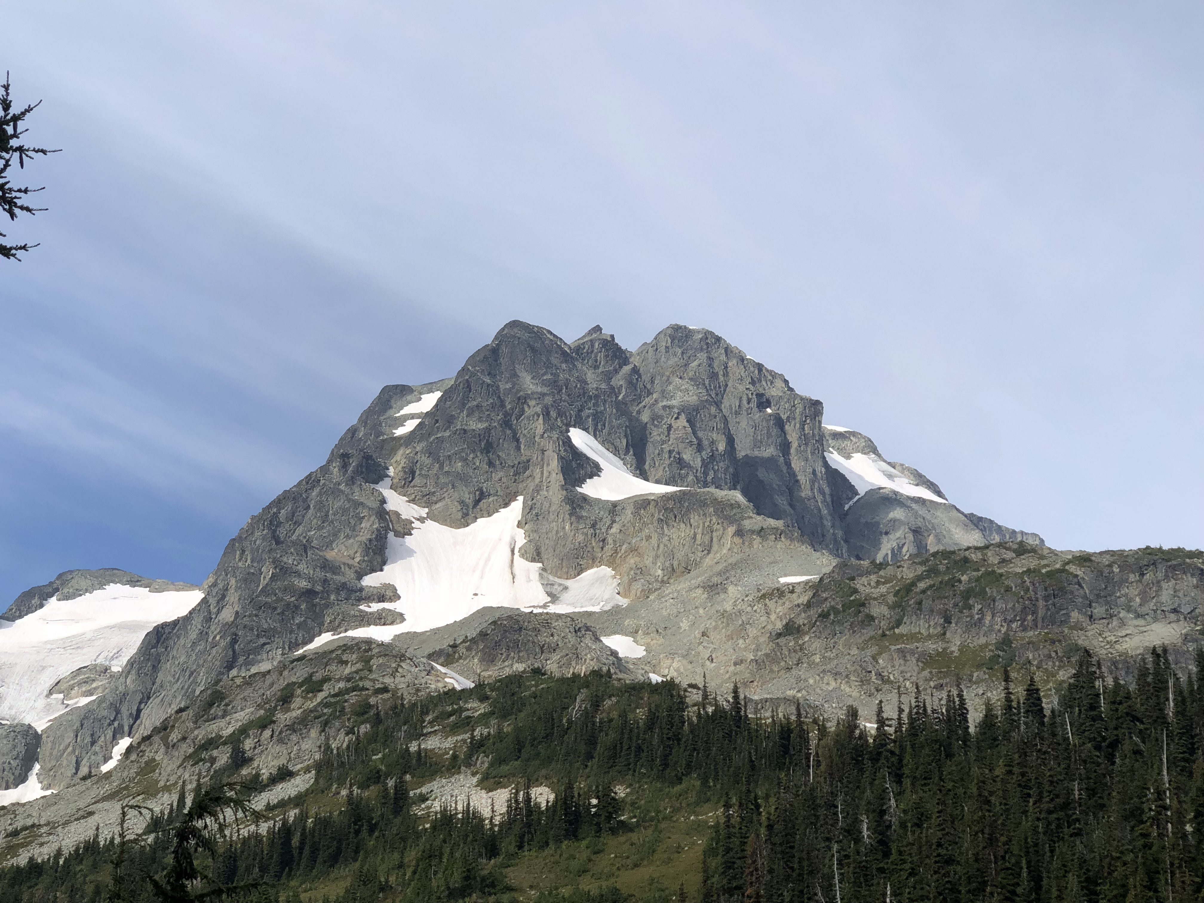
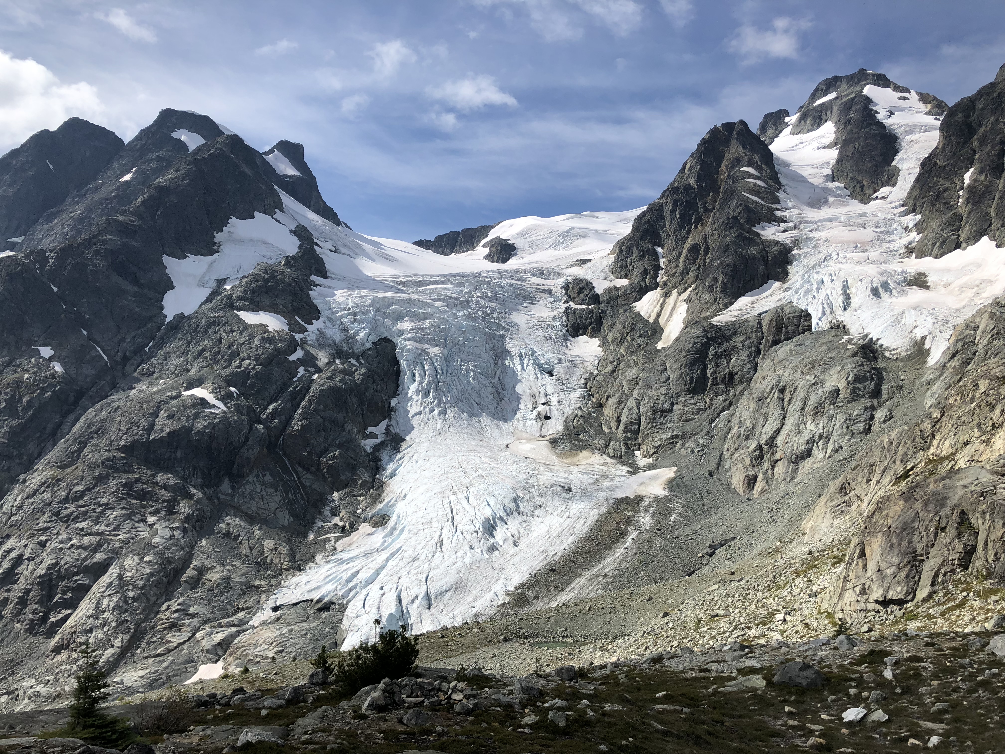
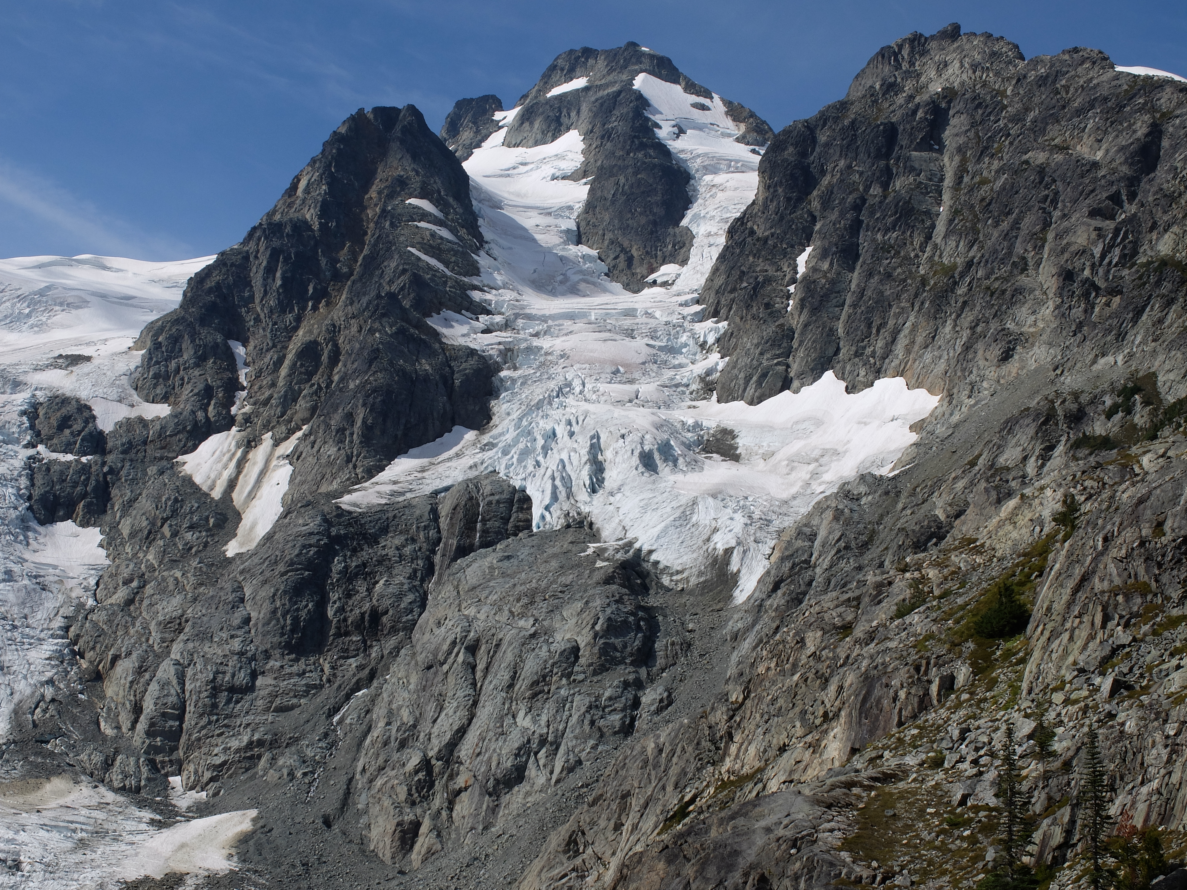
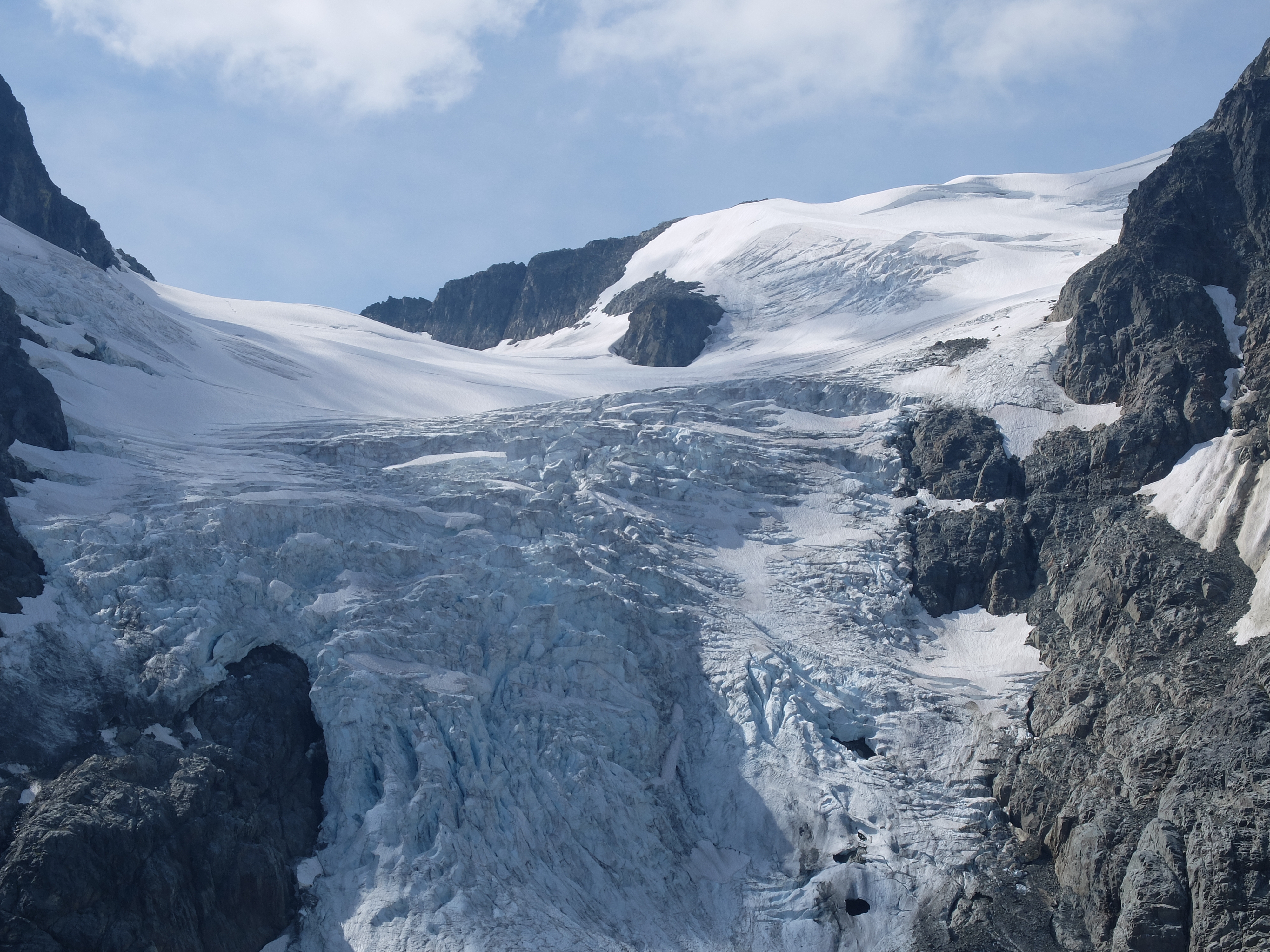
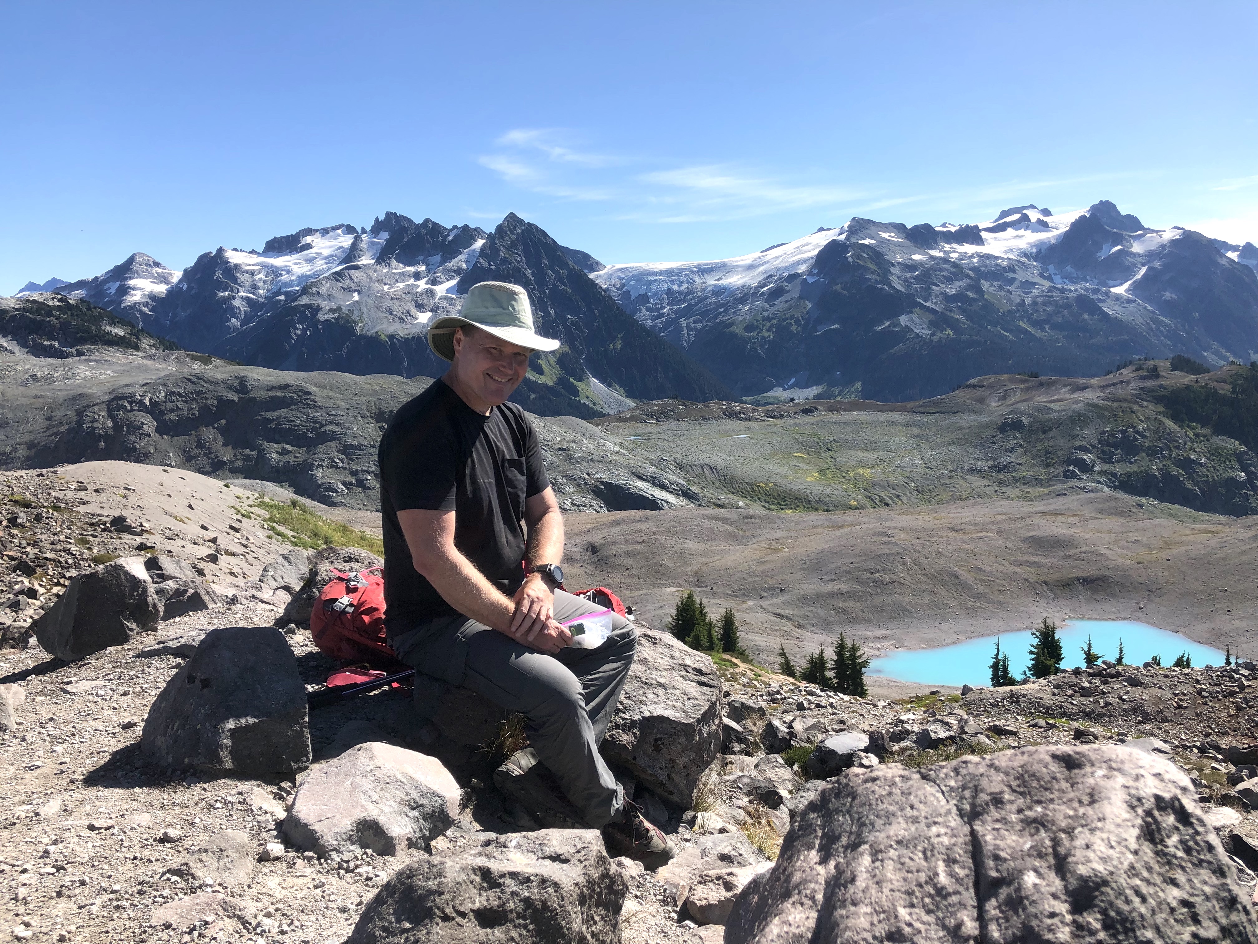
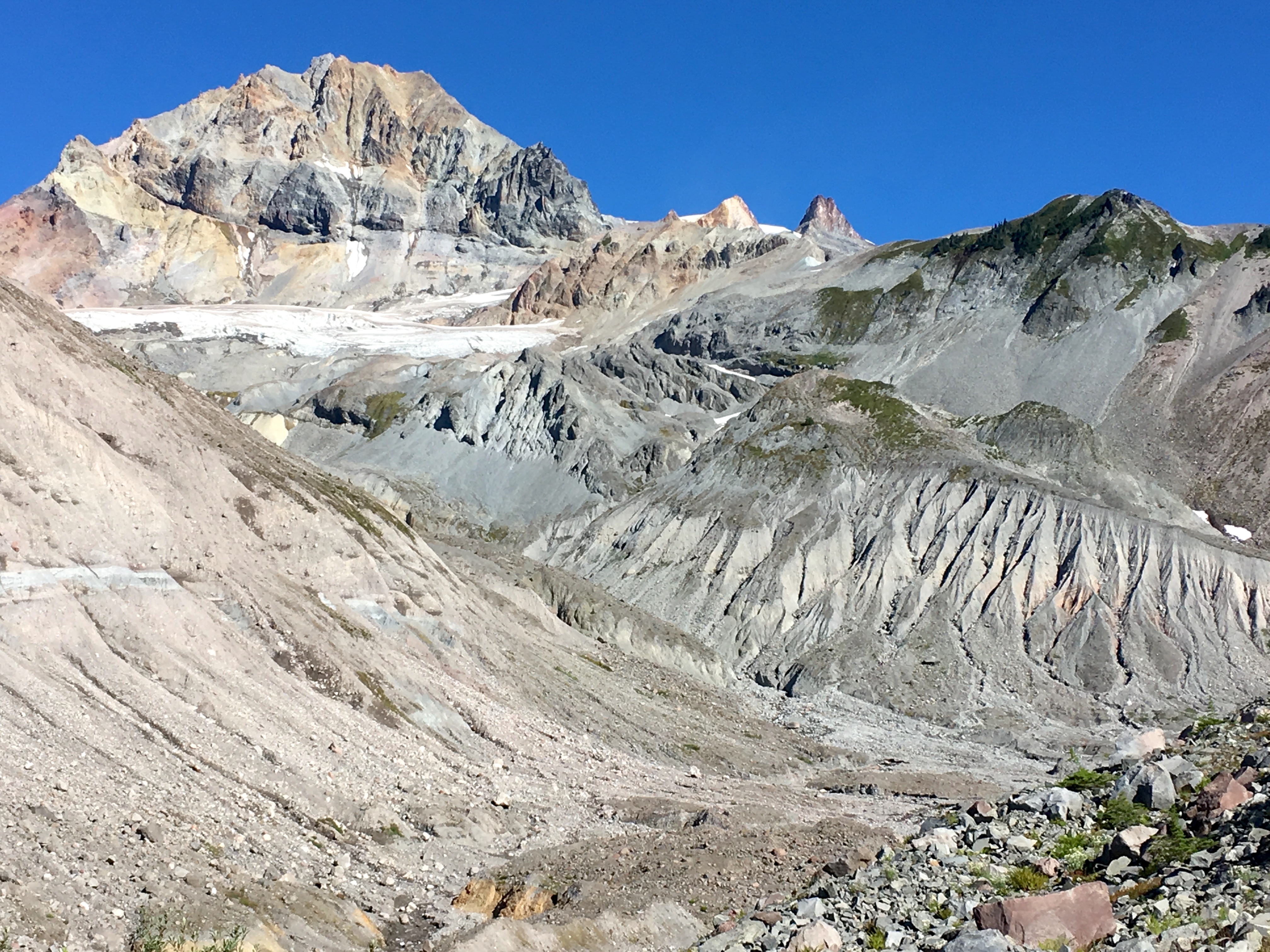
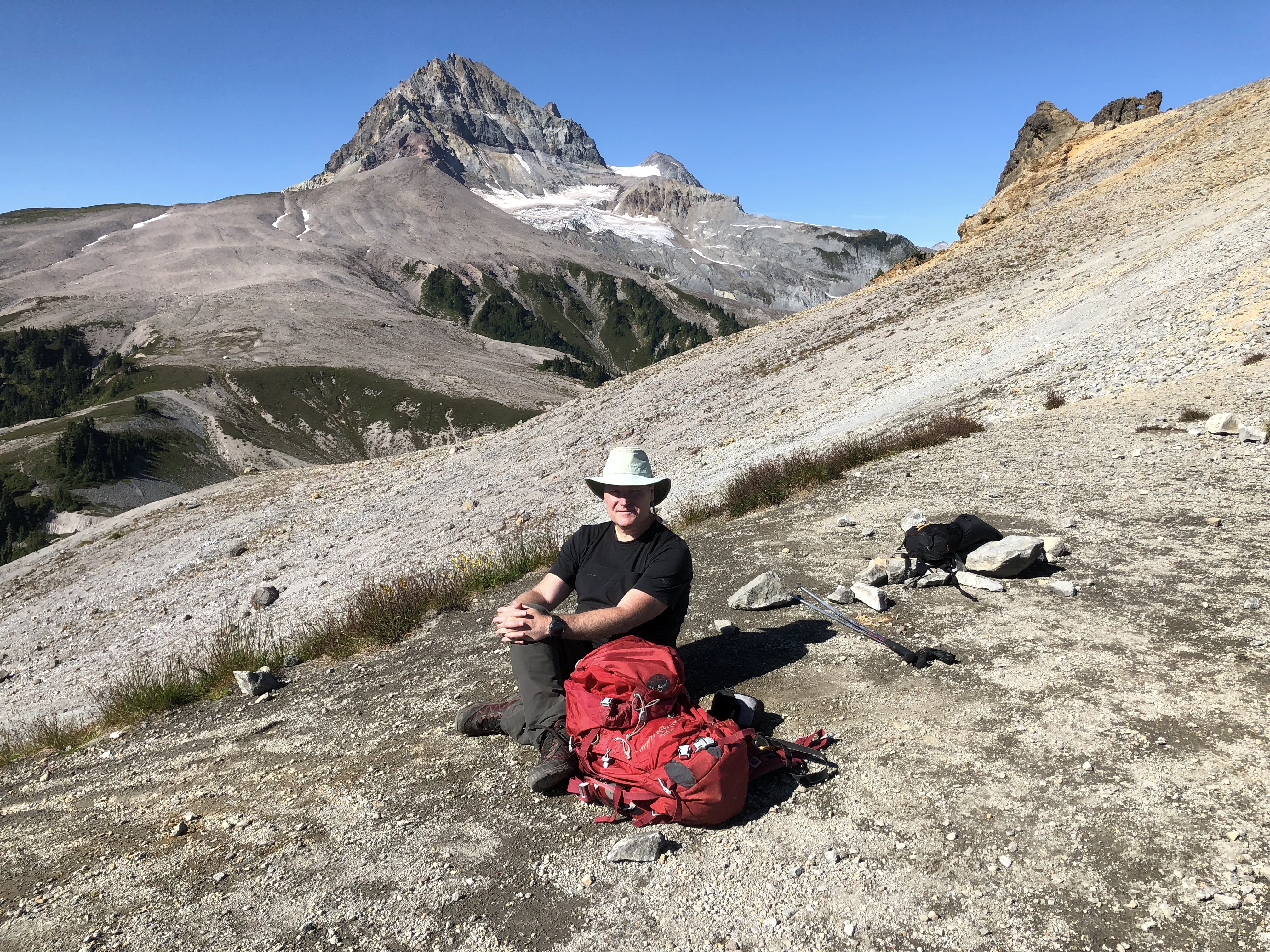
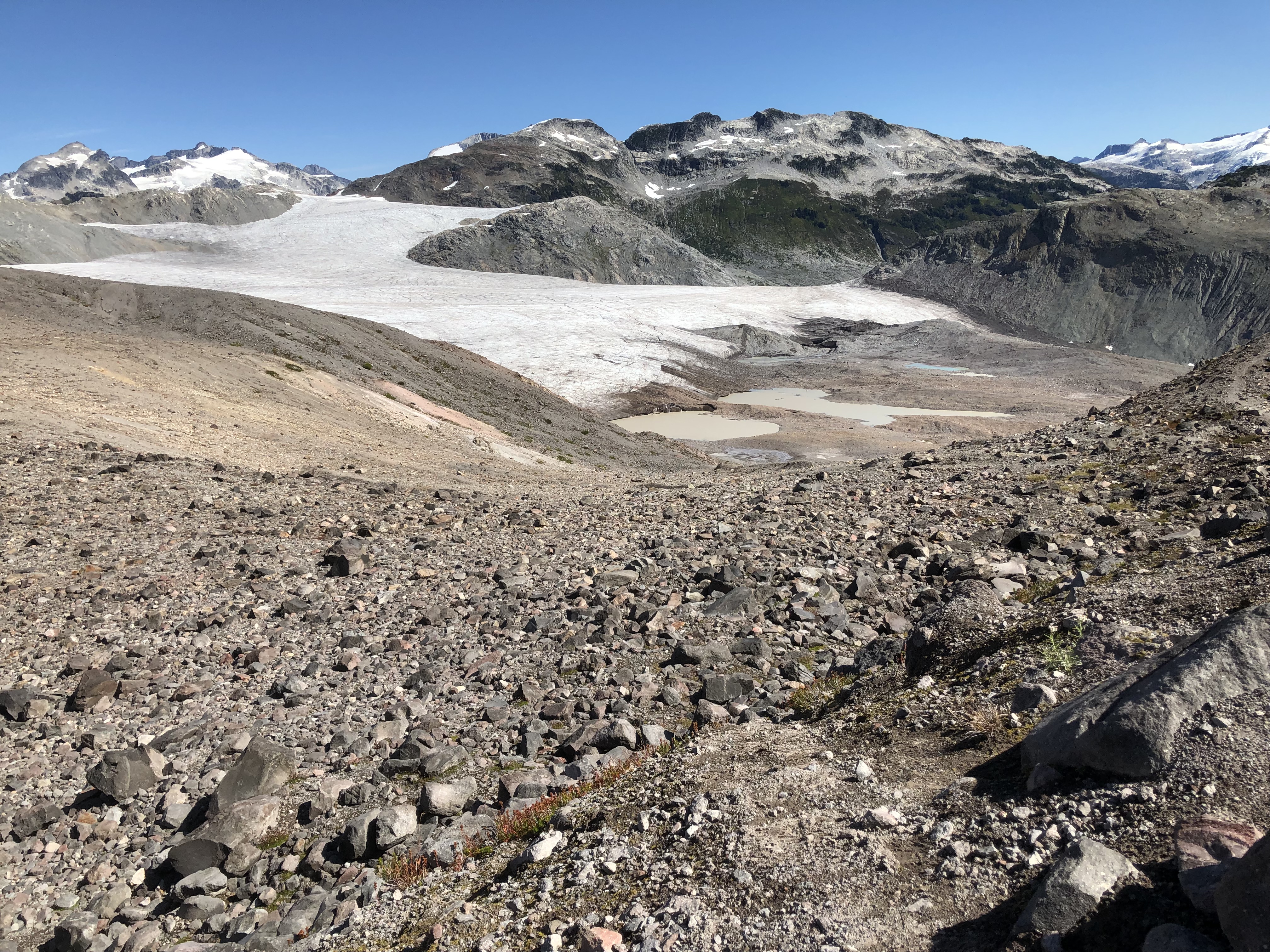
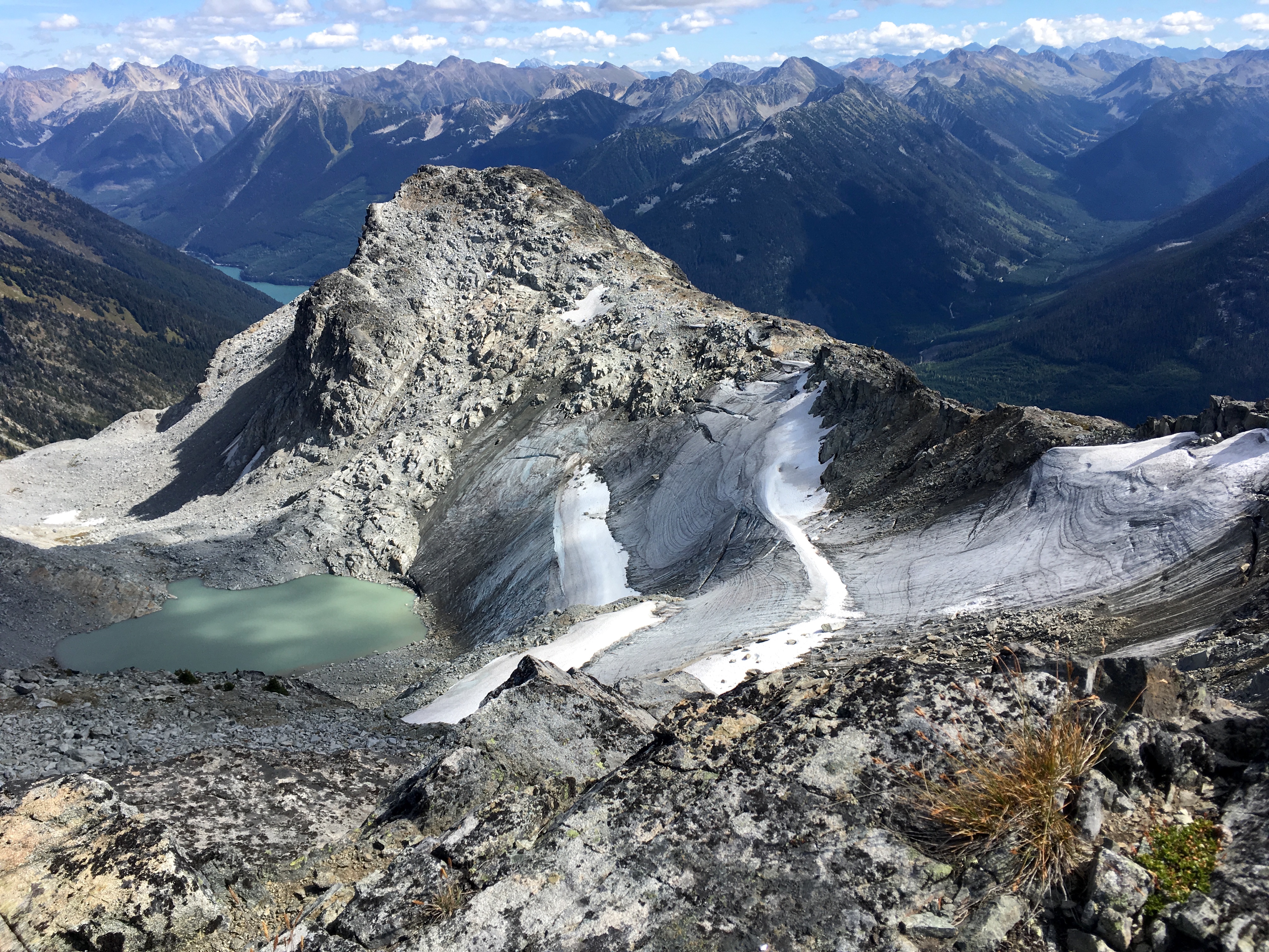
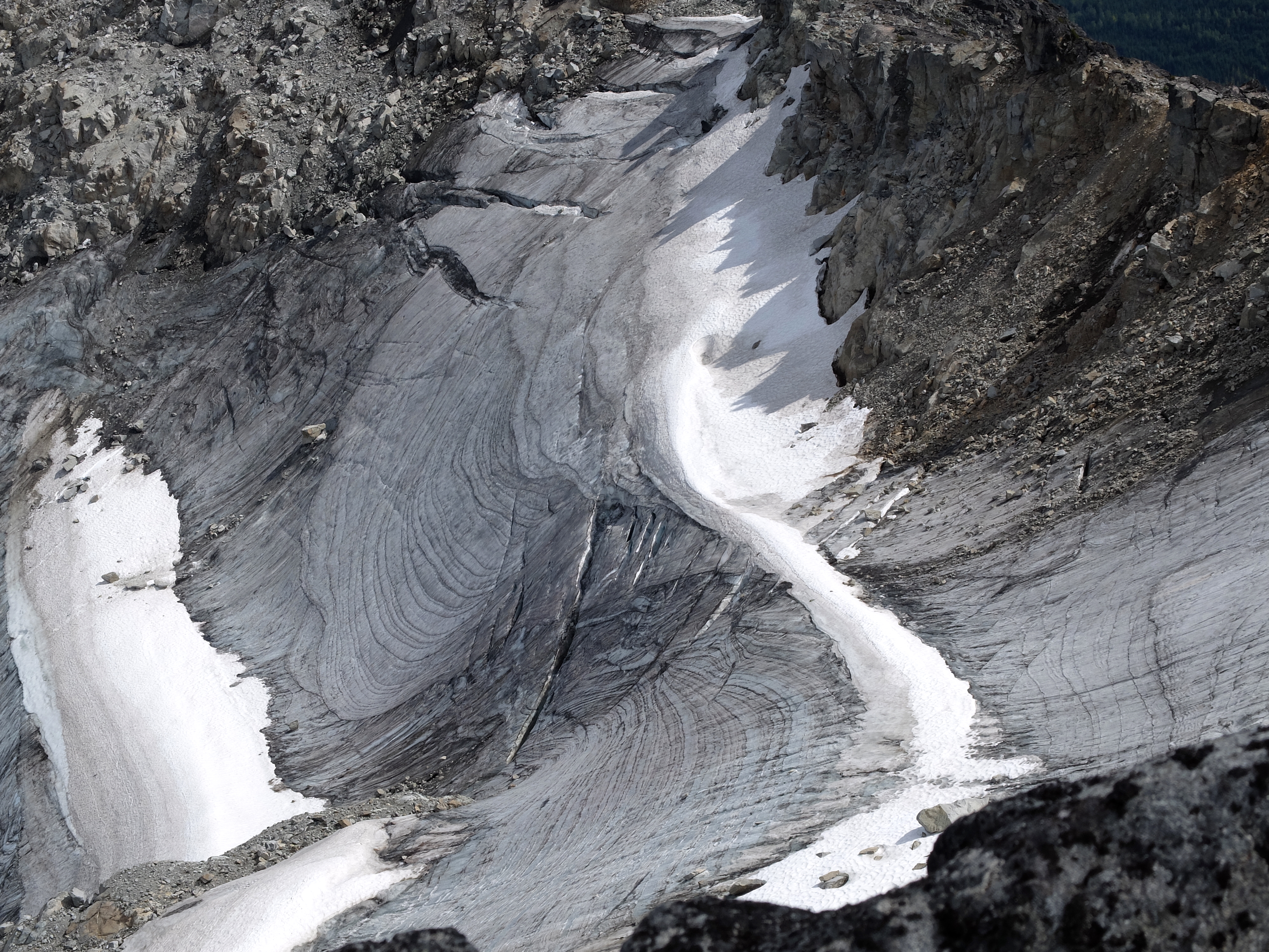
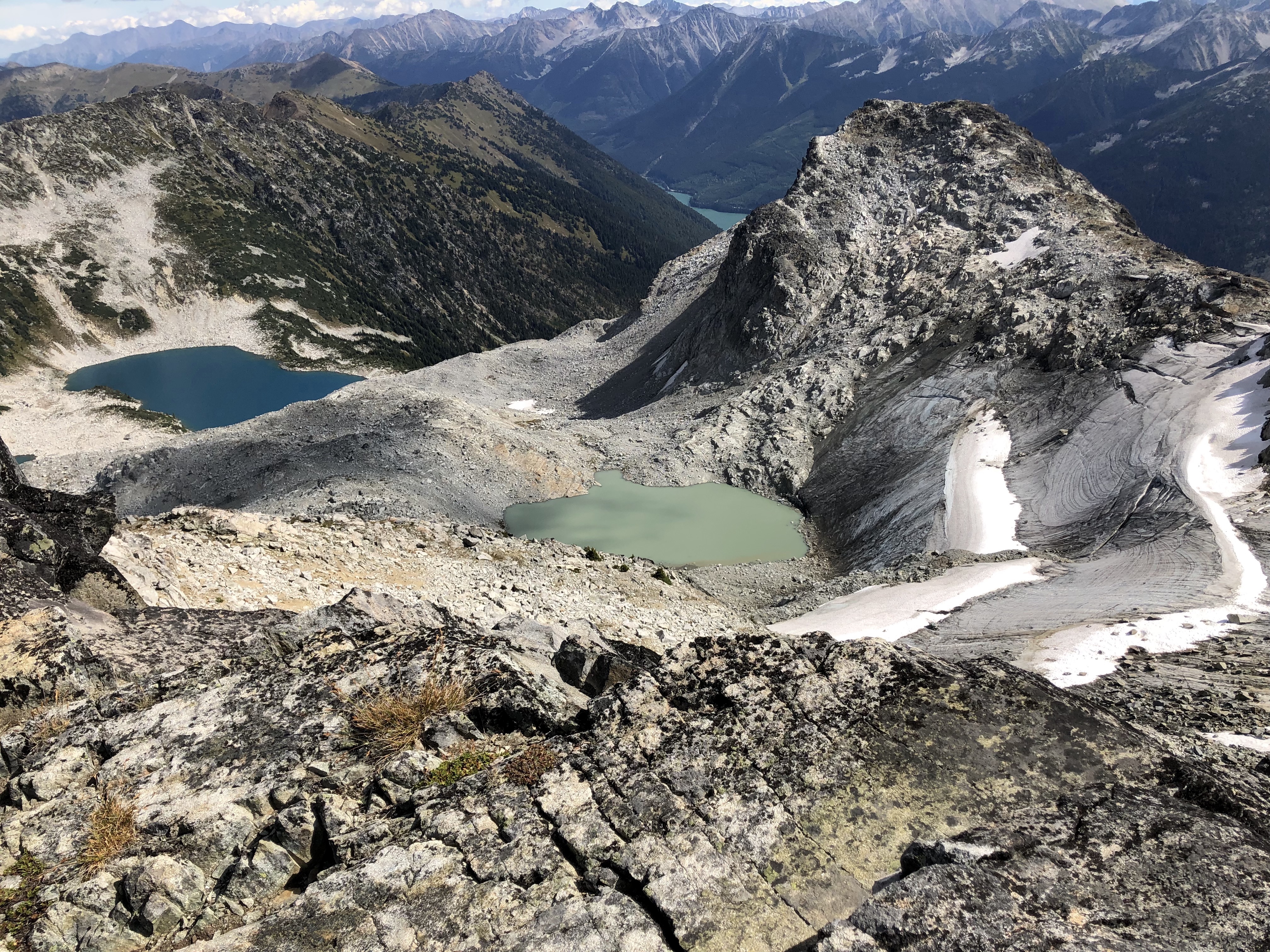
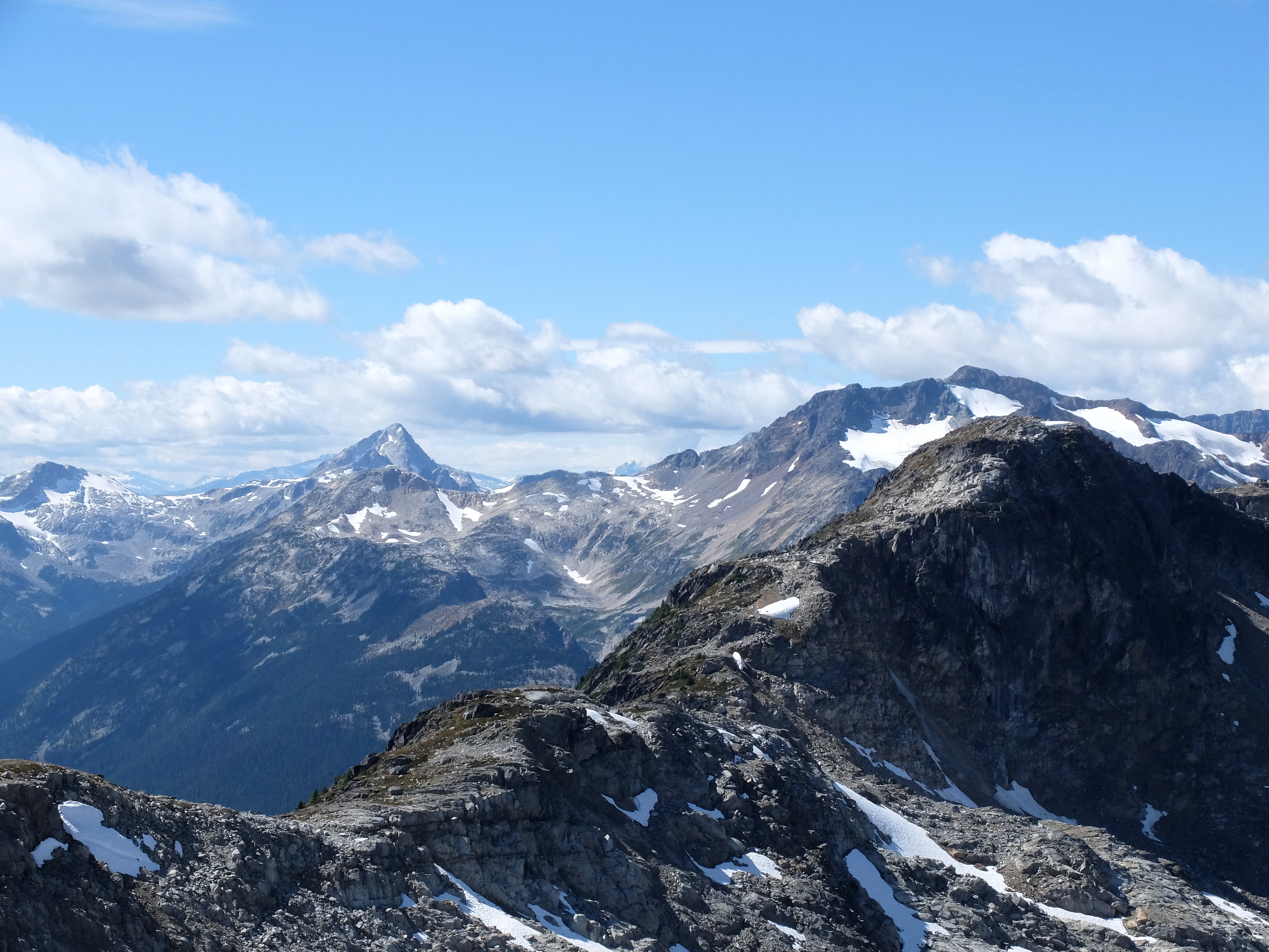
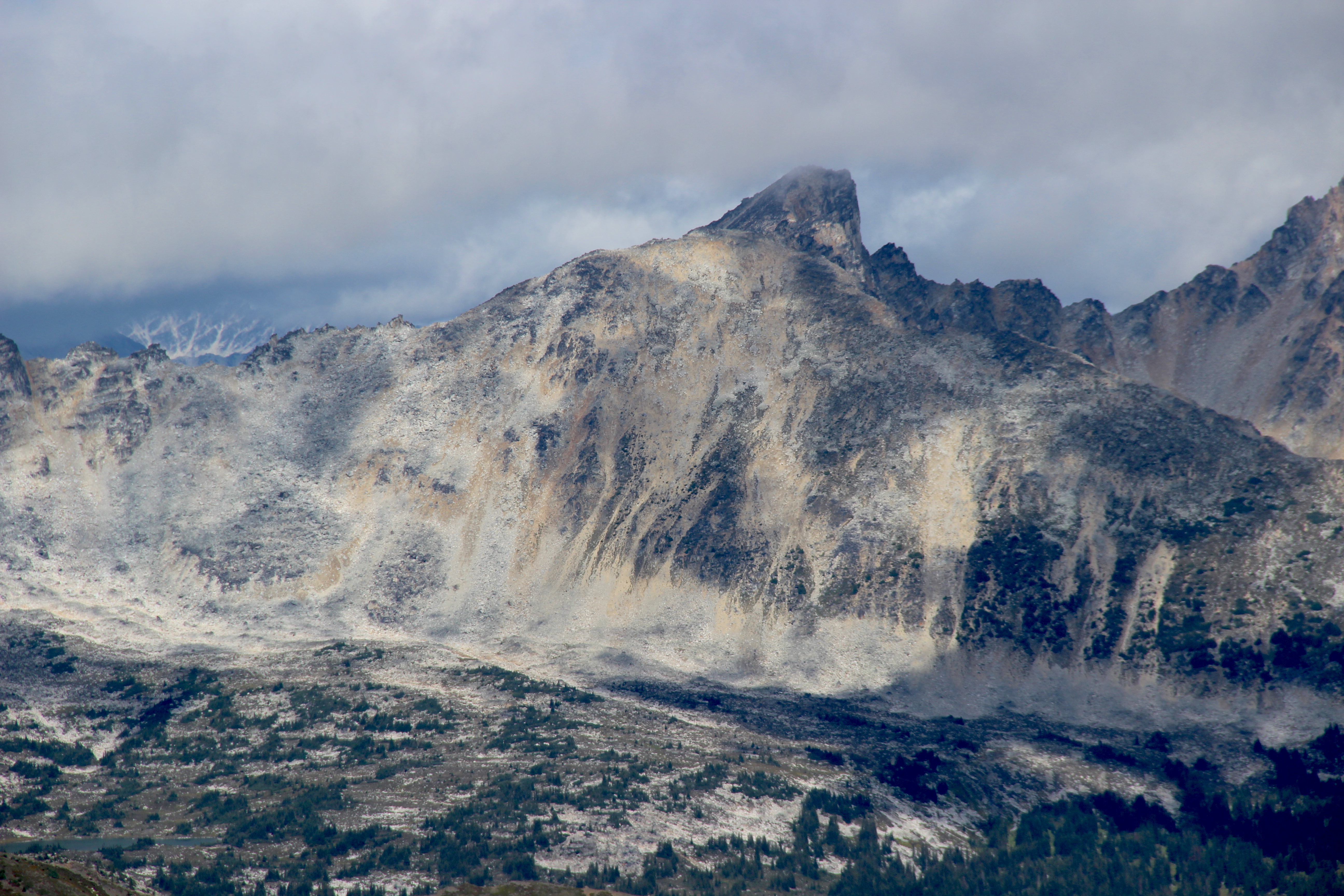
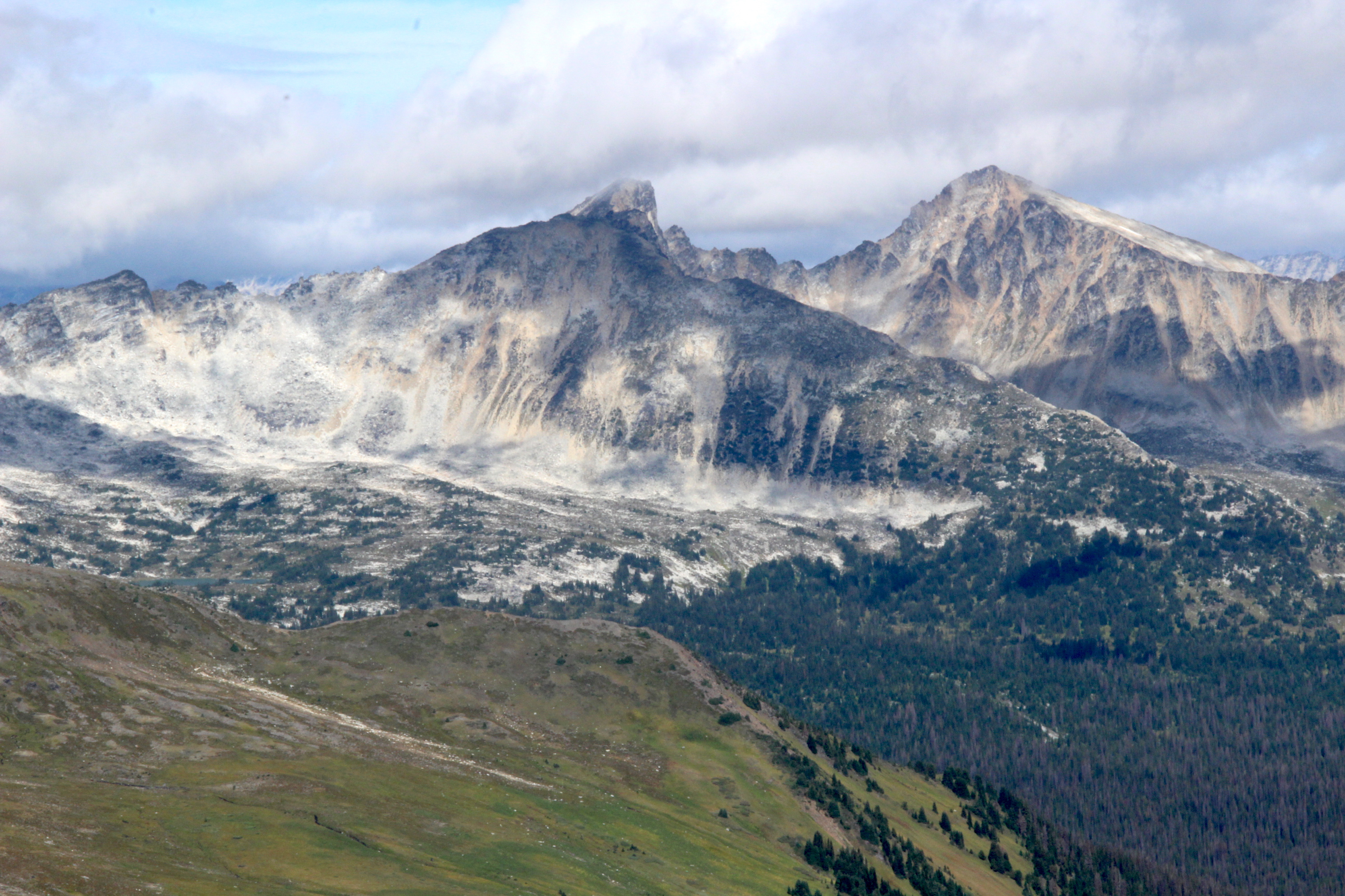
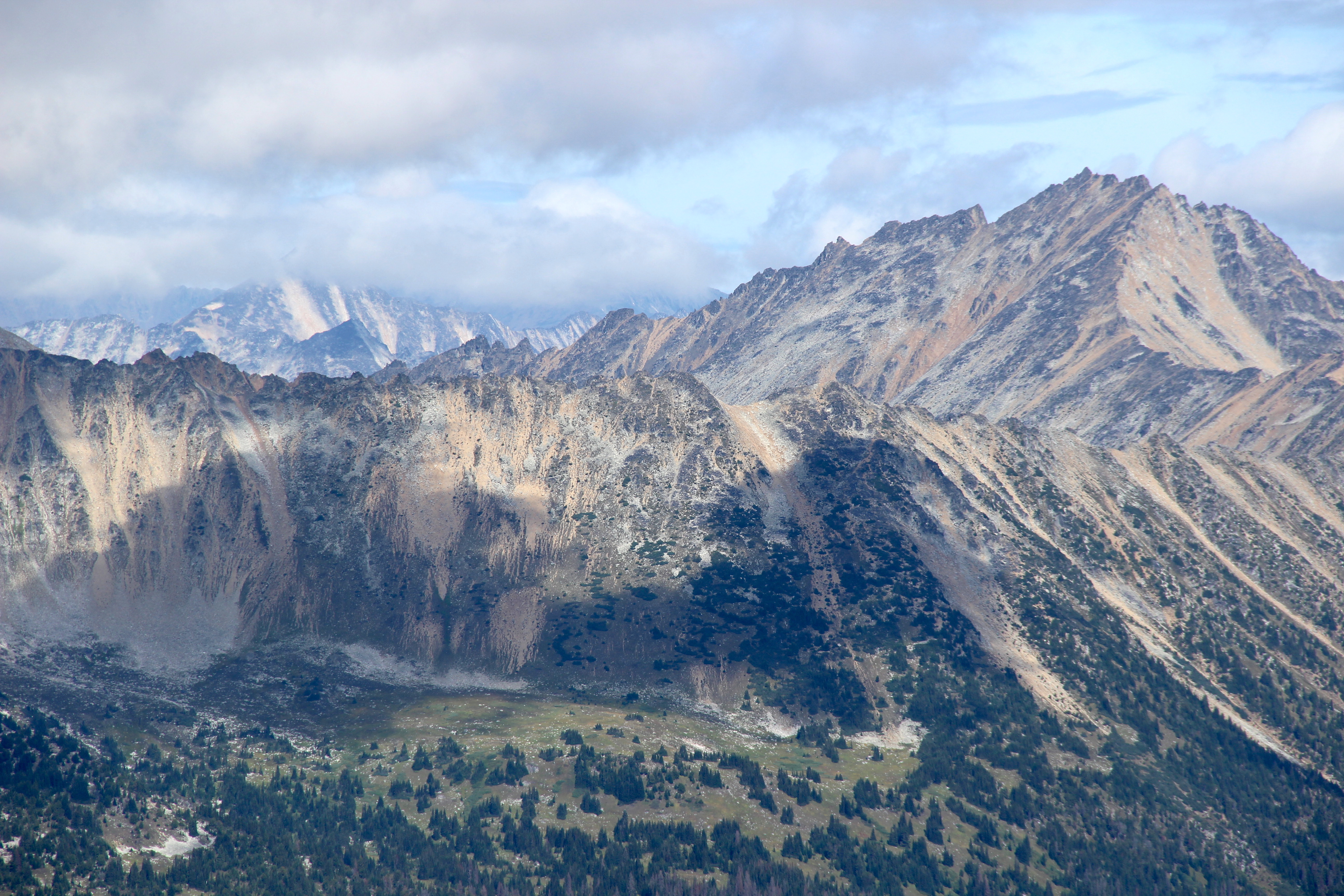
Start your trip at the Cerise Creek Trailhead, which is kind of hidden. From the pull-out, you start by walking down and cross the creek. The original road to the trailhead washed out years ago but if you follow the trail you eventually see the actual trailhead. Continue on the trail to the Keith Flavelle Hut. From the hut, we tried following the description from the book Scrambles in Southwest British Columbia by Matt Gun. When the book says “climb over the steep sided moraine”, that’s exactly what we did. We ended up on the top of a very narrow ridge of a pile of loose rock and glacier debris. Well - it turns what we should have done instead is “go down and around the steep sided moraine” and we would have founded a beautiful easy to follow trail with a bunch of cairns, leading straight to Vantage-Matier Col. That’s what we did a year later. There is a dream lunch spot at Vantage-Matier Col with a magnificent view of the glacier and a great flat rock to take nap on. |
|
|
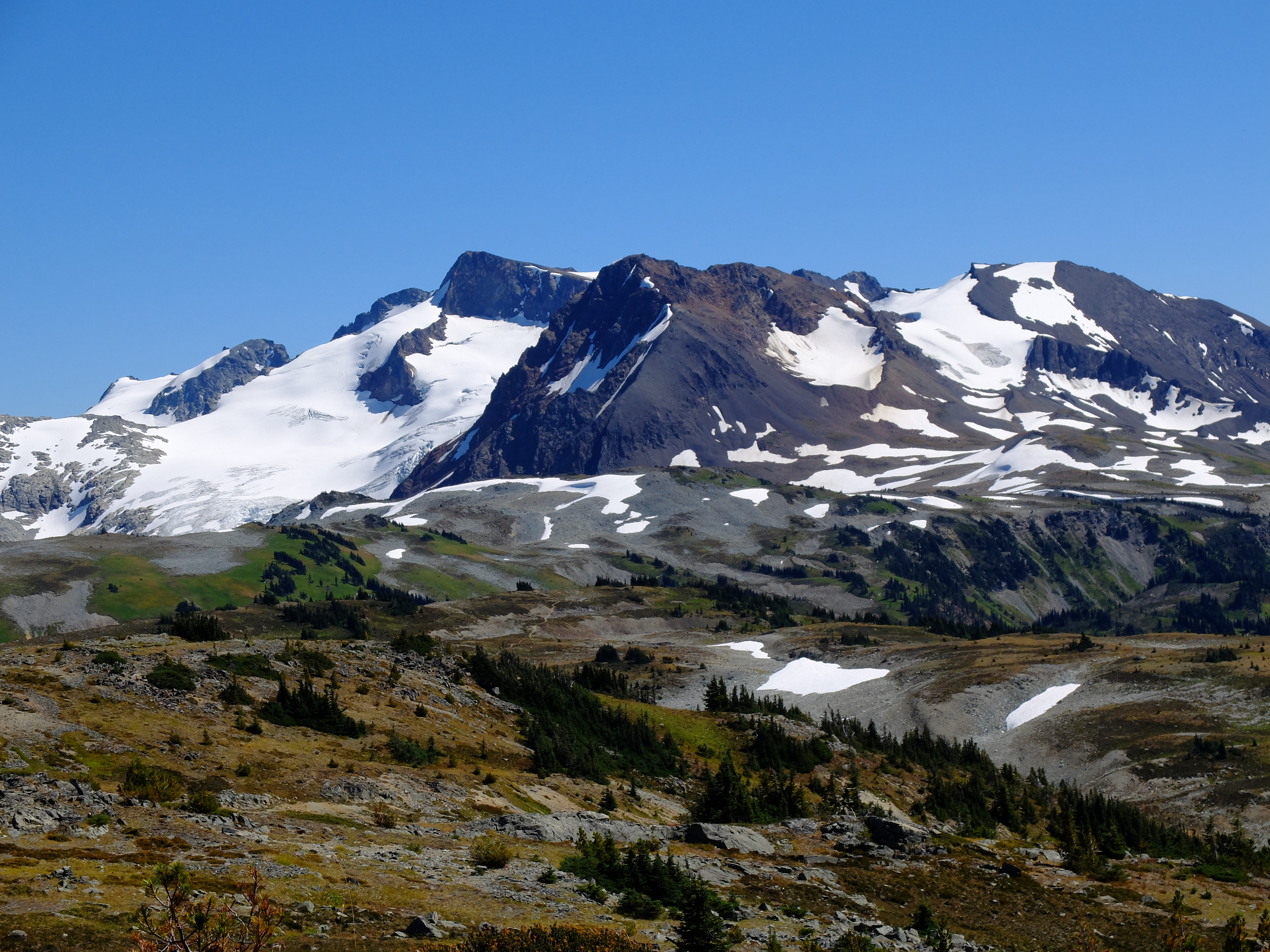
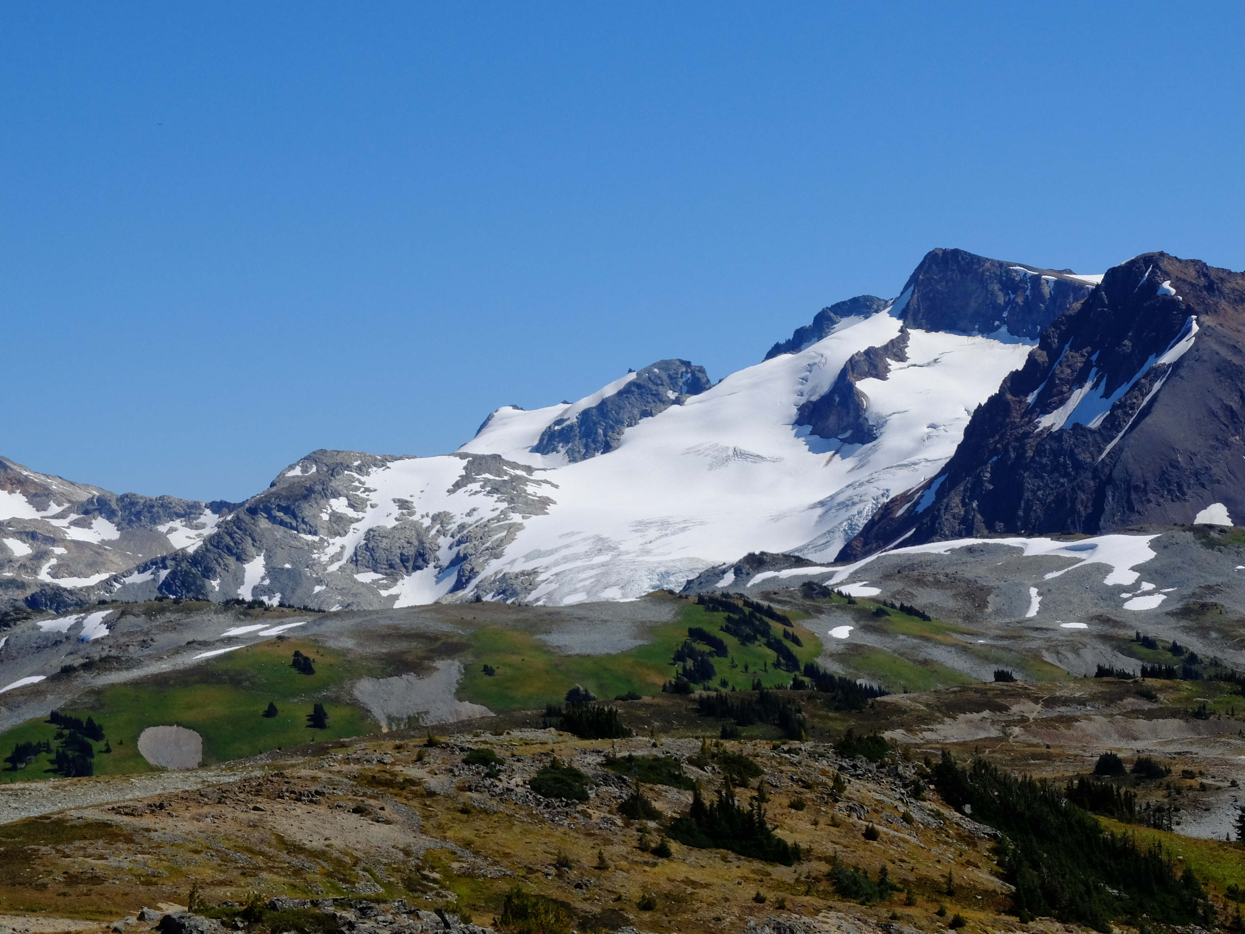
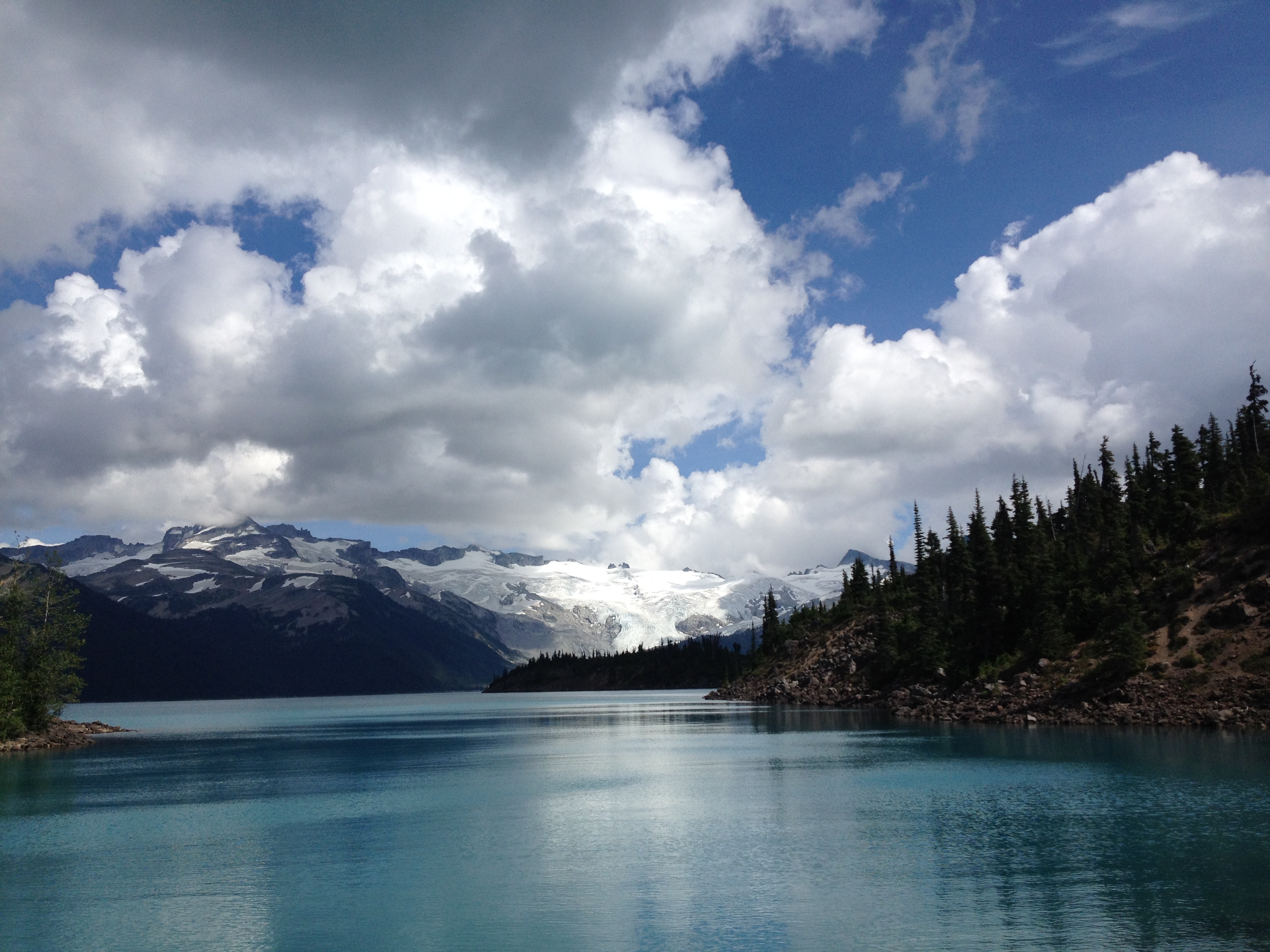
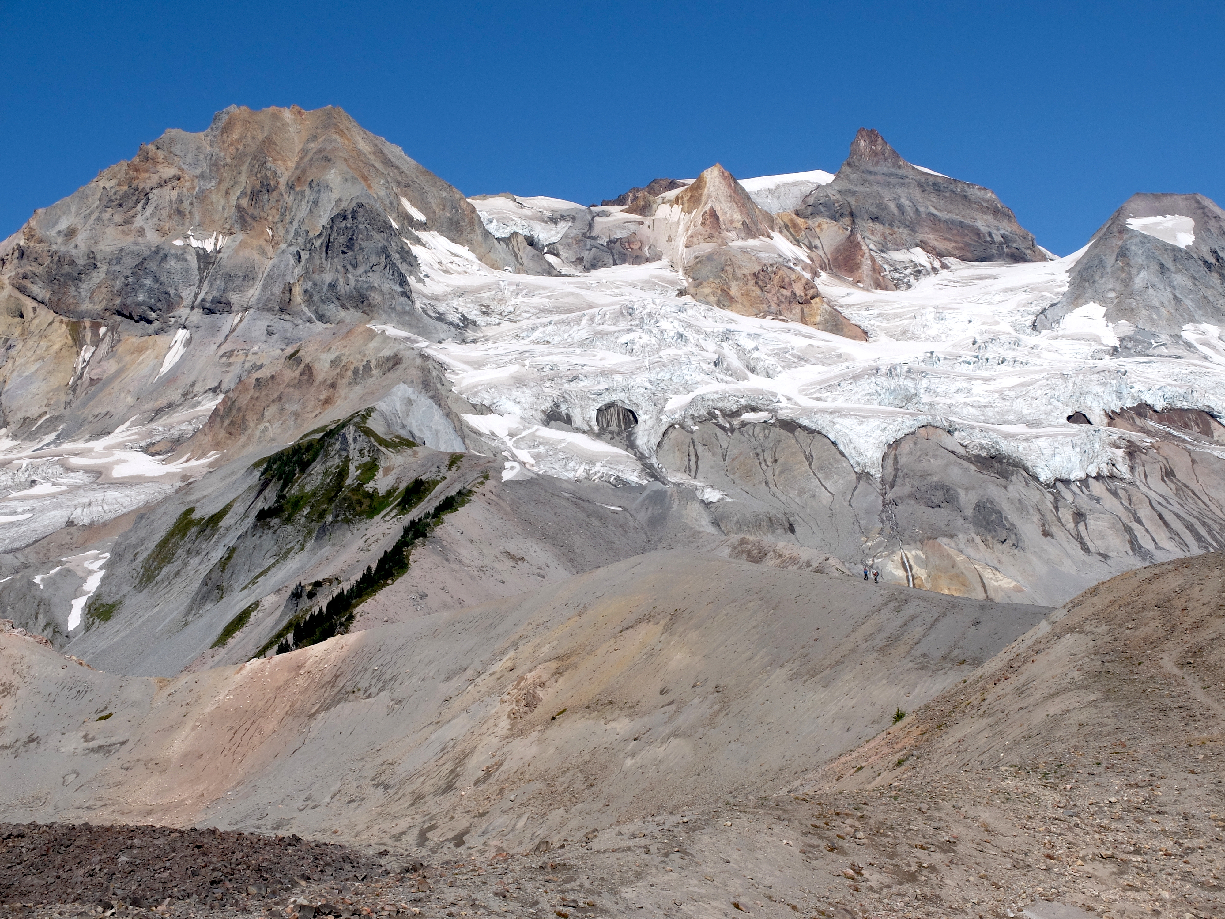
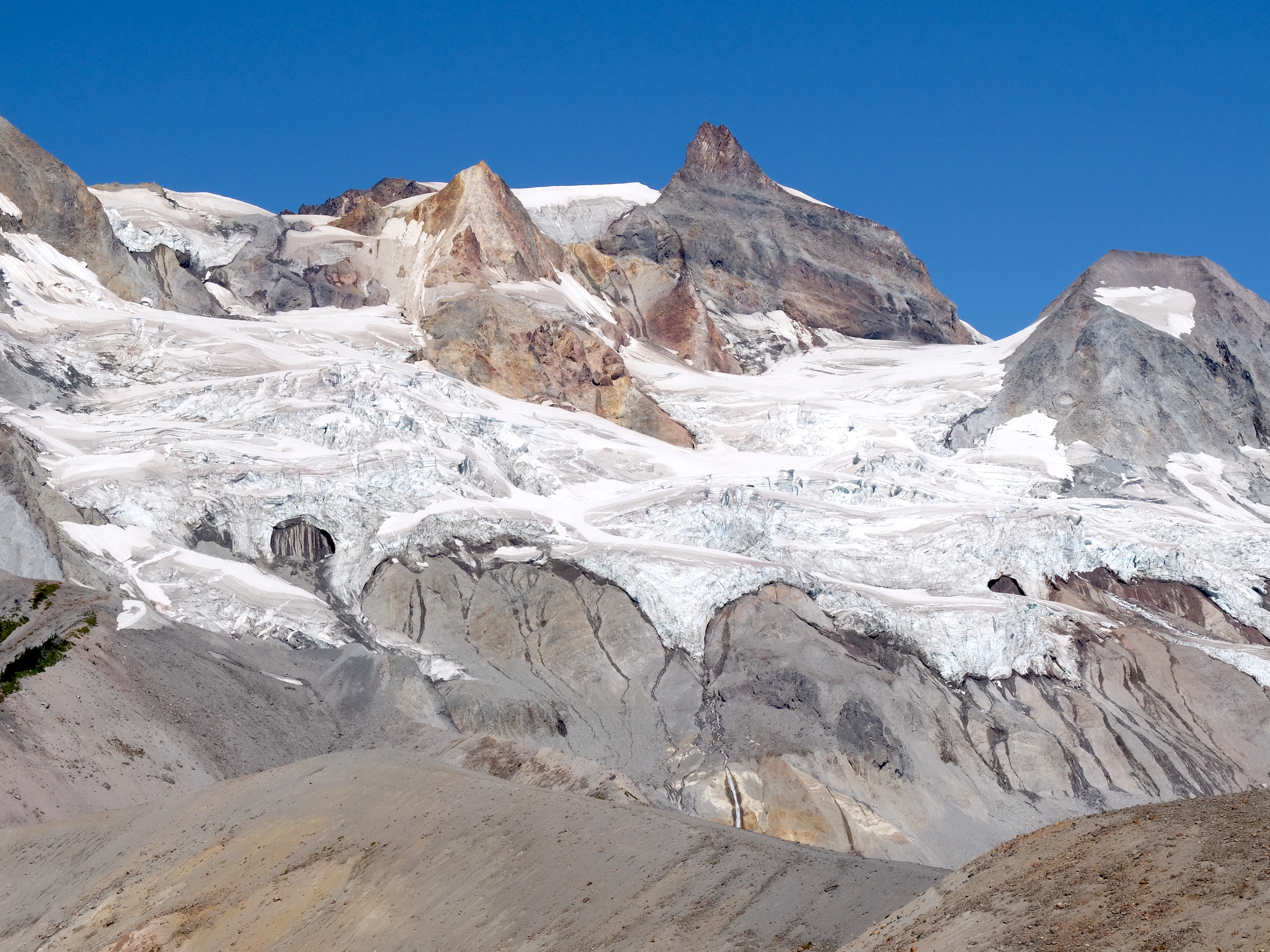
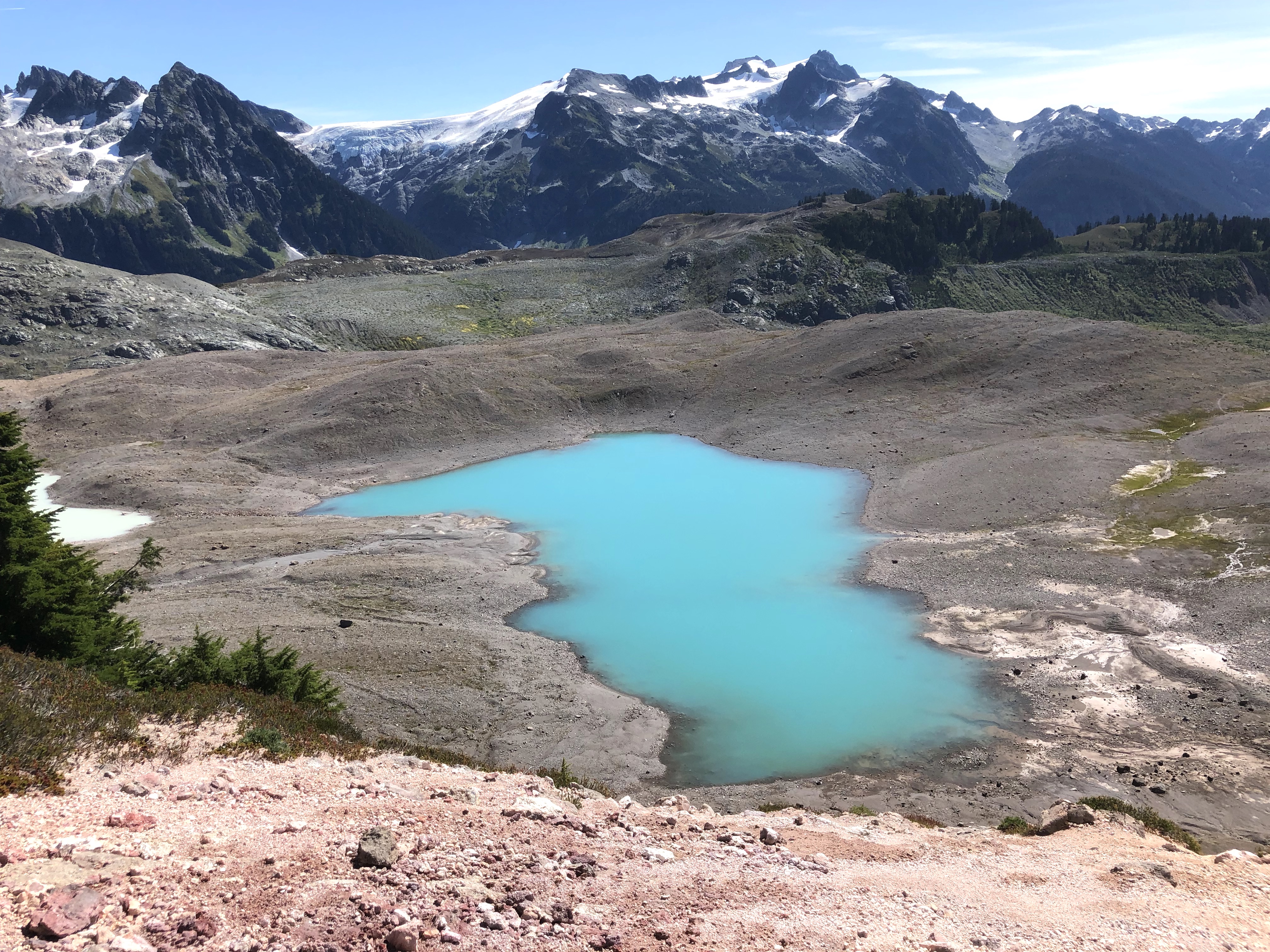
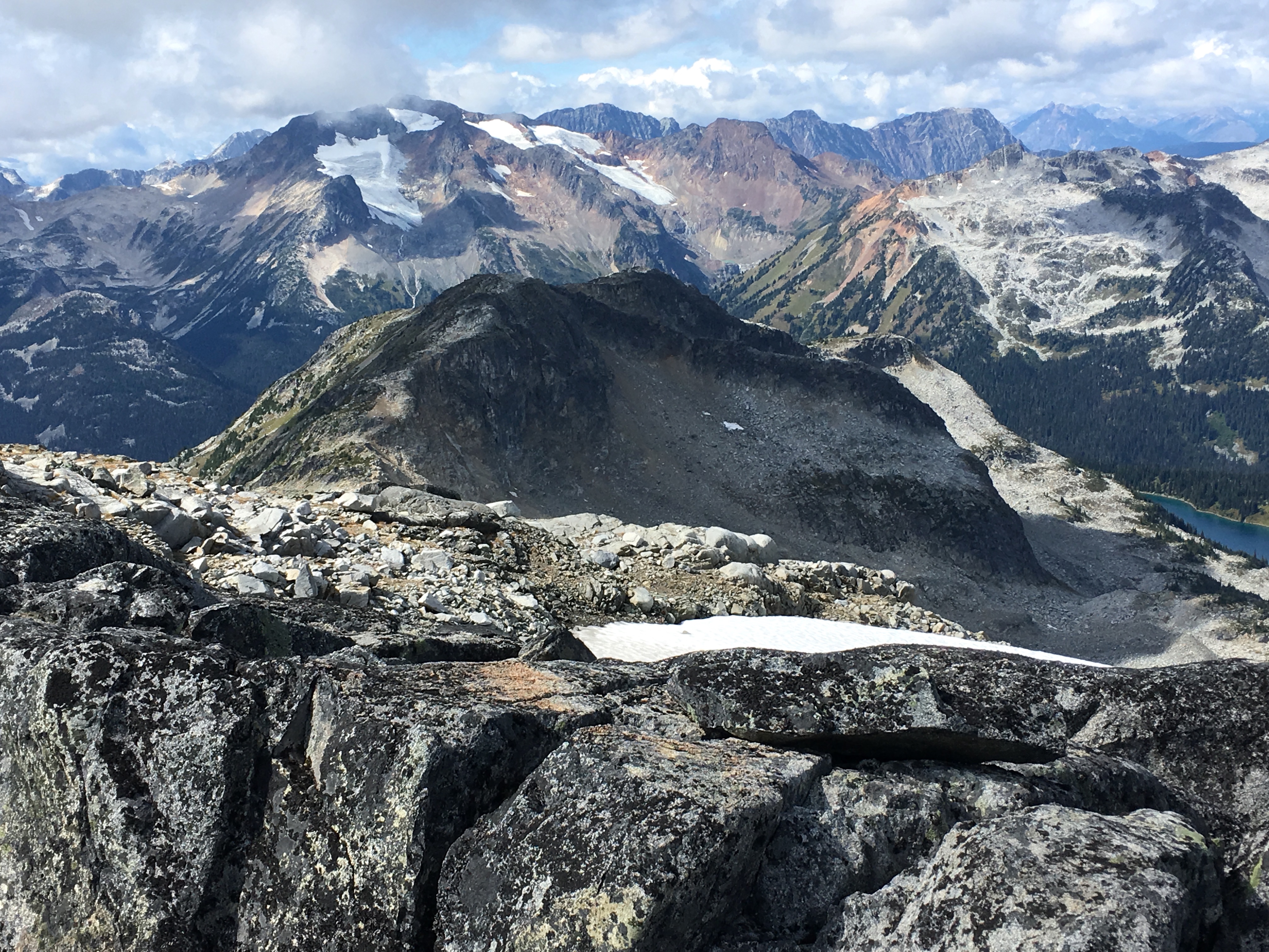
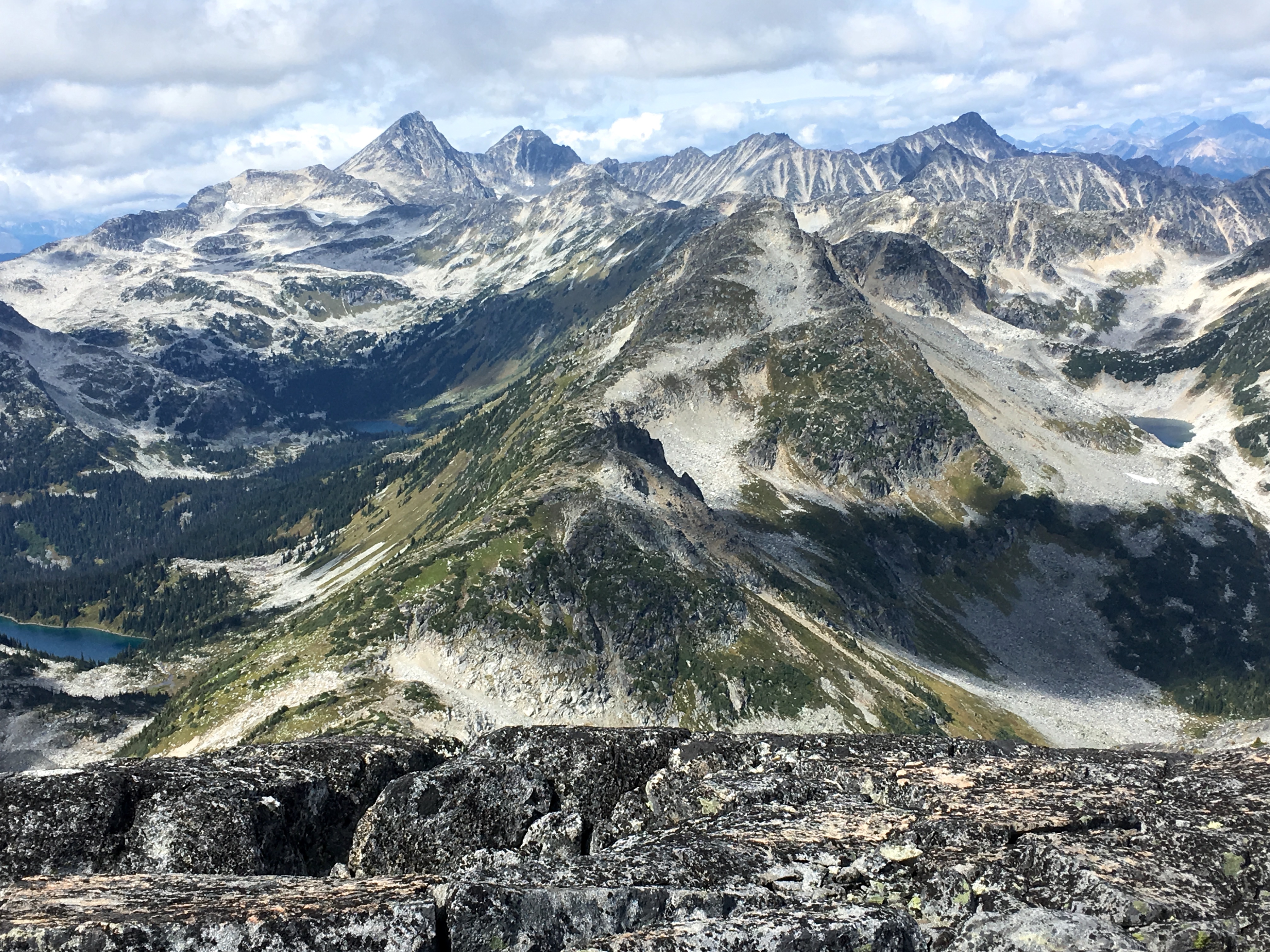
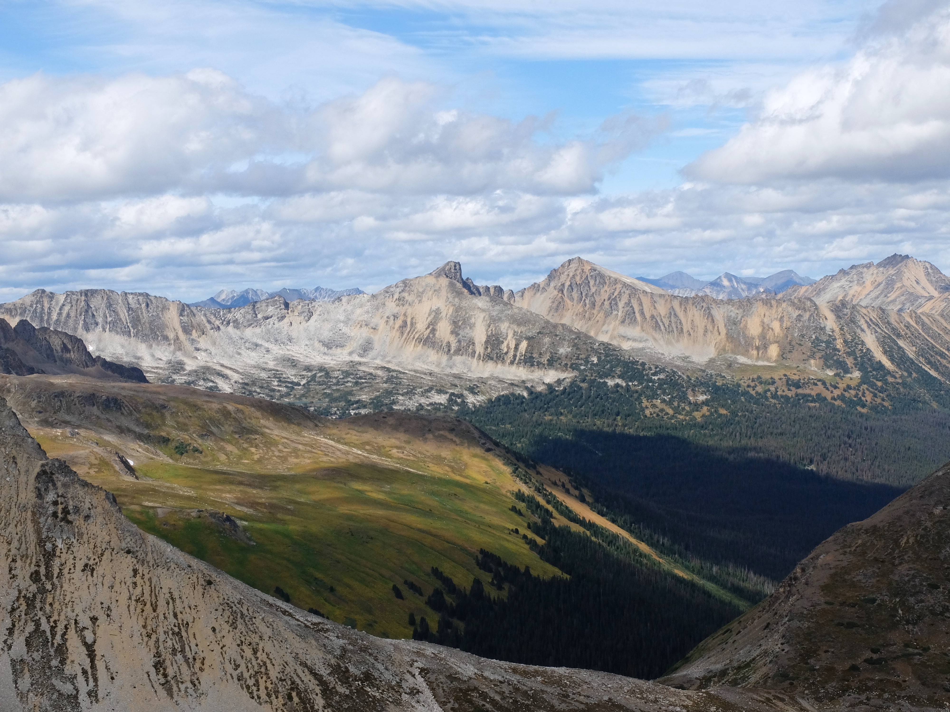
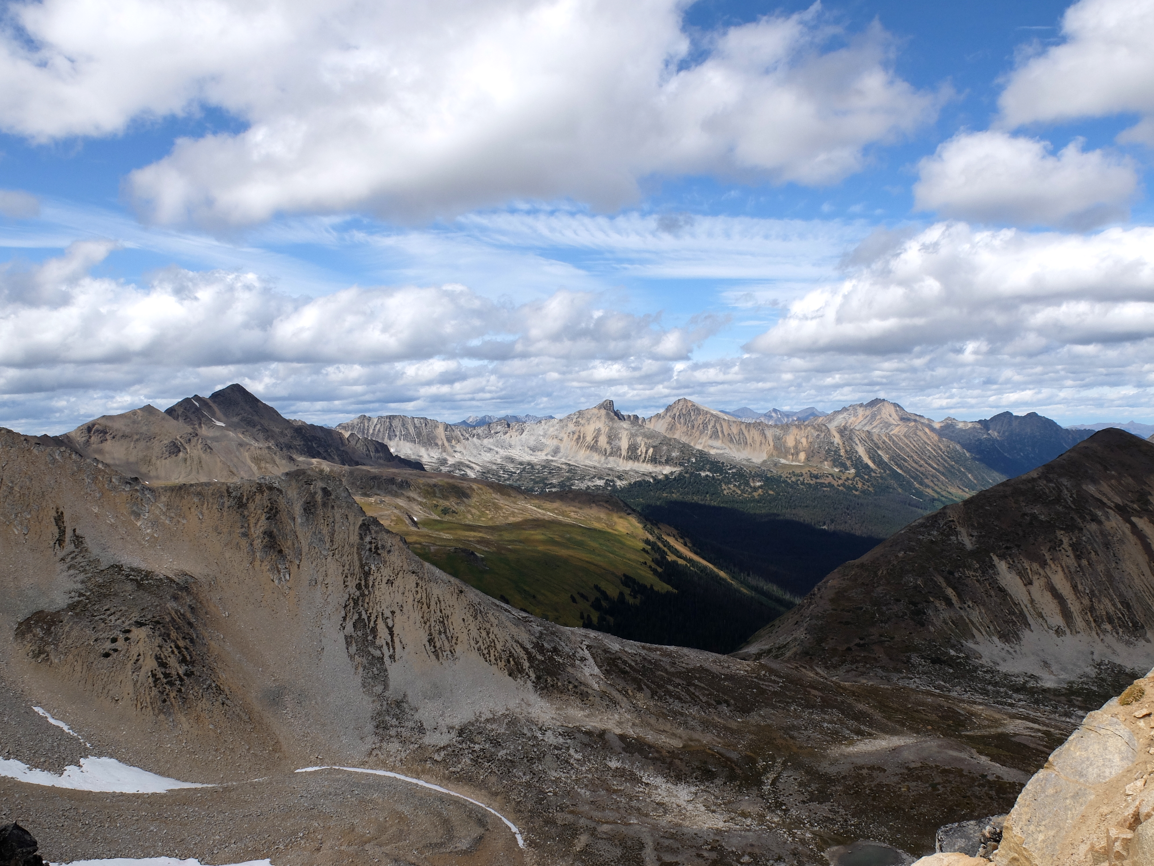
A non-crowded alternative to popular trails around Garibaldi Lake, this easy scramble offers incredible views of Mount Garibaldi, the lake and the surrounding mountains. It does require some path finding, a little bit of bushwhacking and crossing scree fields, but nothing too hard. We did it as a day hike, starting at Garibaldi Lake trailhead. Once at the lake, follow the path around the lake south, passed the Ranger station to the boat dock and a little bay, from there find a climbers path hidden in the bushes. The path is well defined, and usually marked with some flags. once you find it, it’s easy to follow up to the final scree fields. Trekking poles recommended for the scree field part. Once you get to the ridge, you will be immediately rewarded with an amazing view of Mount Garibaldi, the Table, and 360 panorama of mountains. More info: https://www.summitpost.org/clinker-peak/959776
|
|
Opal Cone via Elfin Lakes Opal Cone has been on my bucket list for several years. We finally made it in August 2019. We backpacked to Elfin Lakes Shelter on a hot sunny day, and hit the trail the next morning. The views are amazing all the way to the summit ridge and the scenery keeps changing with every turn, from bizarre volcanic formations to glacier-covered mountain slopes and turquoise ponds. My final inspiration came from the article below, and the experience exceeded my expectations: https://www.exploresquamish.com/news/hiking-opal-cone-squamishs-land-of-ice-and-fire |
|
|
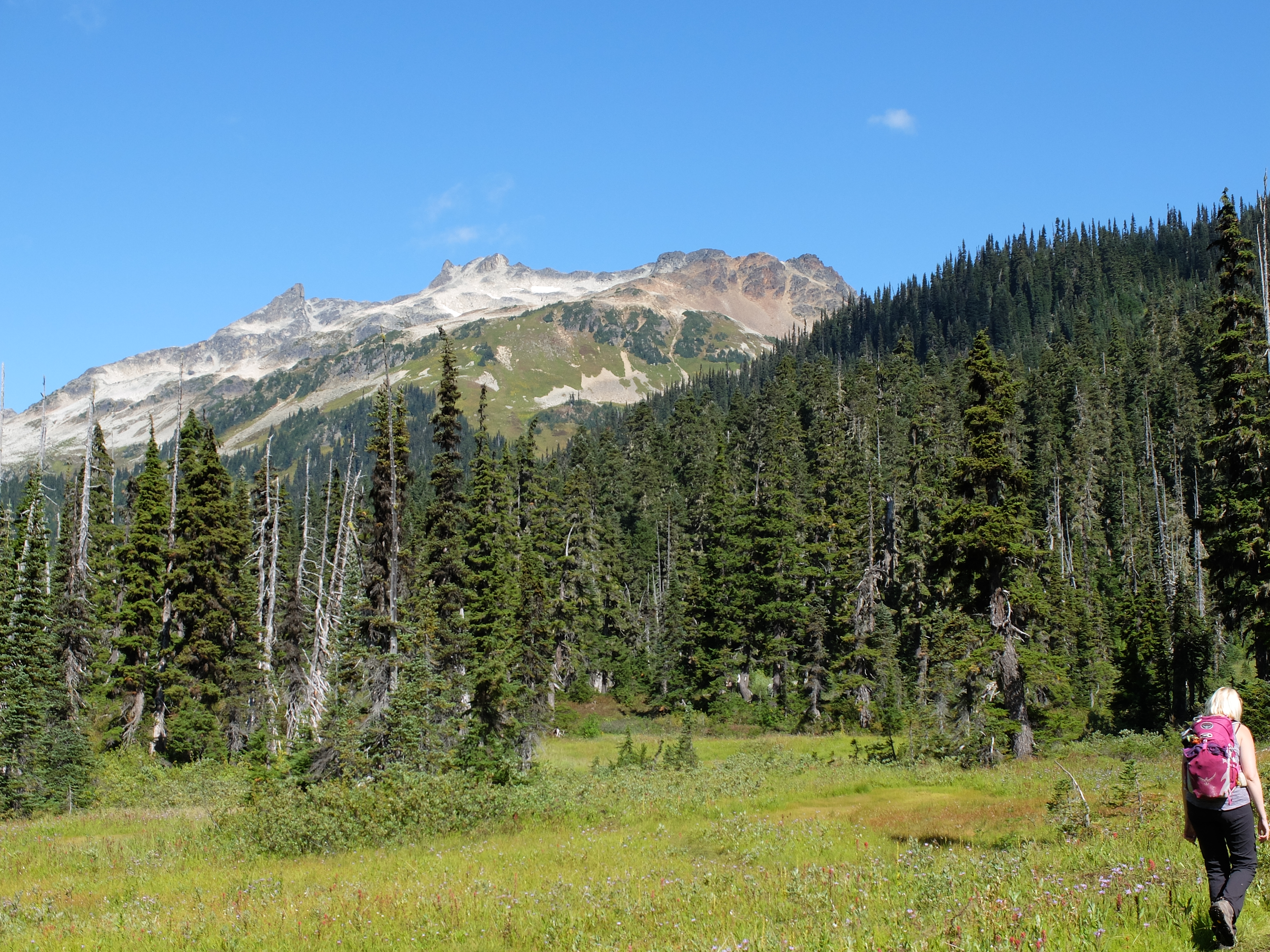
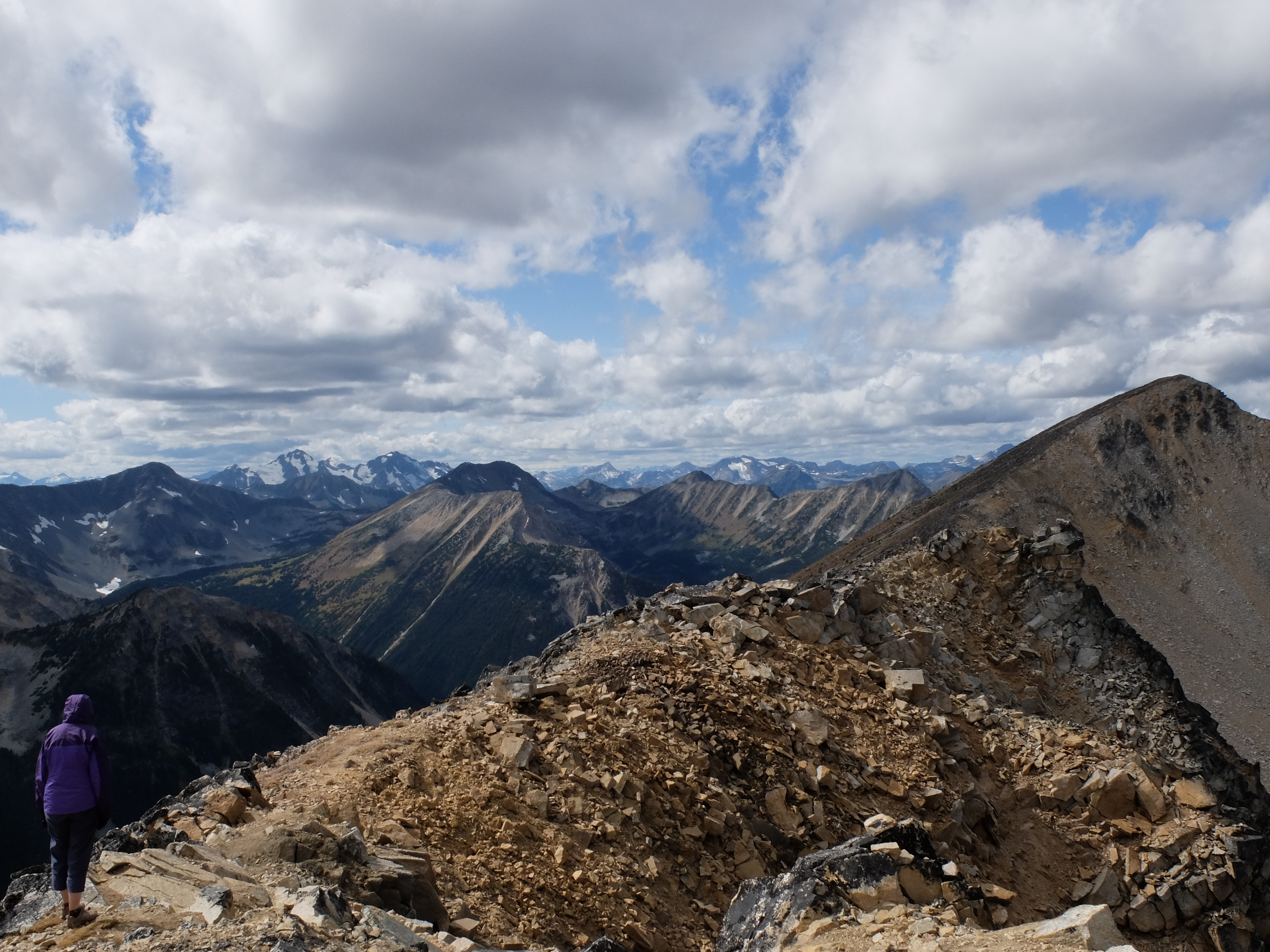
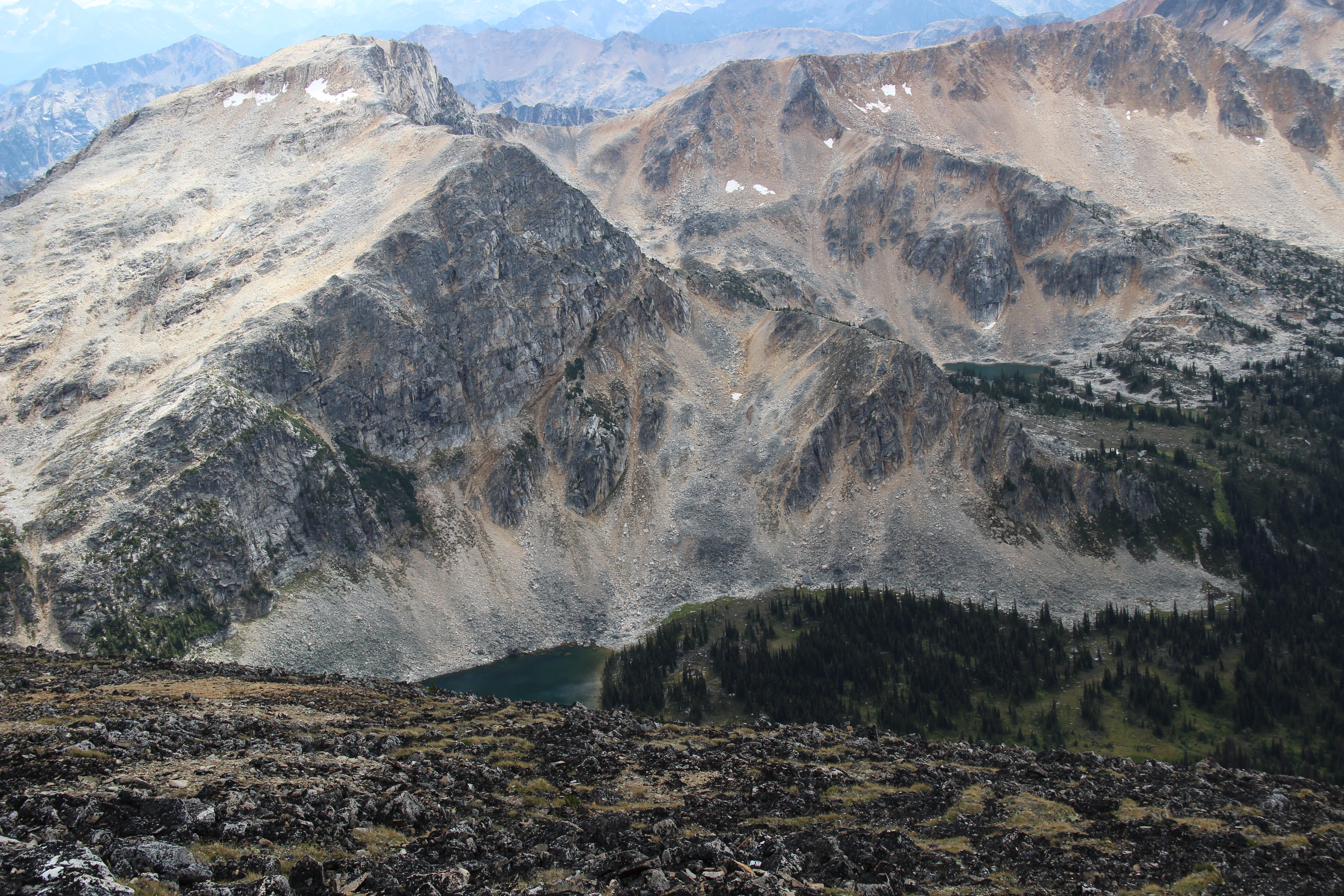
No words can describe how awesome this scramble is. Yes, you will be covered in mud head to toe at the end of this trip, but no regrets. The approach starts easy - take the trail to the Marriott Basin (Wendy Thopmson Hut), then at the fork go to the right (Rohr Lake trail). After reaching a large meadow, the scramble towards the lake begins, steeply up the right side of a boulder field. By steeply, I mean STEEP. And very WET. Once you reach Rohr Lake, you should be able to find a nice path marked with cairns, going around then lake. Be sure to stop and admire the lake and the sheer cliff raising straight from the water's edge. The path continues and will slowly lead you up Mount Rohr, towards the final scramble to the top. Be careful with pathfinding. The first time we did this scramble in 2017, we managed to get lost on the way down and had to bushwhack our way back to the trail. The second time - in 2019 - the route was very well marked with cairns and easy to find. |
|
|
BLOWDOWN PASS AREA
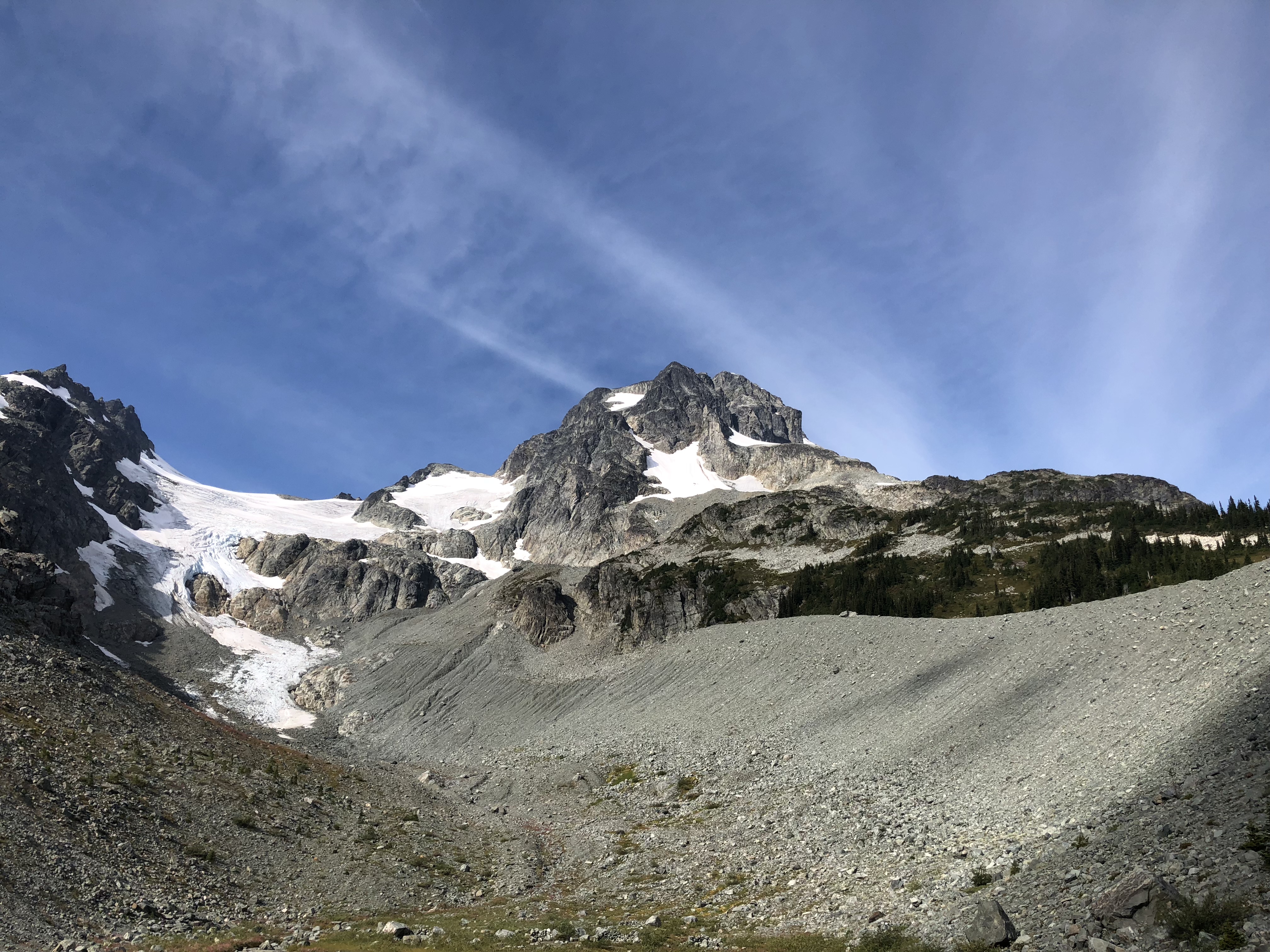
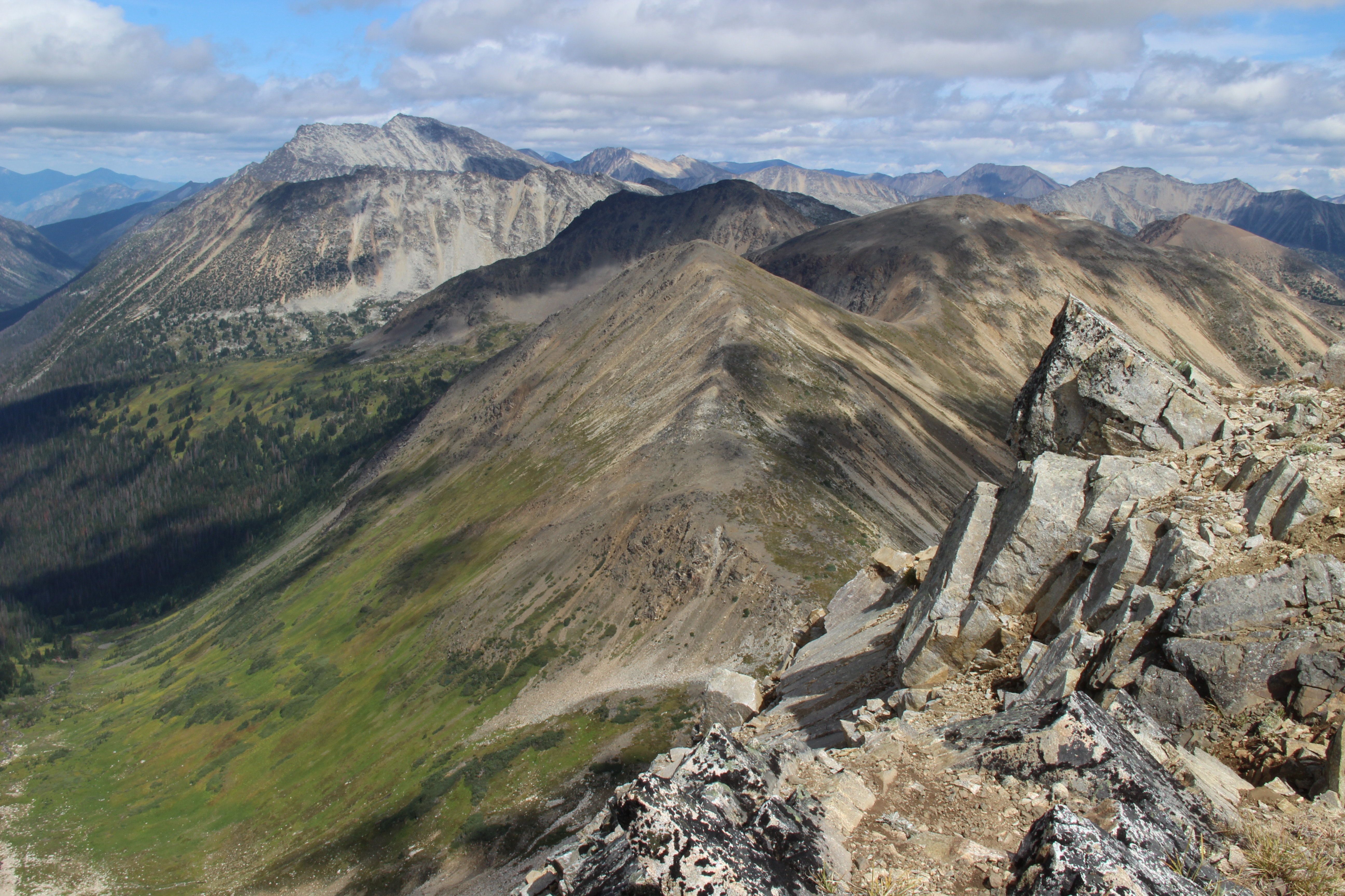
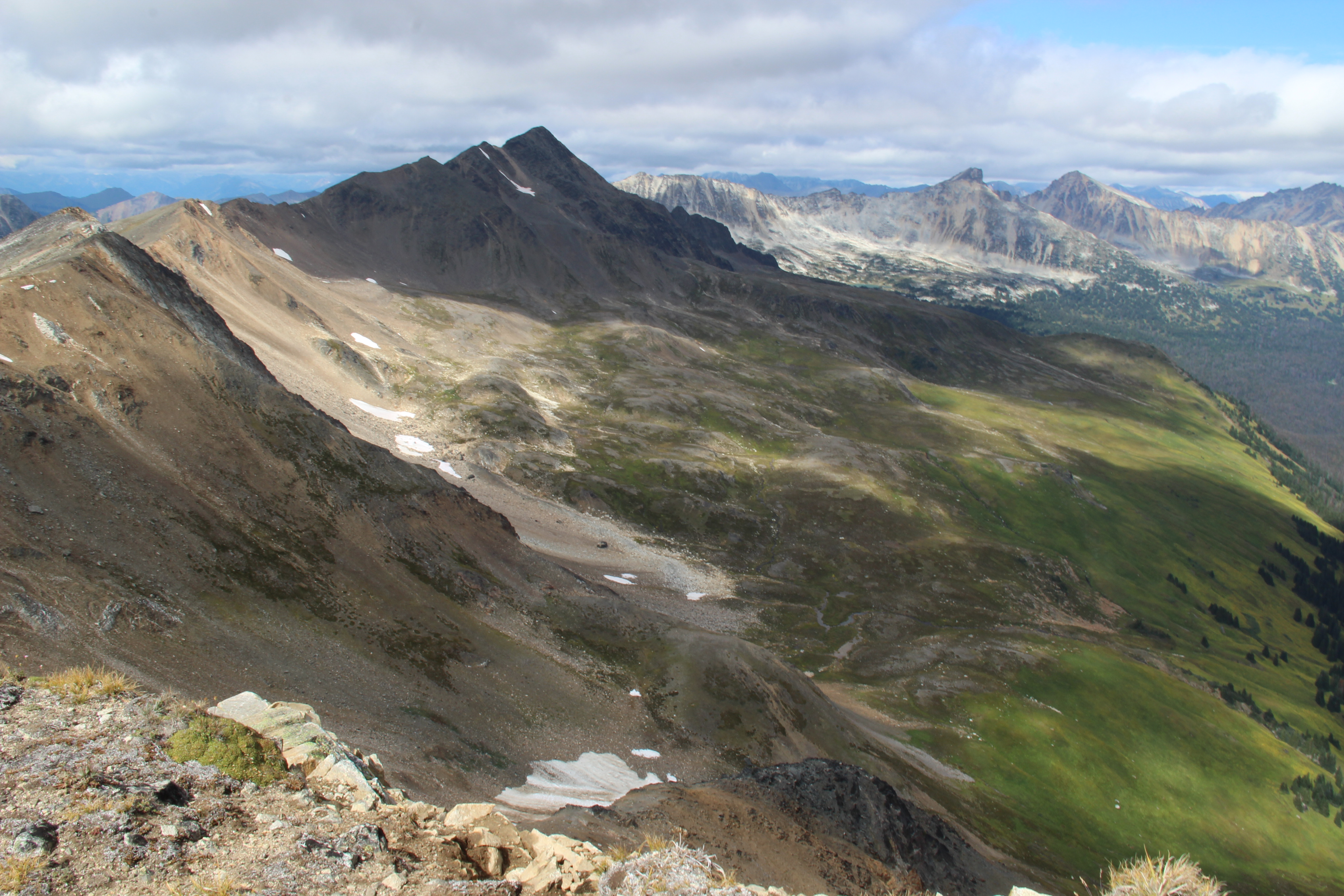
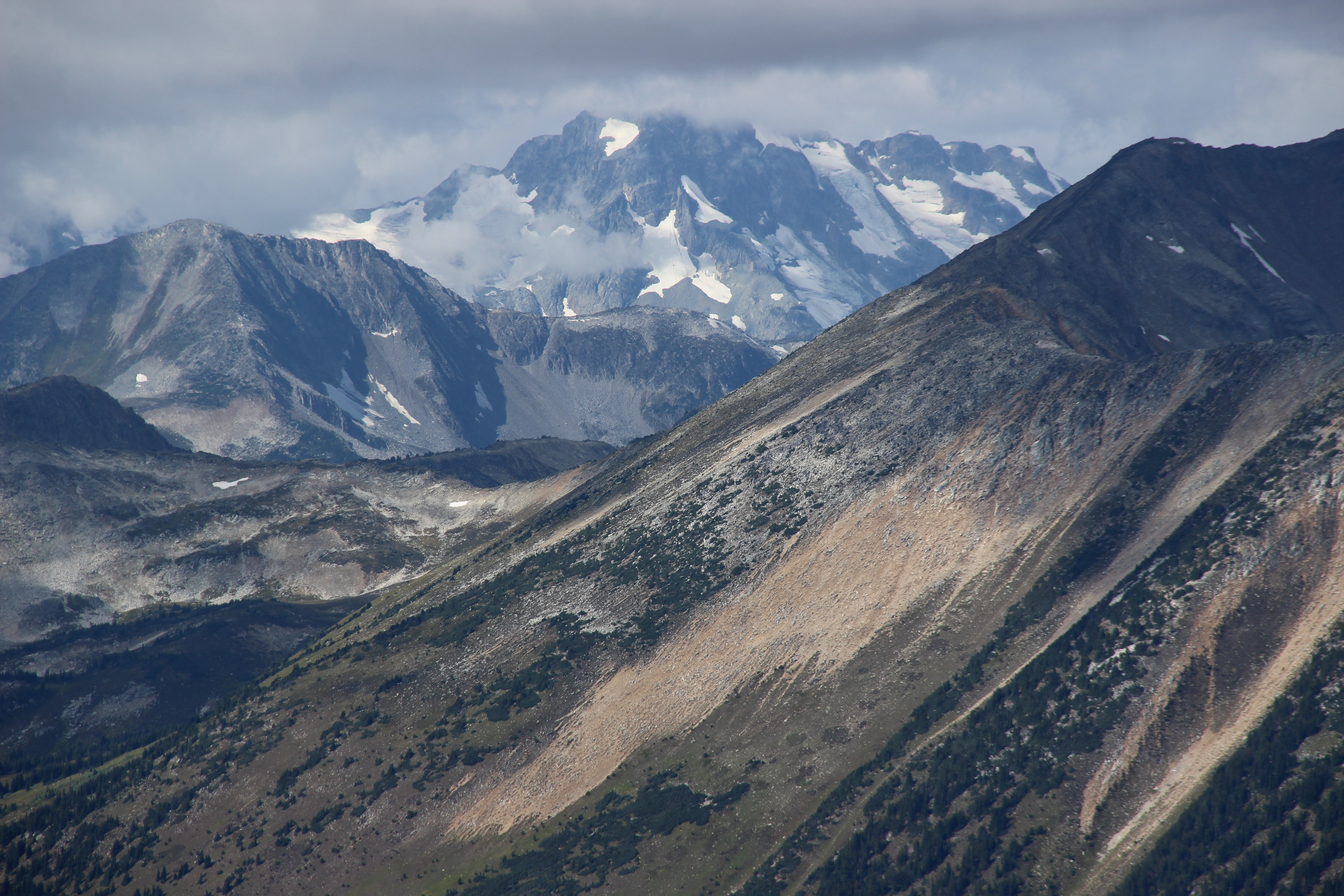
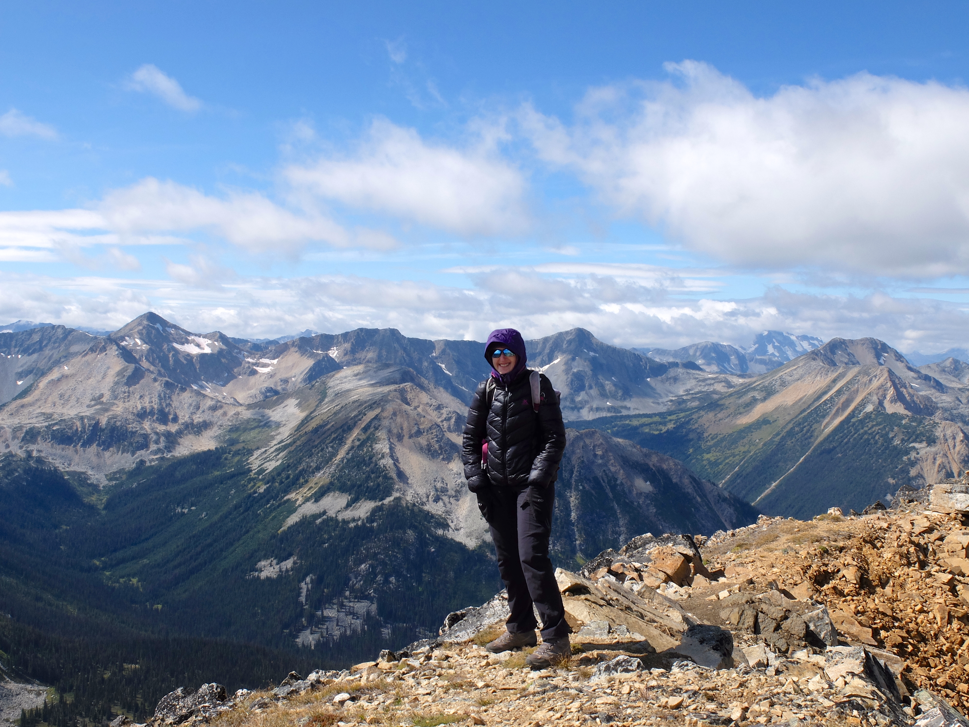
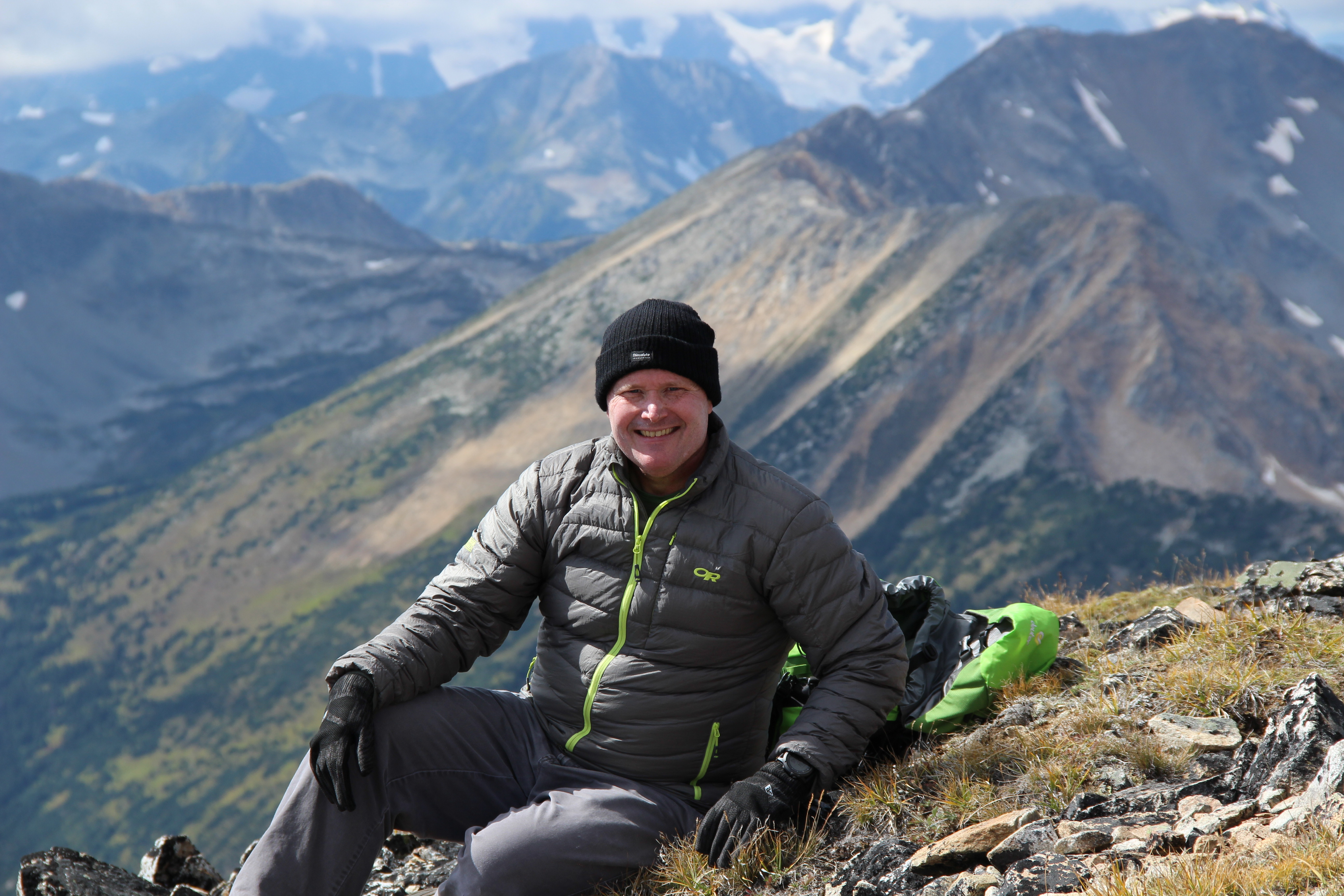
Gott Peak is a summit on the north side of Blowdown Pass, on the edge of untouched Stein Valley, offering a mind-blowing 360 degree panorama of summits, mountain meadows and lakes, with almost no signs of human civilization in sight. If the weather is slightly cloudy, you will see an ever-changing light show of shadows cast by various peaks, creating almost a cinematic experience. The distance and elevation gain depends on how far up the gravel road you can drive. From Whistler, follow Hwy 99 to Mount Currie, then turn right towards Lillooet, past Duffey Lake. Turn right onto Blowdown Creek FSR about 3.5 km east of Duffy Lake. From there, there is a network of various logging roads, just follow the one that looks the most accessible. This snippet from Google Maps will take you to the trailhead. On our first trip, we tried following somewhat convoluted and maybe out-of-date directions from Scrambles in Southwest British Columbia by Matt Gun (which is an excellent book), and we got lost. Just drive the most obvious road. If you have a 2WD with high clearance, you should be able to get to the "parking" area which serves as a trailhead, then - walk up for a minute or two to a turn off and on your left you will see a turn off. There is usually a cairn or remain of a cairn at the turn off to the jeep road.This is where the well maintained gravel road turns into a true jeep road (about 9-10km from the highway). Driving all the way up to the pass requires agressive 4WD driving. If you don't notice the turn-off to the jeep road, you would go straight for another couple minutes and you will see a wide clearcut area, where the road ends, with some broken trees and logs, with no obvious way to continue. If you end up bushwacking, you need to turn back and look for the jeep road. We witnessed folks bushwack all the way up to the pass and that was not happy hiking. Hike up the jeep road to the pass and from there turn left and ascend steeply to the first view point, a false summit often called by hikers "Not-Gott", with a small wind break made out of rocks, then follow the ridge to the true summit with even more amazing views the entire way. More info and stats here: https://www.livetrails.com/trails/Gott-Peak-from-Blowdown-Pass-trailhead-2504.html |
|
|
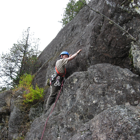
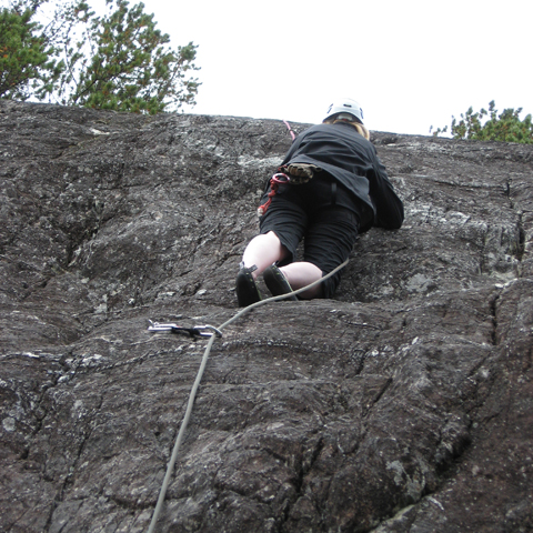
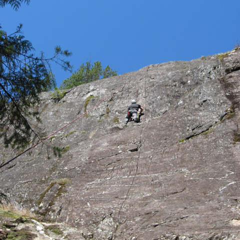
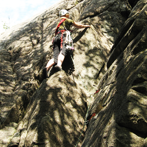
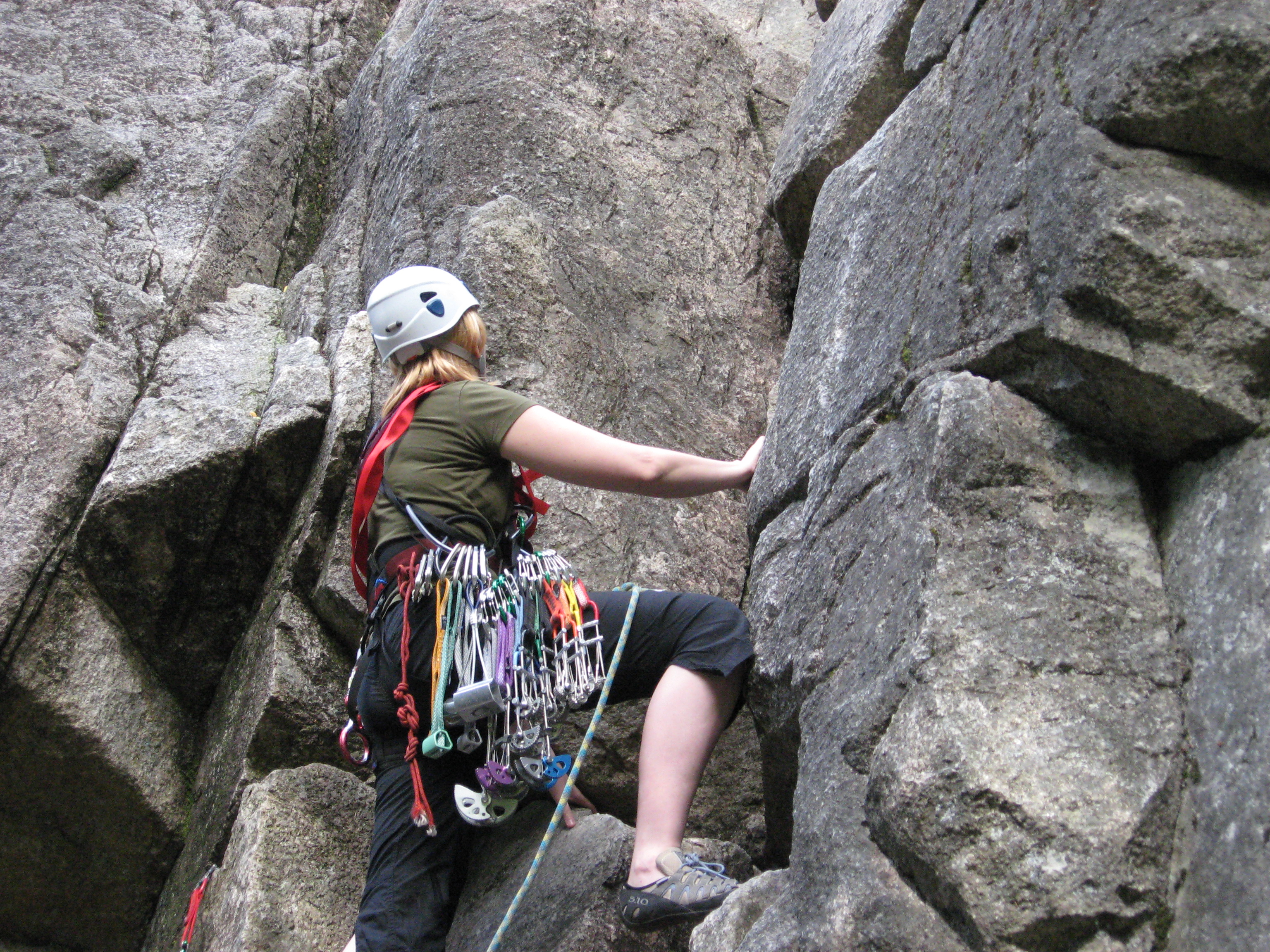
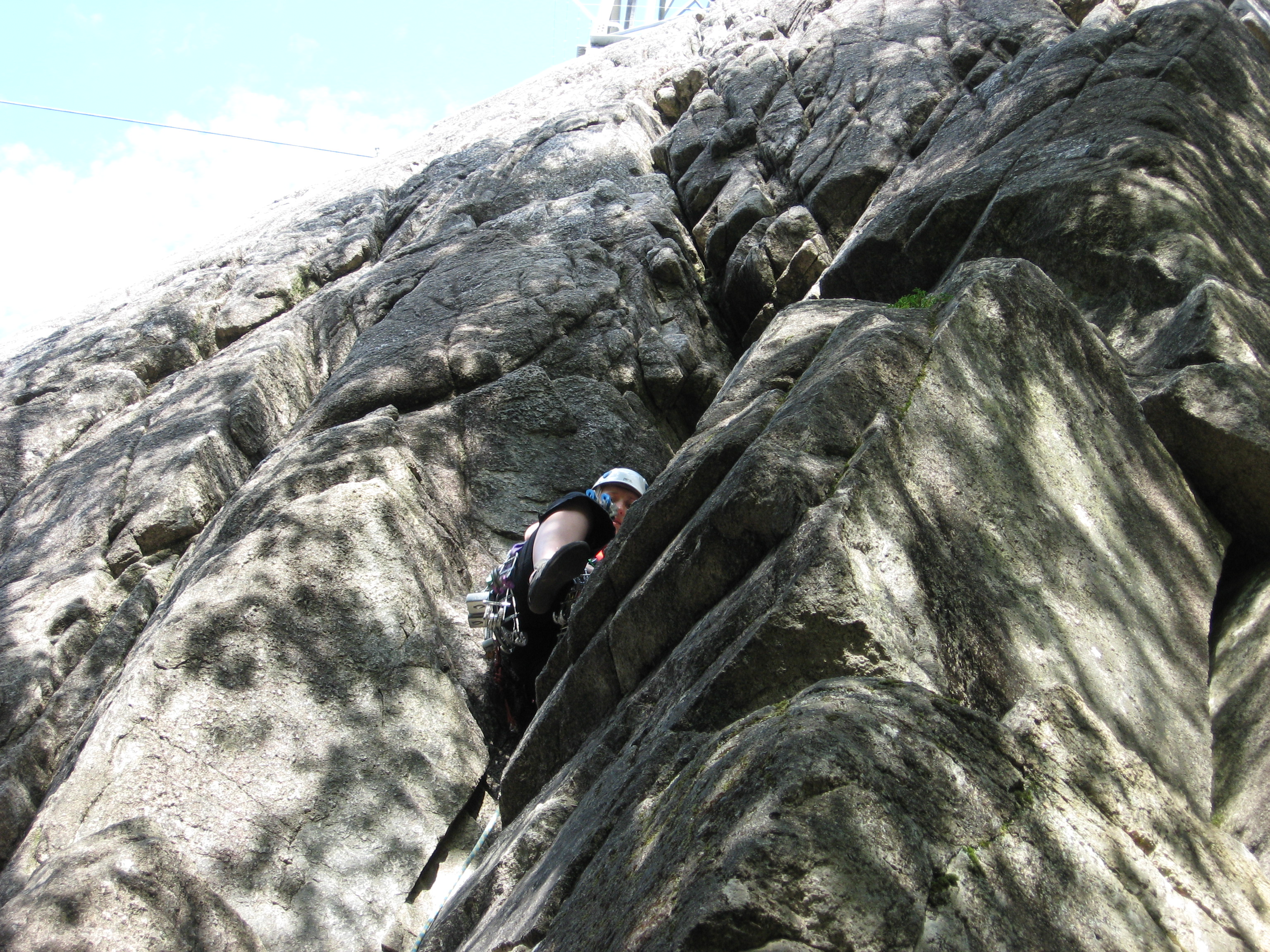
Squamish, with Stawamus Chief towering over town, is a world-class destination for climbers, specializing in finger and joint destruction in perfect granite cracks. The famous Cobra Crack is here. I am not a world class climber. Nor are my climbing buddies. I learned to climb on tiny finger pockets and sharp edges of limestone rocks of Polish Jura. In Squamish I was back to square one. My hands and fingers are ridiculously narrow and thin. What for most people is an easy beginner level hand crack, for me would be an offwidth. One size does not fit all. Not much fun for me until someone showed me a "girls' route", a 10.b finger crack. If crack climbing is not your cup of tea as much as it is not mine, there are some sport climbing options. Difficulty rating in BC seems much tougher than in the neighbouring Washington State so WA climbers, beware.
Squamish Select, by Marc Bourdon We had a lot of fun climbing at Nordic crag near Whistler.
If you're not a climber, but still would like to get to the top of the Chief, there is a fun hiking trail traversing all 3 summits, with nice views from the top. |
As of 2018, the sign was no longer there (too bad!)
|
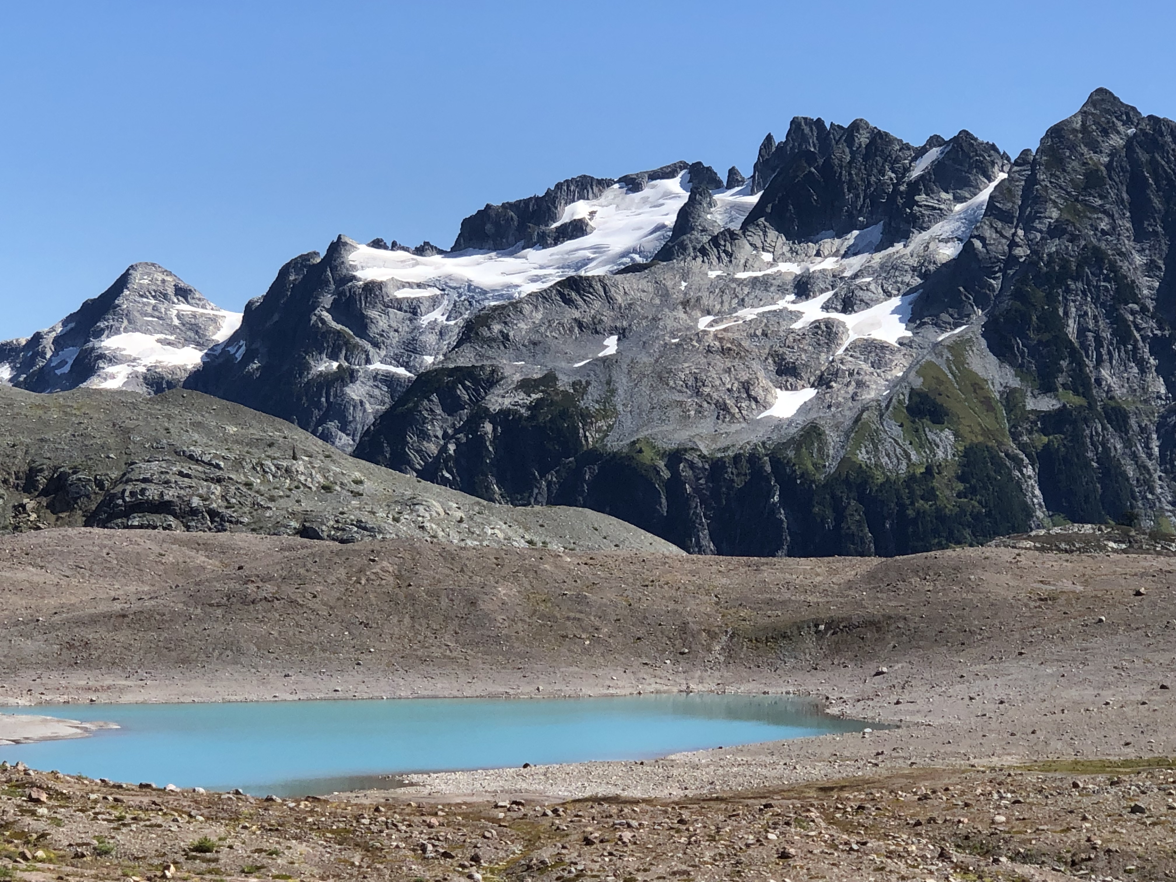
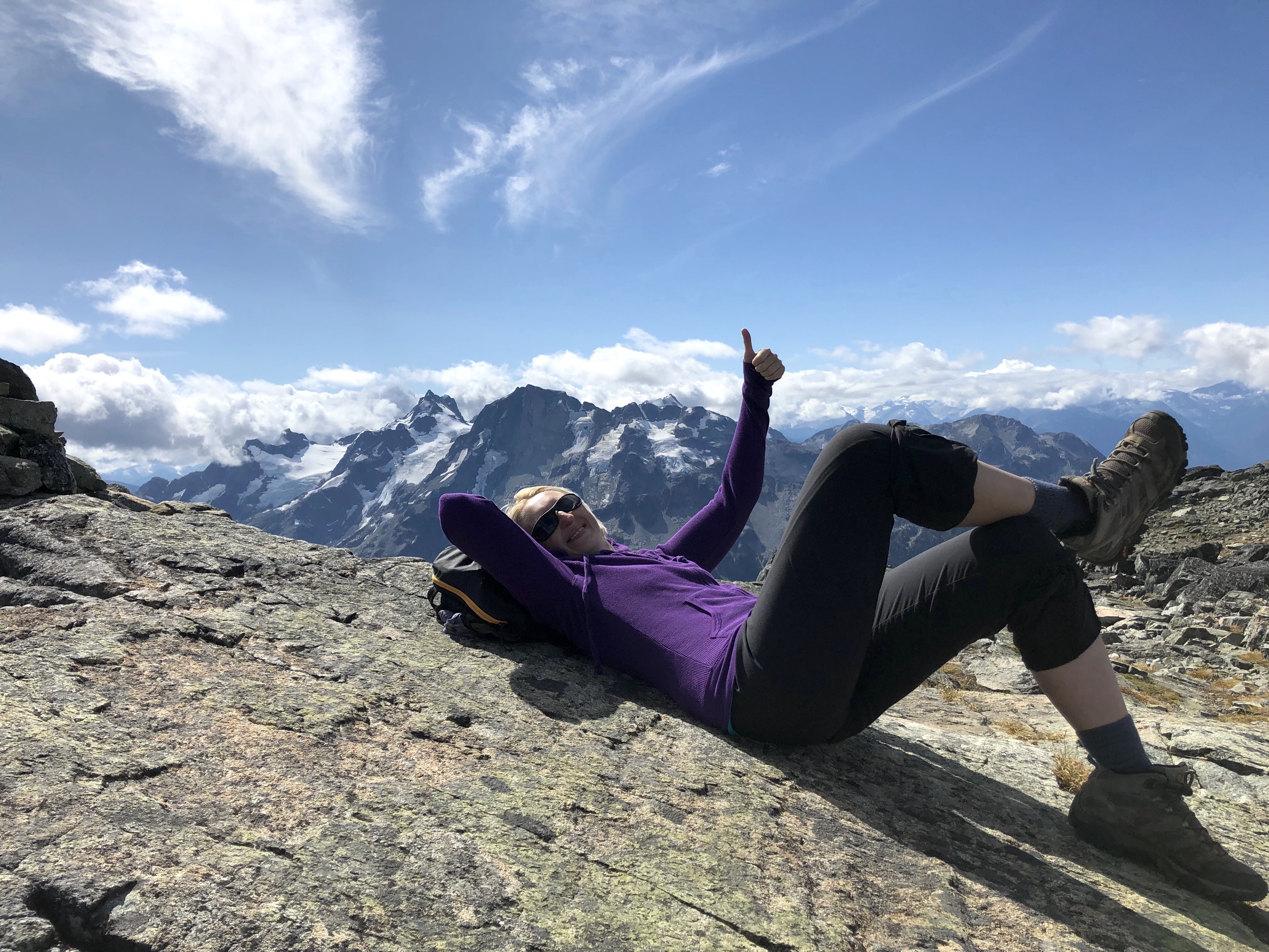
 Wedgemount Lake
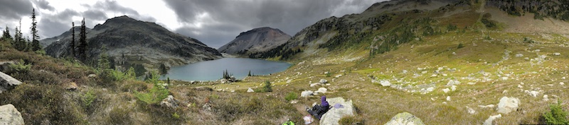 Ring Lake
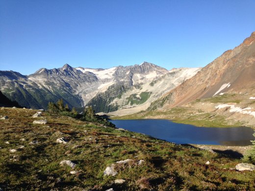 Russet Lake
 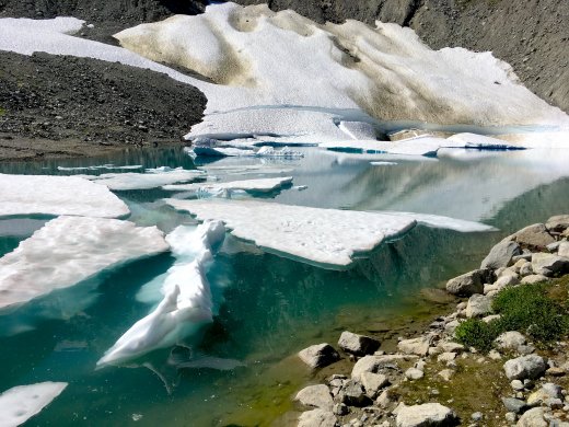 Skywalk North
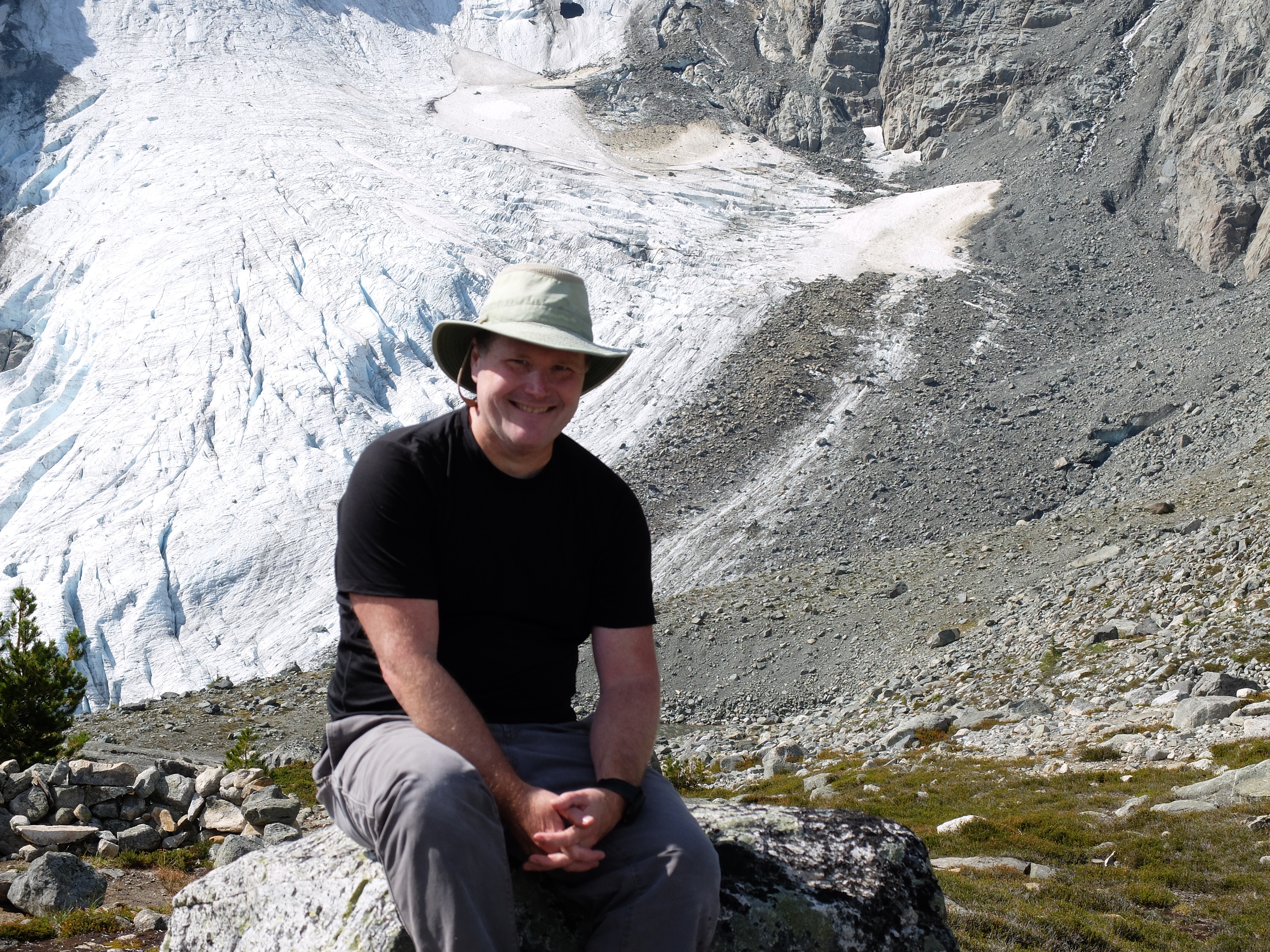
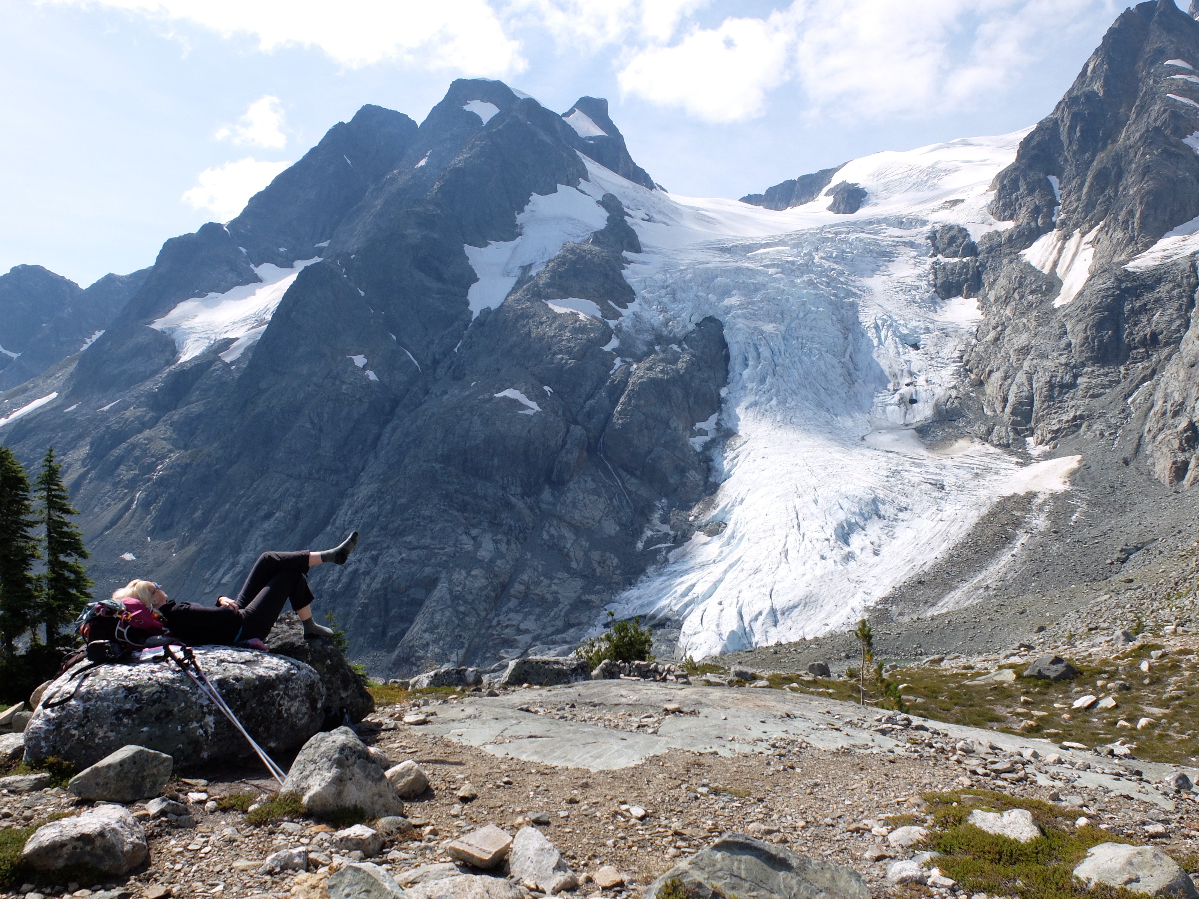
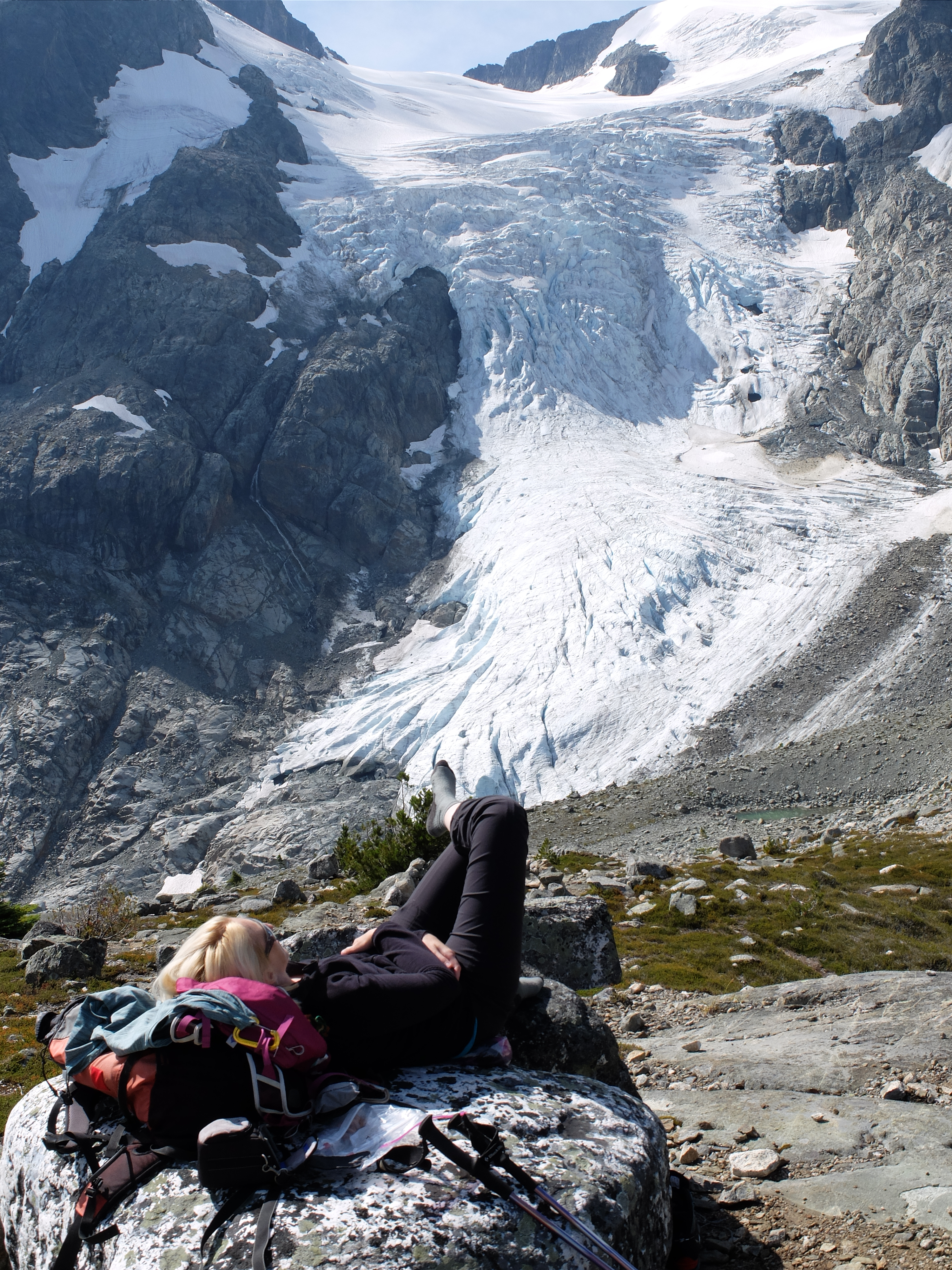
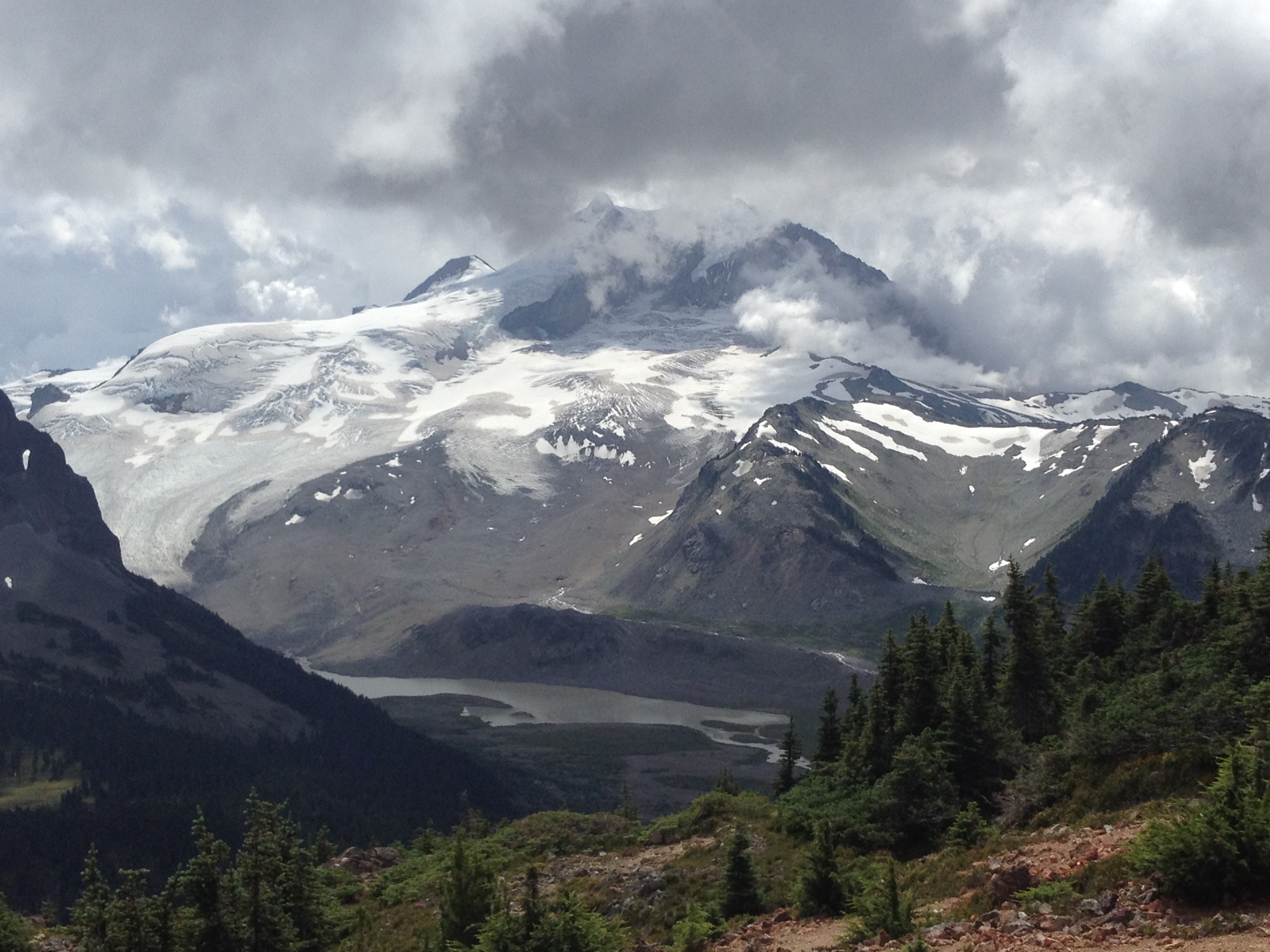
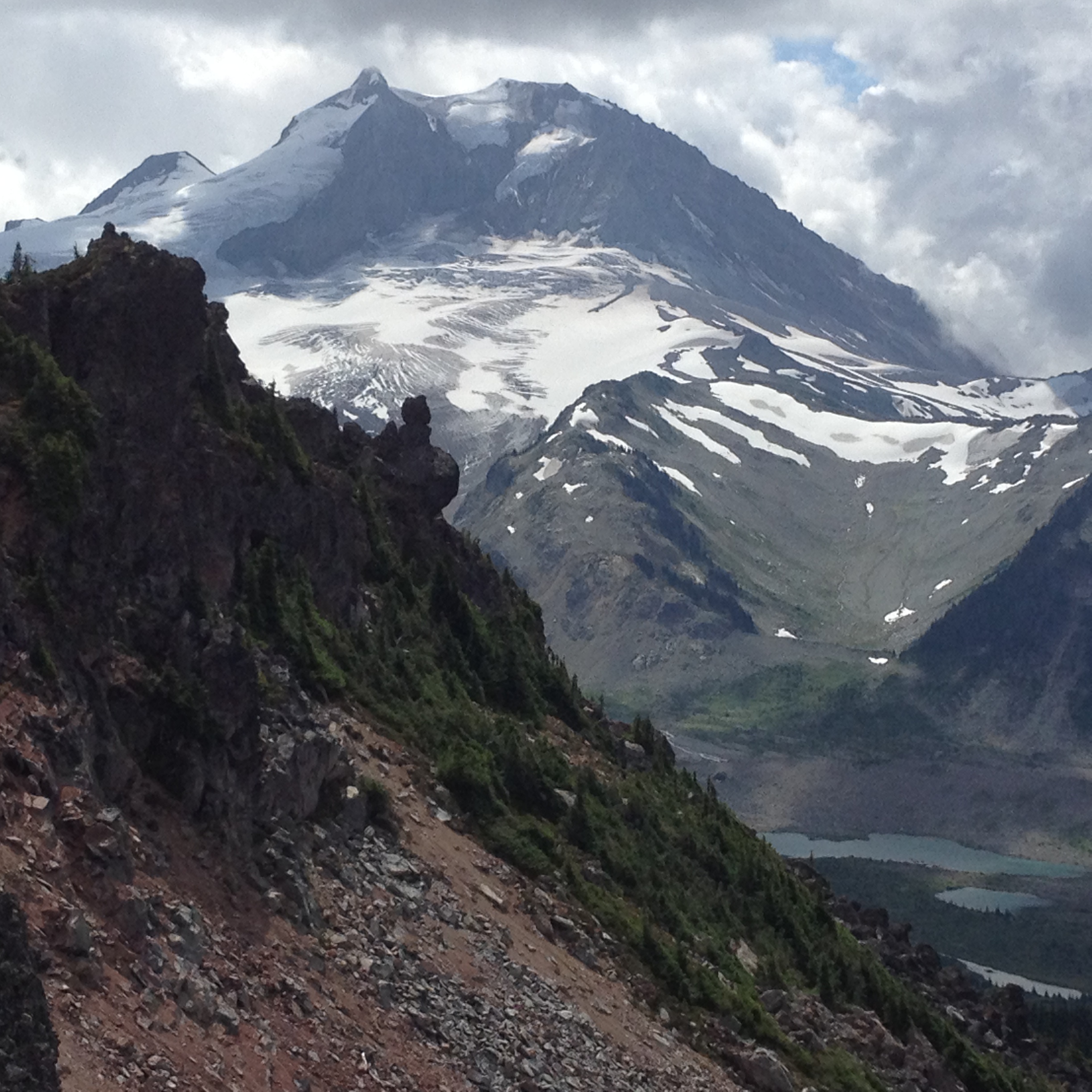
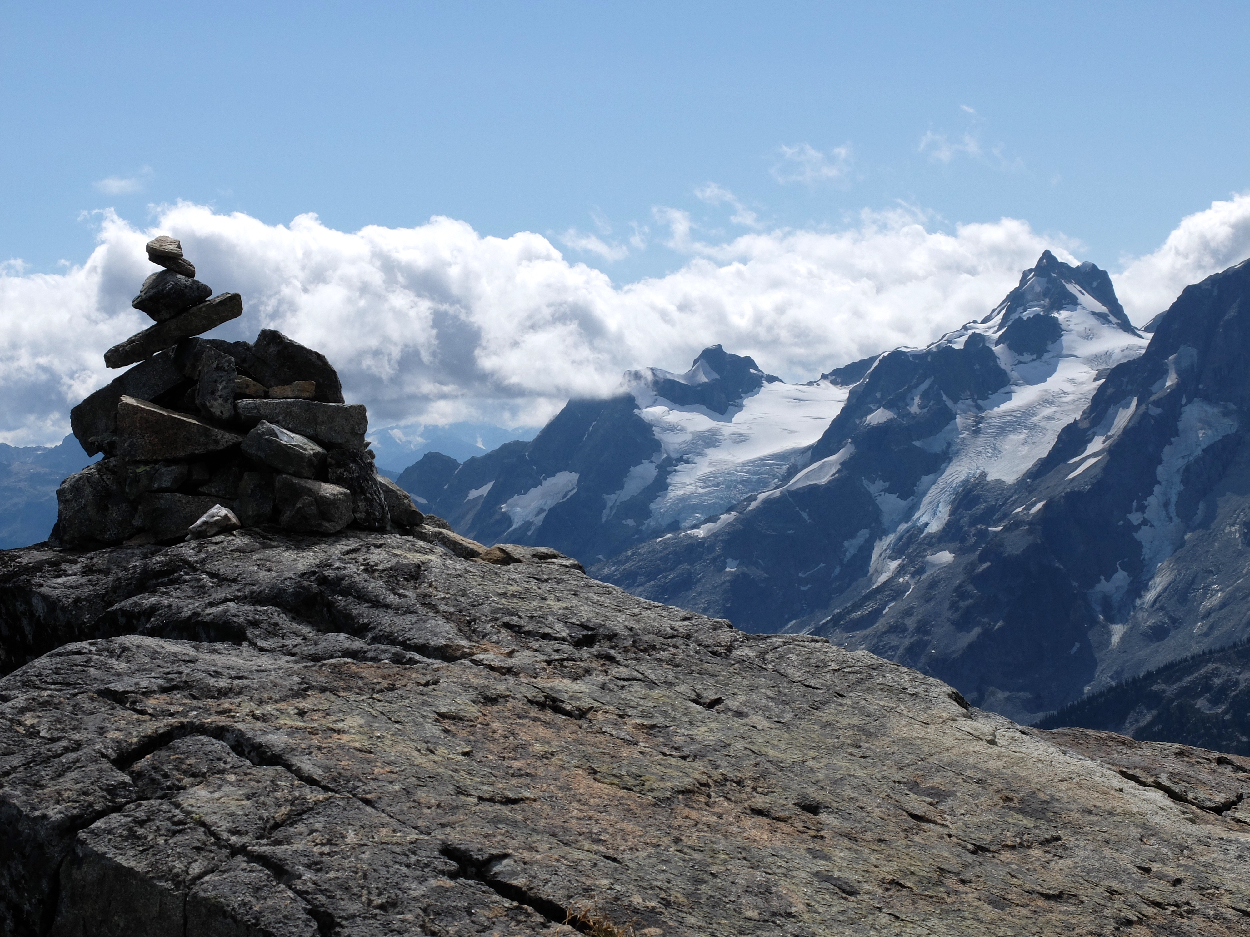
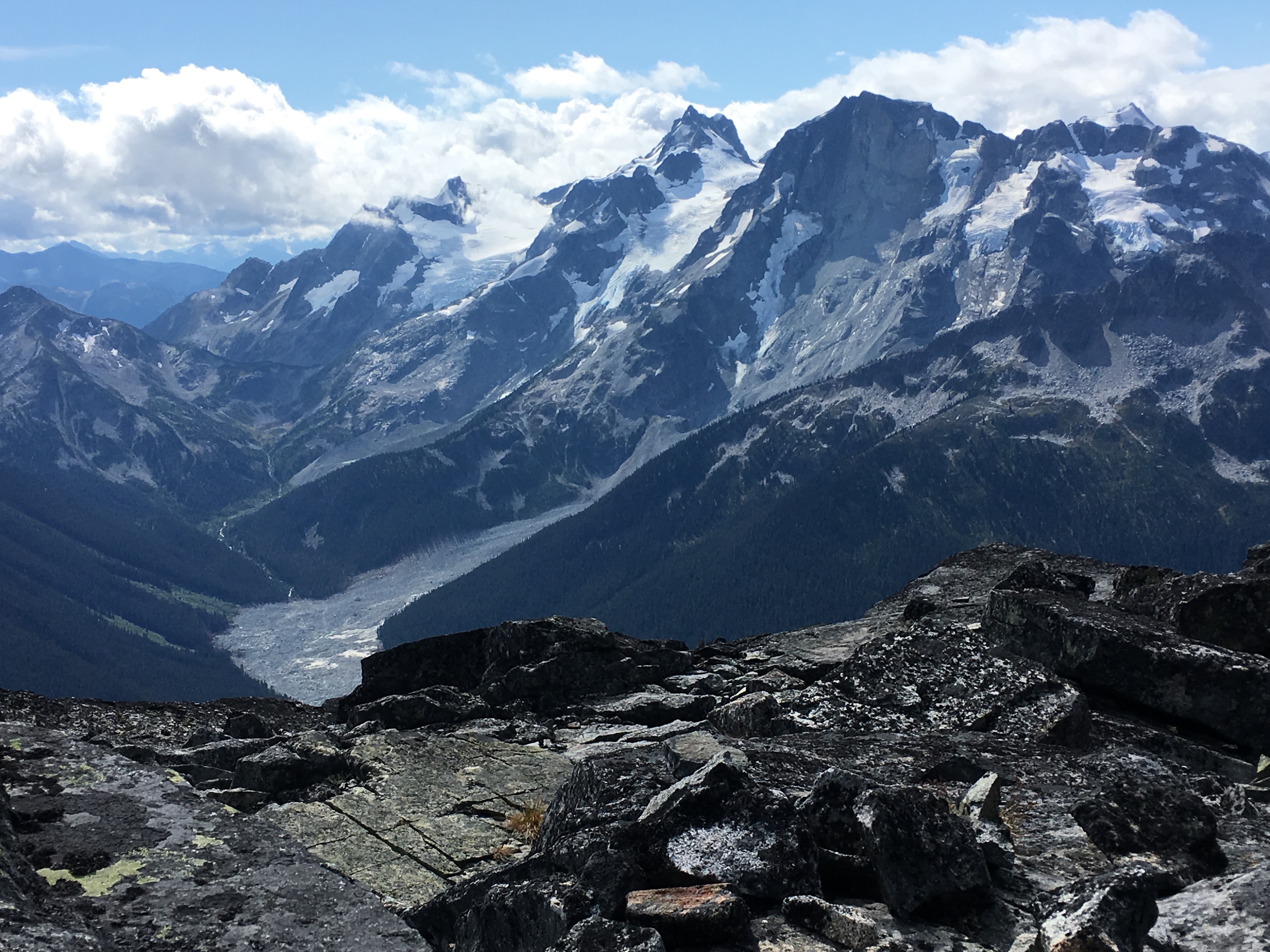
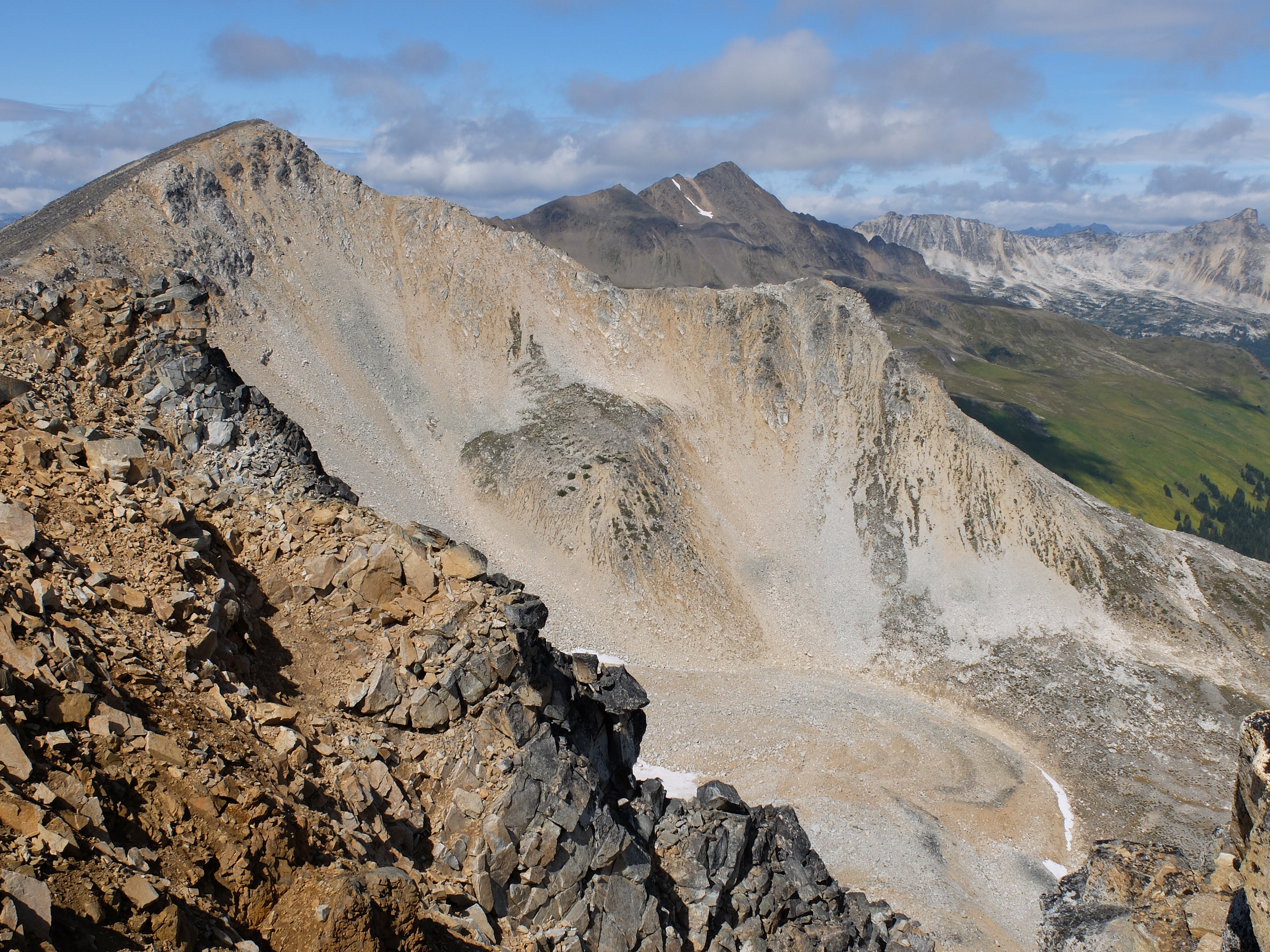
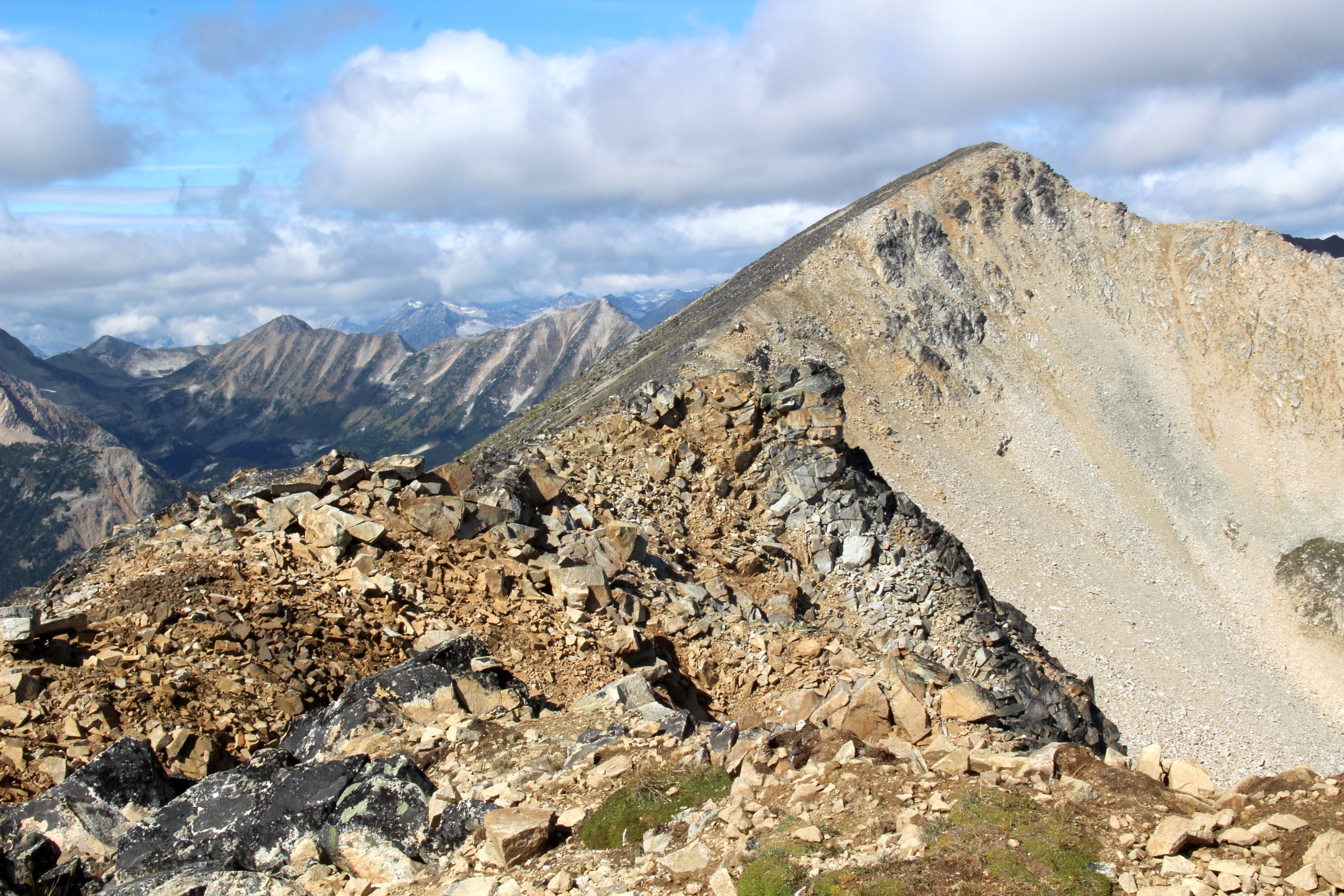
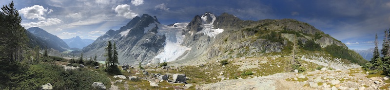 Vantage-Matier Col via Cerise Creek trail
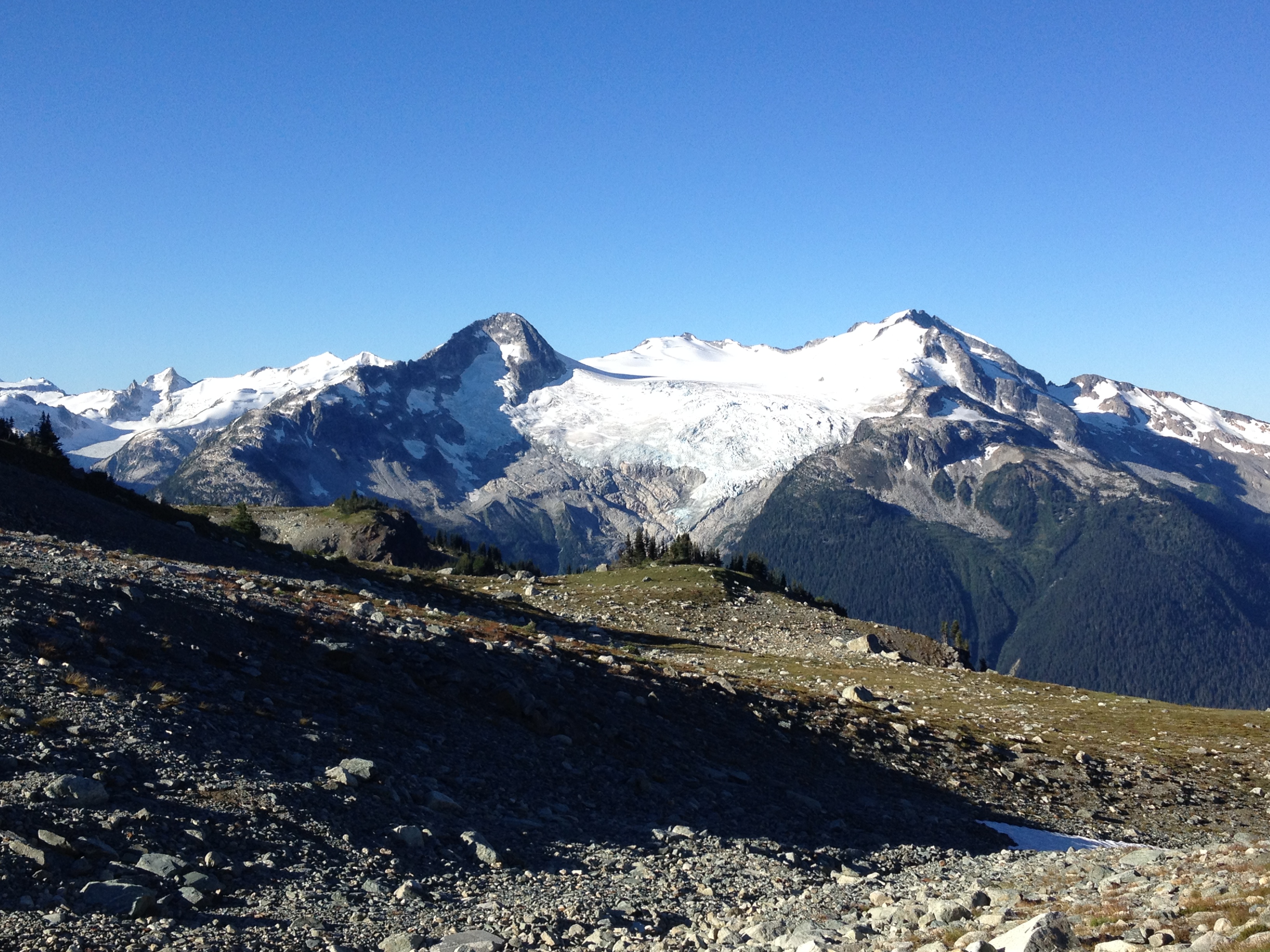
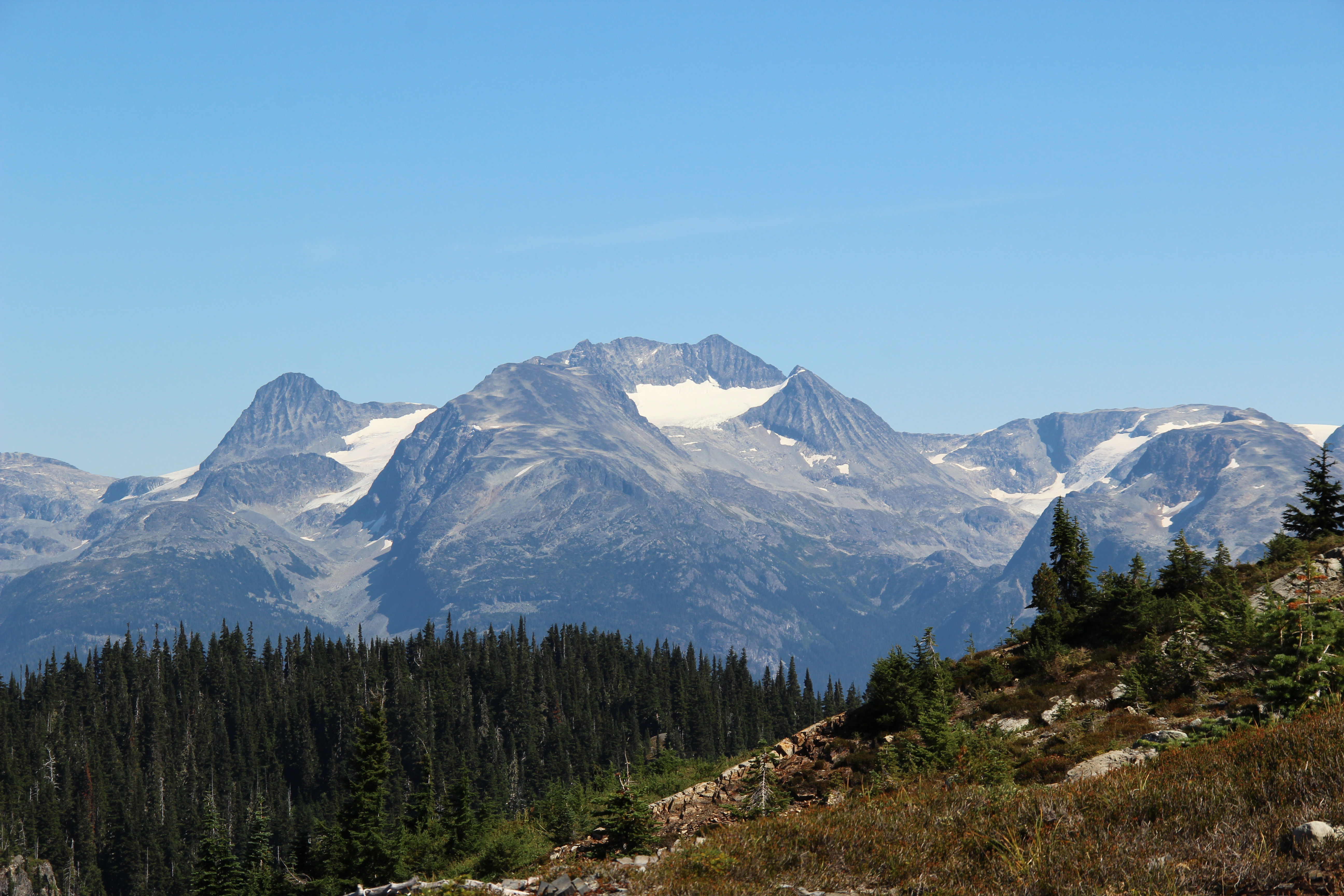
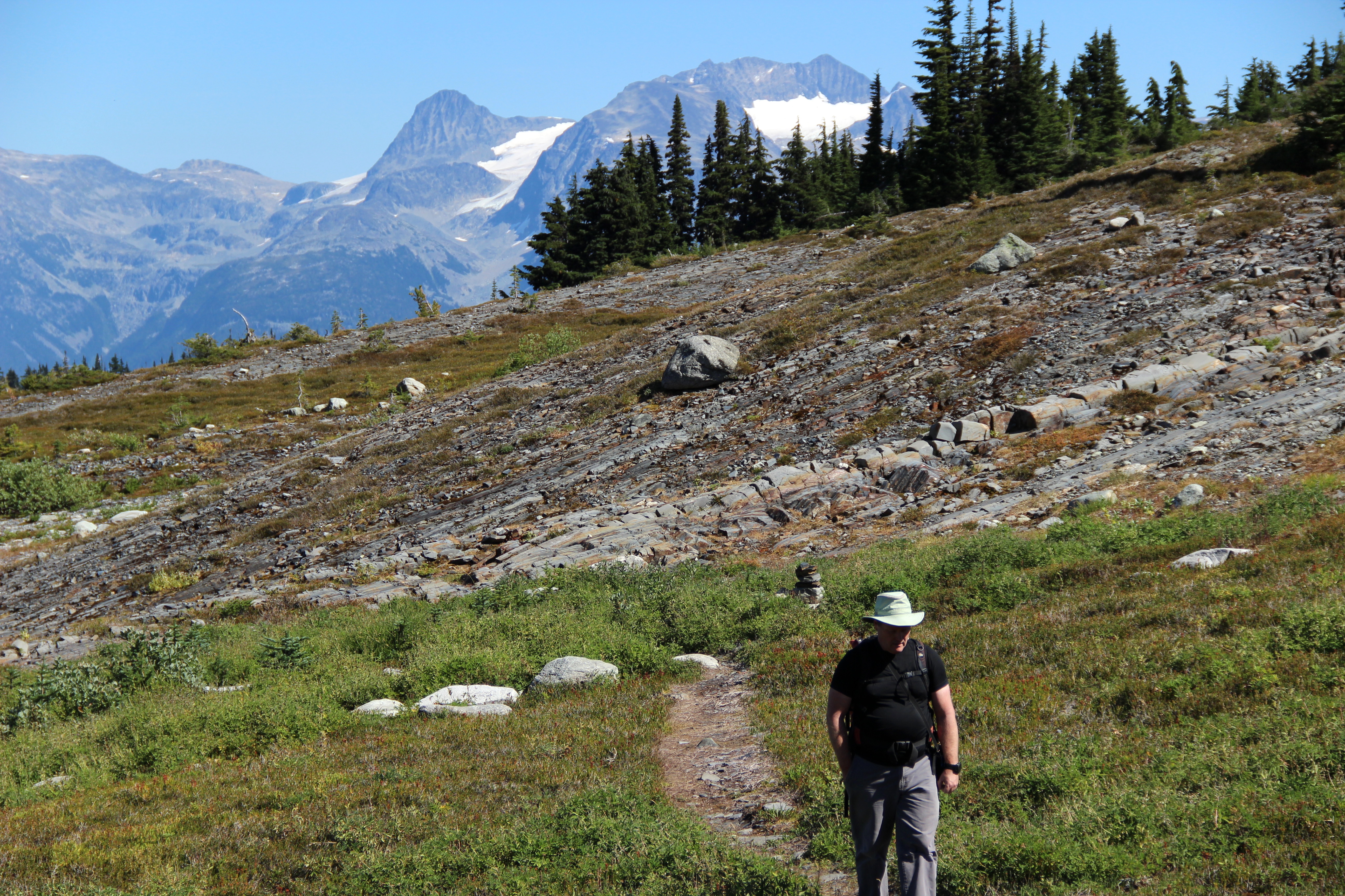
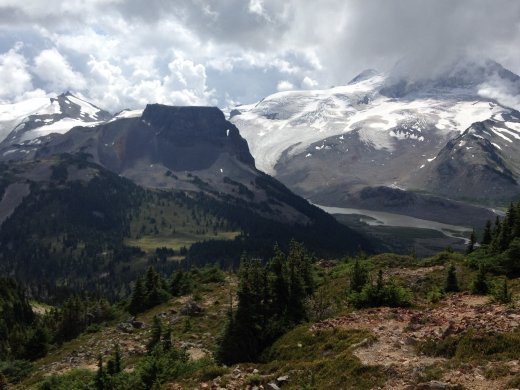 Clinker and Price
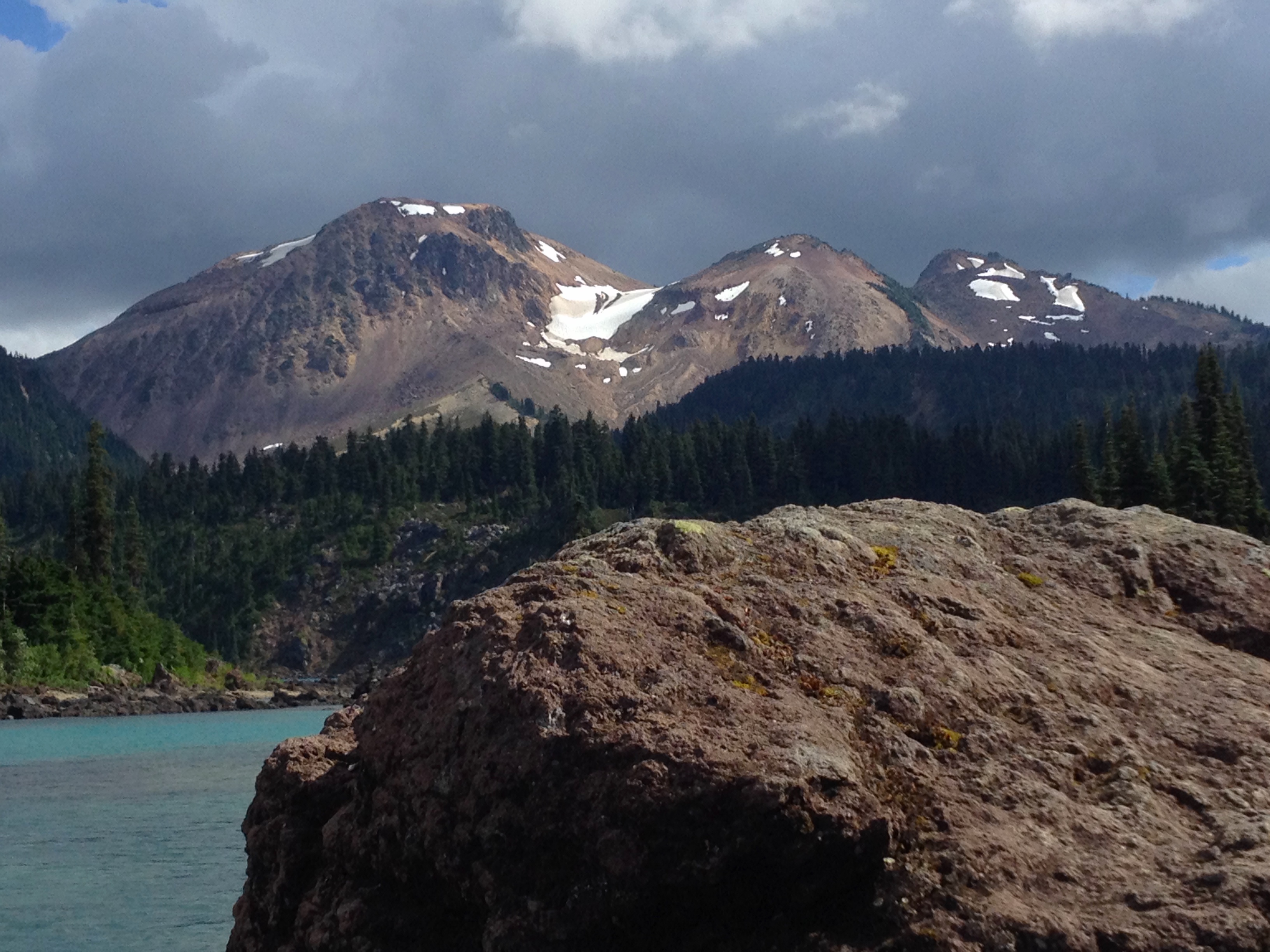
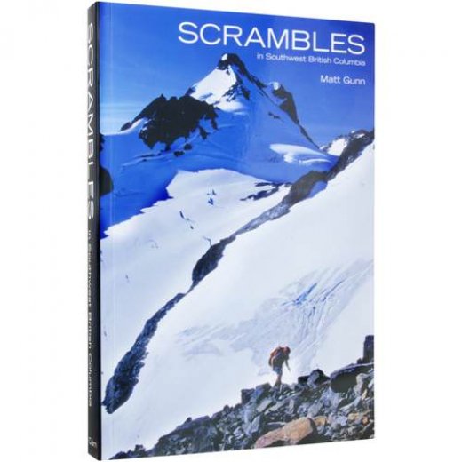
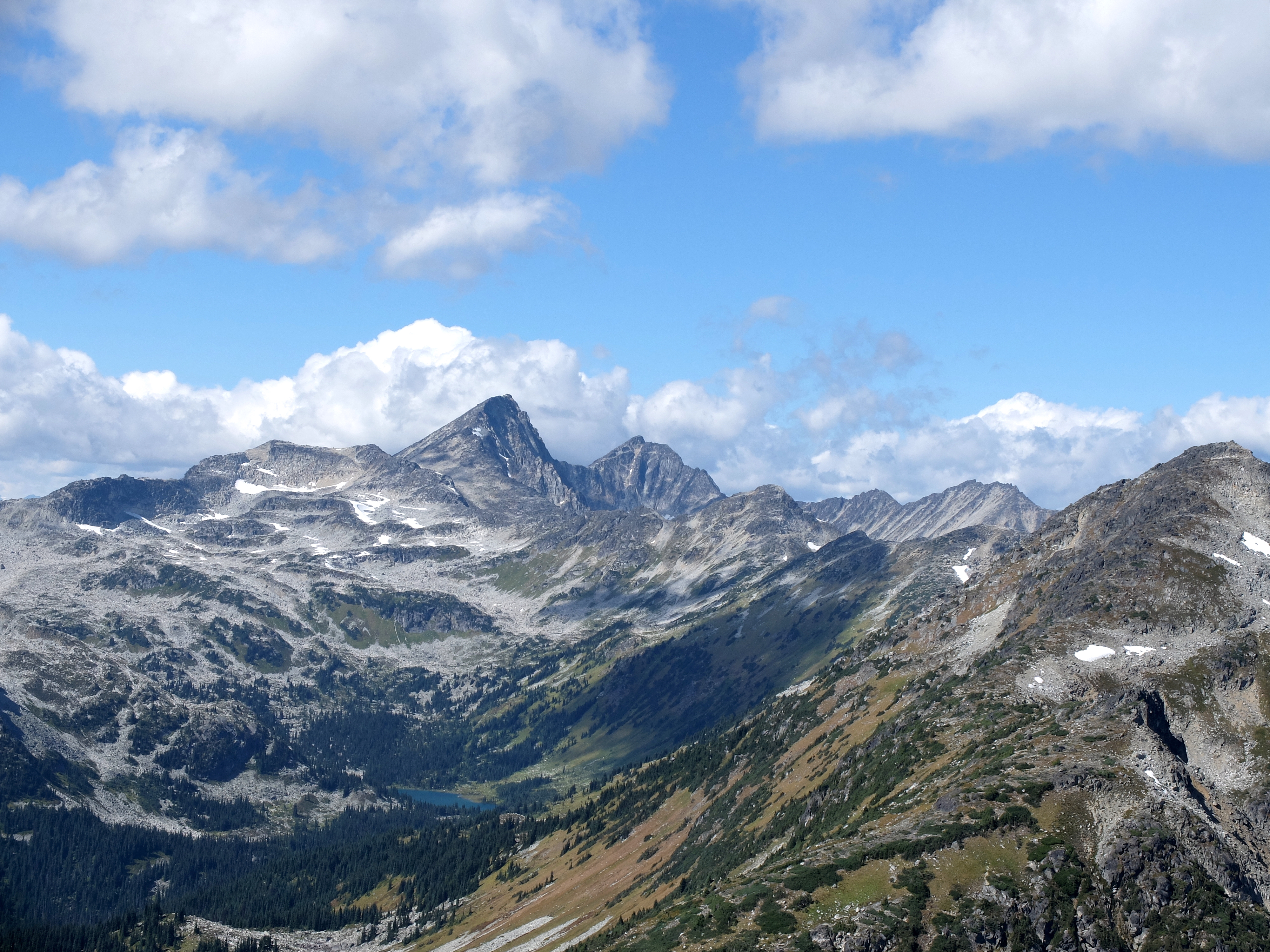
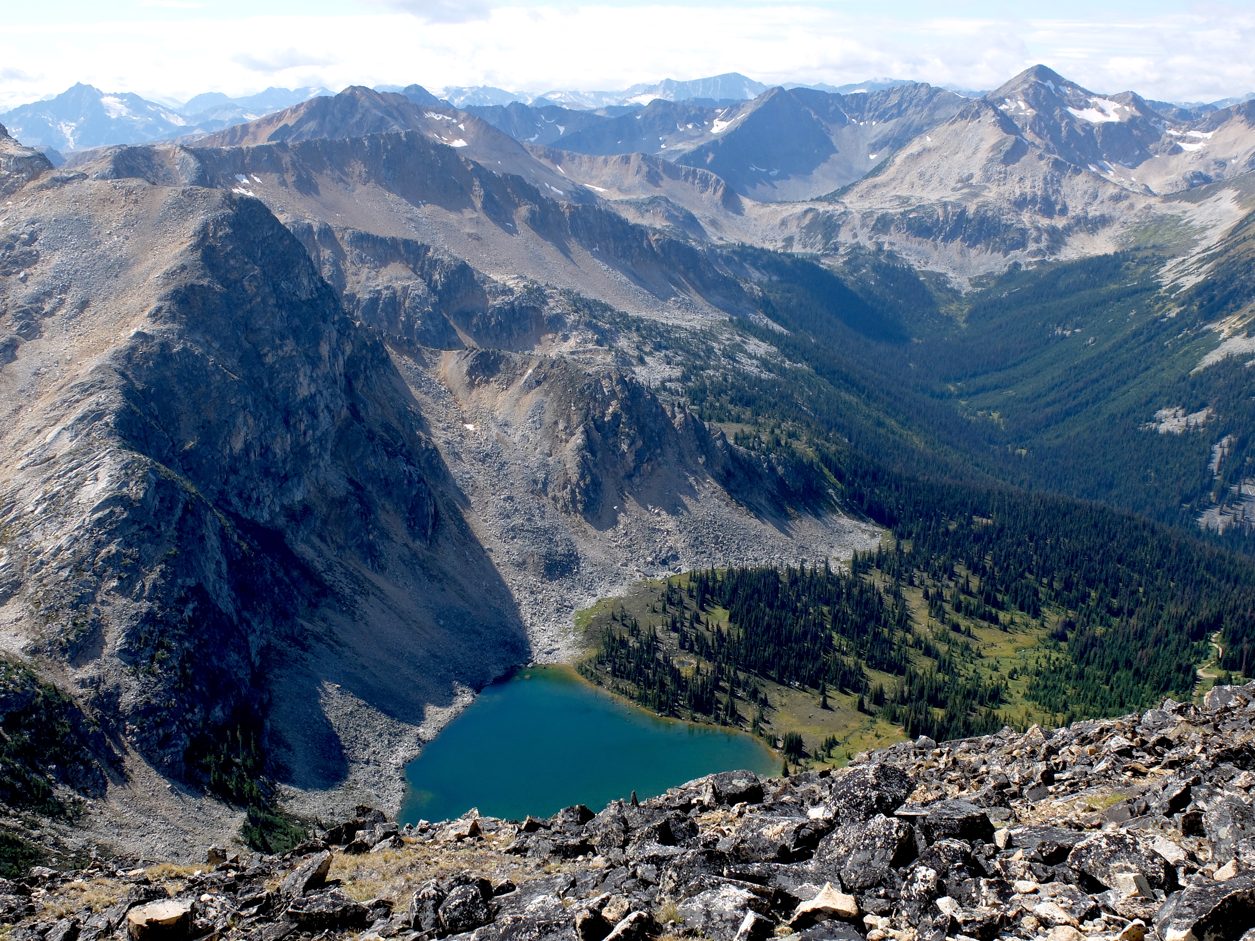
 Mount Rohr
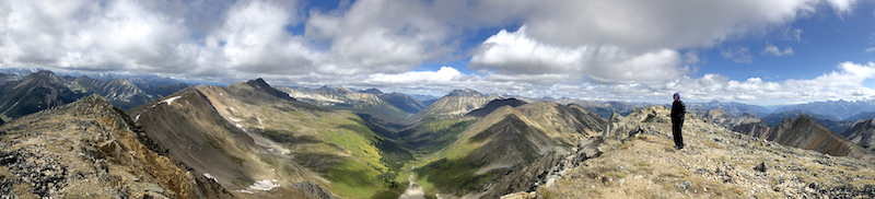 Gott Peak
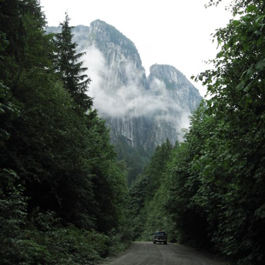 ROCK CLIMBING: Squamish and Whistler
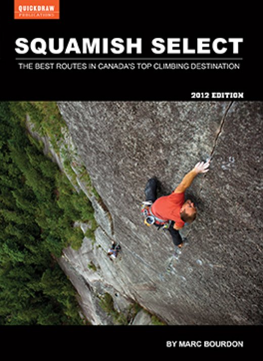
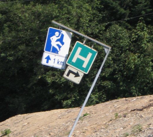 A road sign near Stawamus Chief & climbers camp. There is a dark joke somewhere in there.
 girlbot@ewatrebacz.com
 BabelScores
 Youtube
 SoundCloud
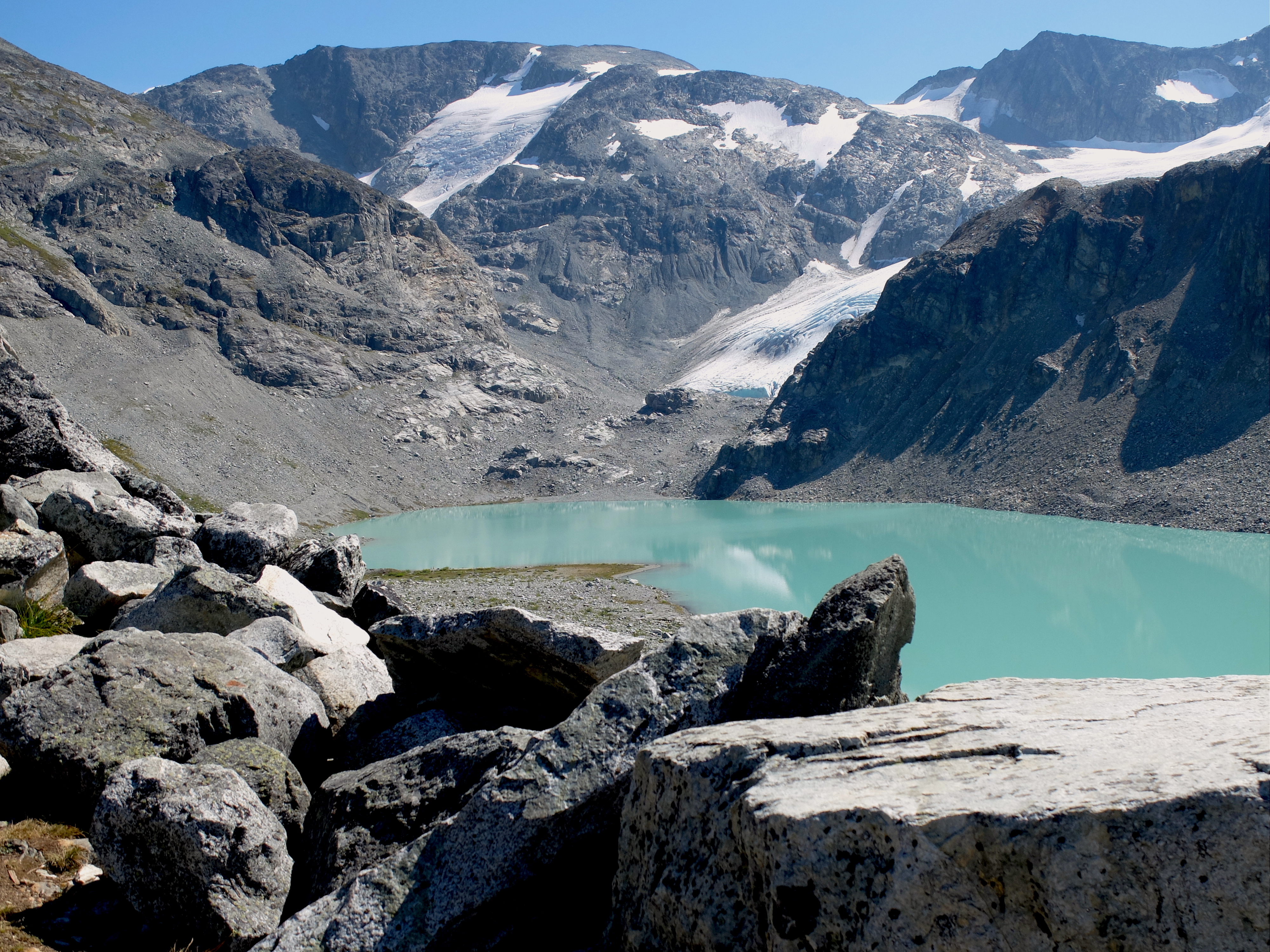